
I am a meteorologist and a former youth leader at church…I have a lot to say on both subjects…and then some
Instead of doing a whole video on this, I thought I would show the update from yesterday for South Texas, as the rain is expected to cause flooding in the Rio Grande Plains, and possibly out toward the Middle Texas Coast.
Let’s start with the set up…
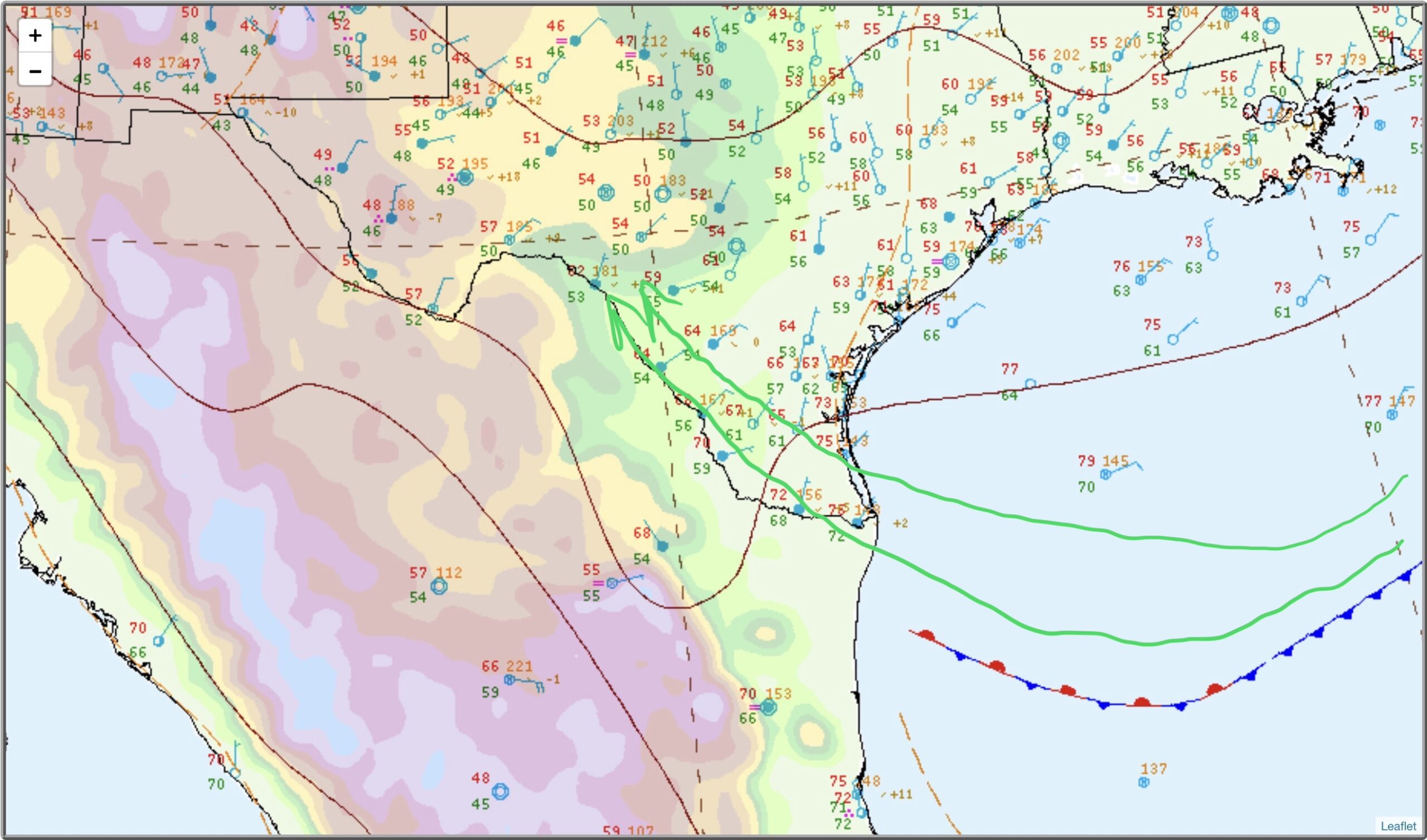
Looking at the above image, from 6AM CST there is a trough of low pressure over the Rio Grande Valley, which points up the into the Rio Grande Plains and into the western part of the Hill Country. So the wind is going uphill, which is none as orographic lift, helping to squeeze more moisture out of the atmosphere, than just the trough of low pressure. If you look out over the Gulf, the dewpoints are around 70°F and we can visualize that better with the Precipitable Water (Pwat) map. Which is the amount of water in the atmosphere that if you could condense it all out is what you would have. Even though the amounts are just above one inch, remember that the wind is replacing what is condensing out, and if the source continues to push more water into the region, you are going to get much more than current PWat. So let’s look at those over the next 3 days…
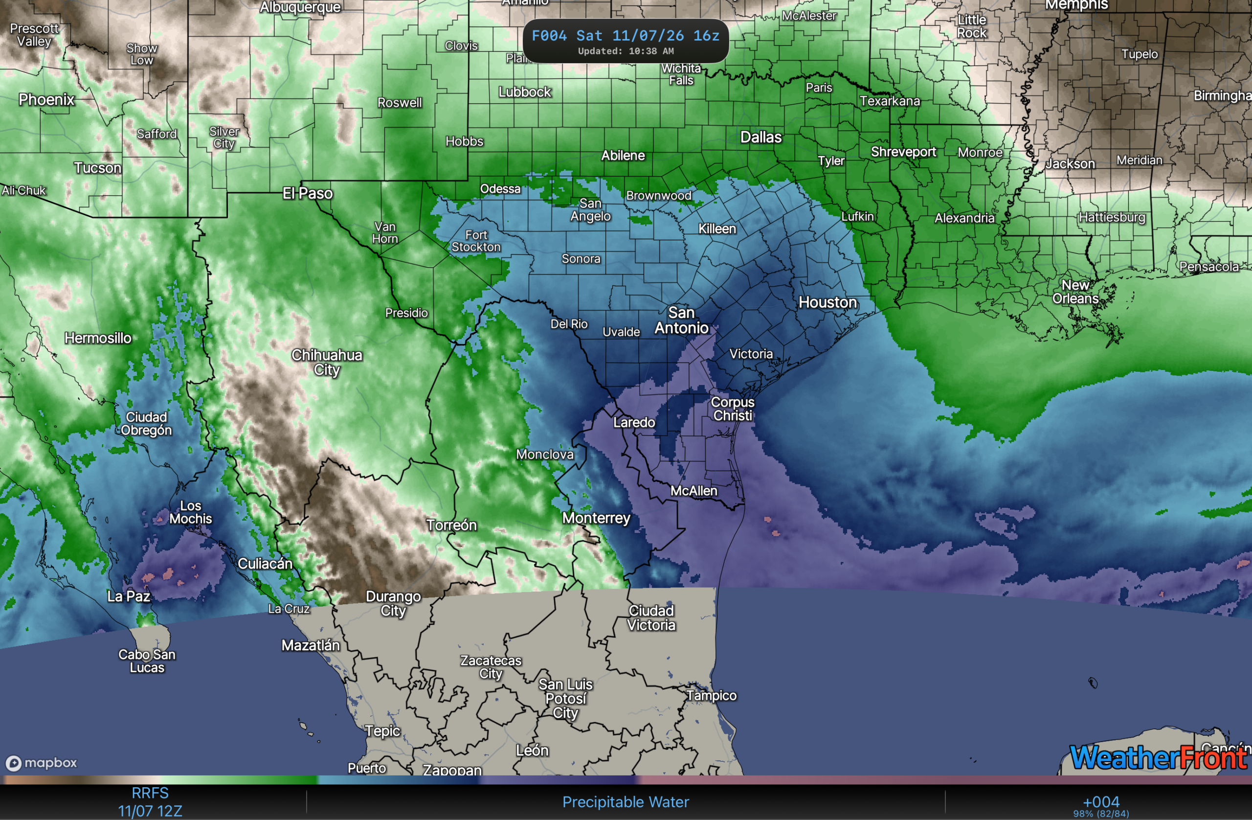
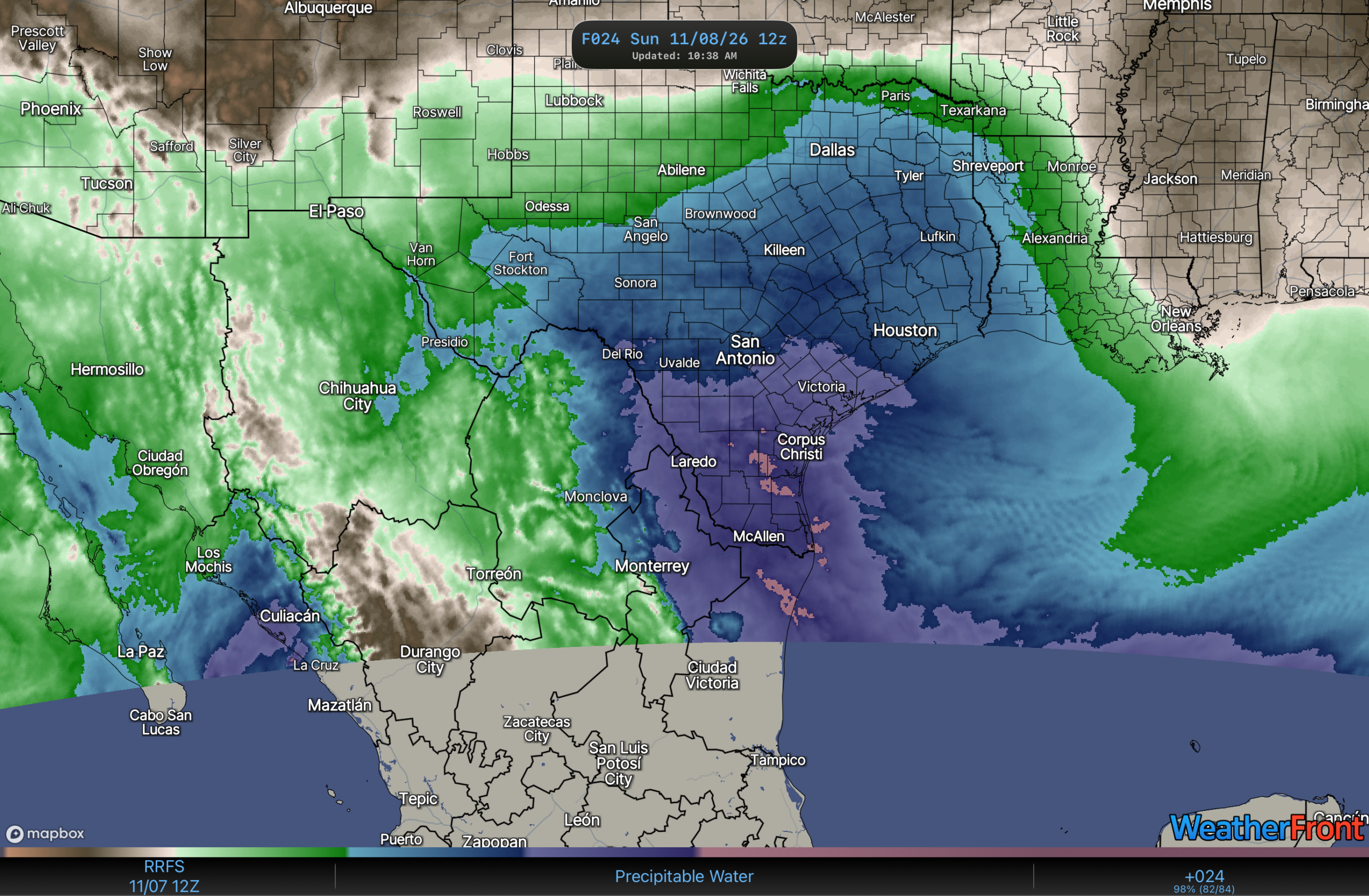
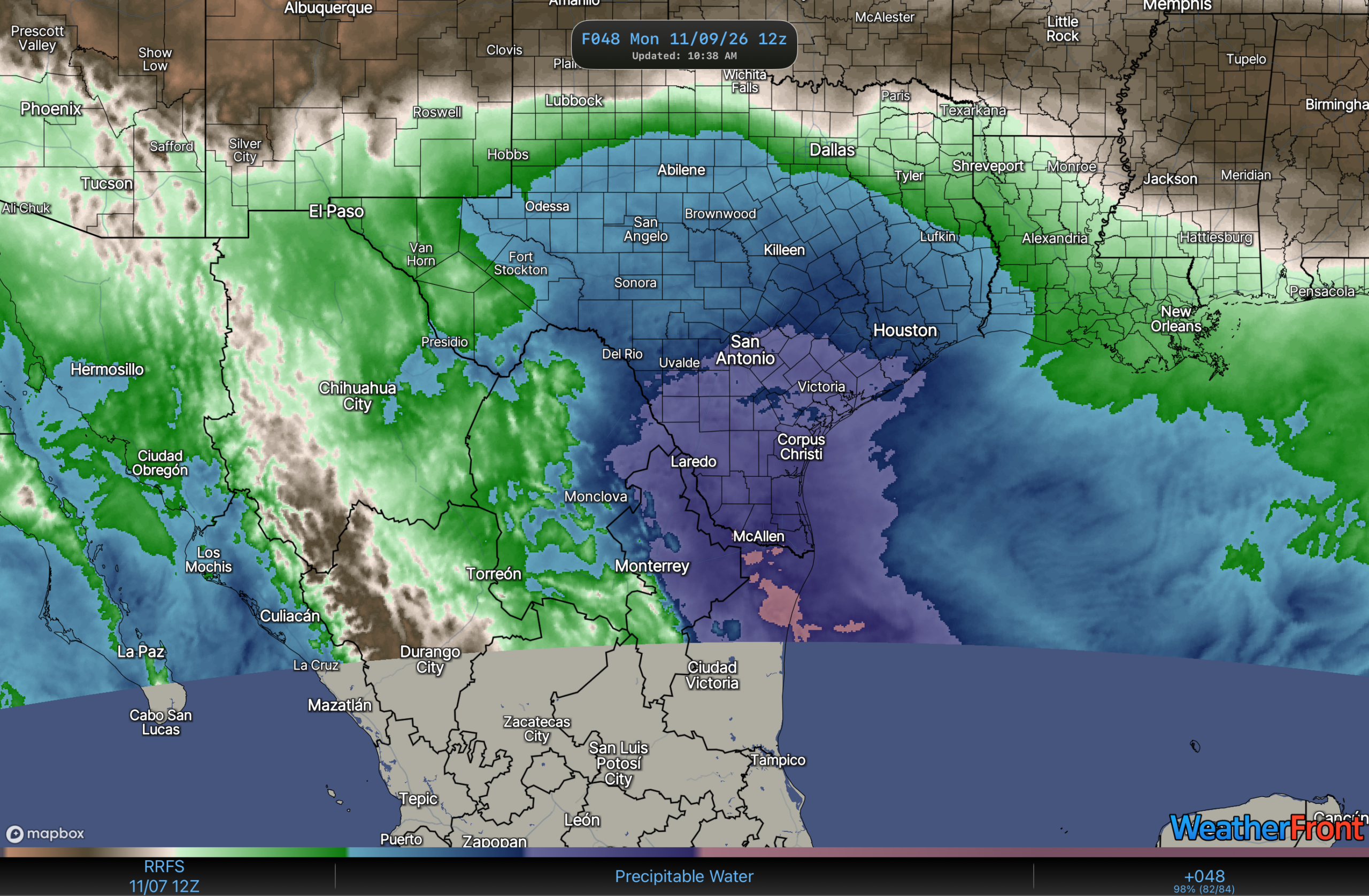
Here’s the map from 10 am CST this morning, and remember the winds are going to be pretty much from the east or southeast and a persistent trough over the Rio Grande Valley through the weekend. Note the plume of moisture focused in the western part first, and then gradually moving east over the next 3 days.
So the NWS Corpus Christi NWS, issued a version of the WPC Excessive Heavy Rain graphic this morning…
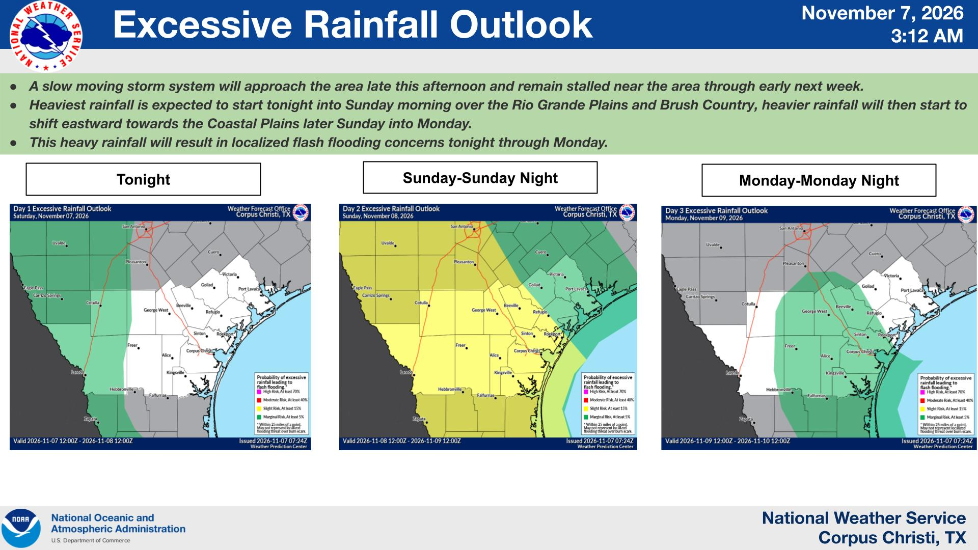
Looking at the Probabilistic Precipitation graphics
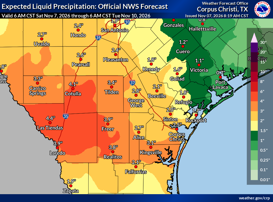
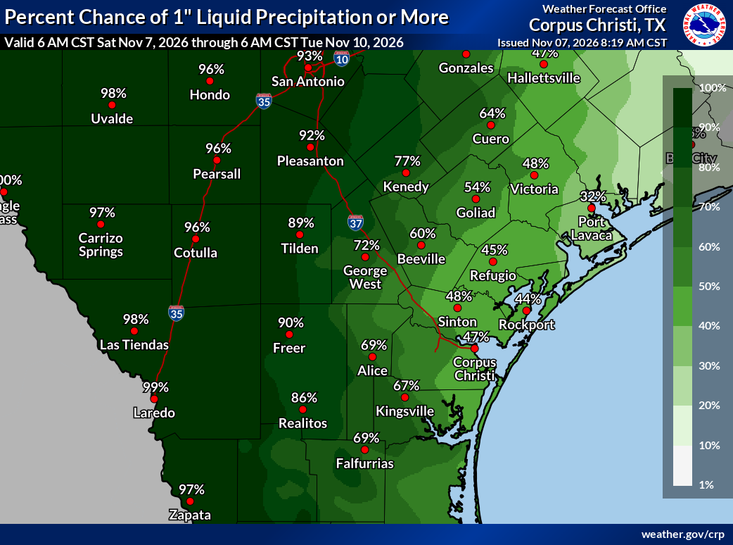
The expected rainfall is on the left and the chance of 1.00” is on the right. These maps are valid from this morning to Tuesday morning. 3-4 inches of rain in the Brush Country and the Rio Grande Plains, and 1.5-3.0” of rain along the Coastal Plains (the Victoria Crossroads will have less than 1.5”). The chances of getting 1” or greater is near 50% in the east and increasing as you head west into the Brush Country.
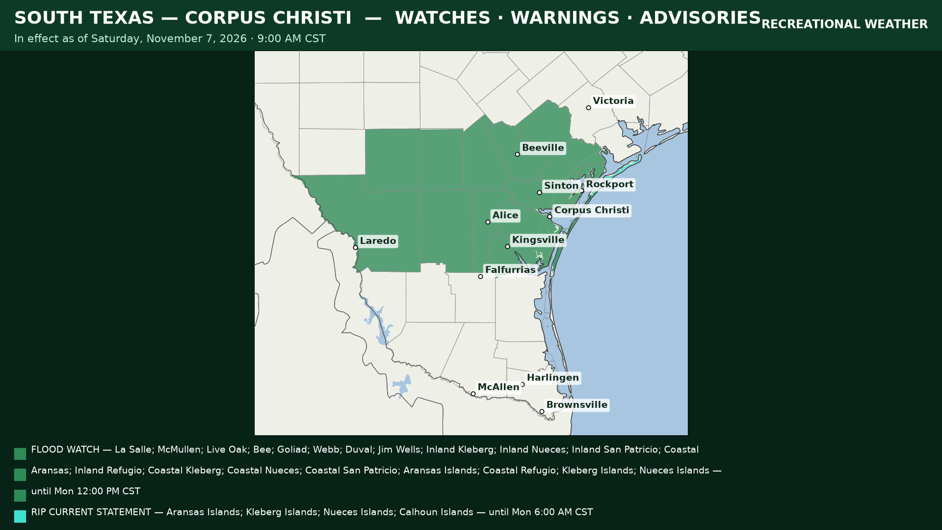
So the Corpus Christi office has issued a Flood WATCH, for all of South Texas. It doesn’t look like Brownsville or San Antonio has issued anything, yet.
This set up is serious, as the flooding in the headwaters of the rivers and potential flash flooding could be a major issue in the coming days. The Rio Grande River will be most affected with the expected rainfall around 4 inches for 72 hours. However, there is an upside that the water running from the Frio River Headwaters will end up in Choke Canyon reservoir and the rest of the Nueces River will end up in the Lake Corpus Christi. So those reservoirs would be filled, but with all the rain expected there is likely to be some moderate flooding.
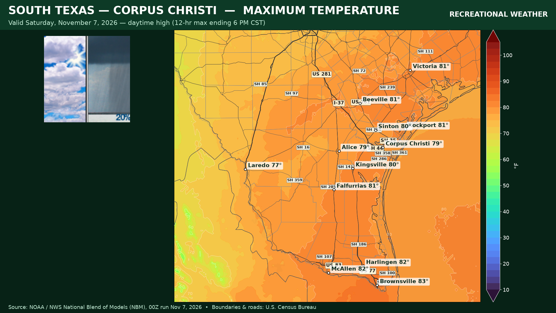
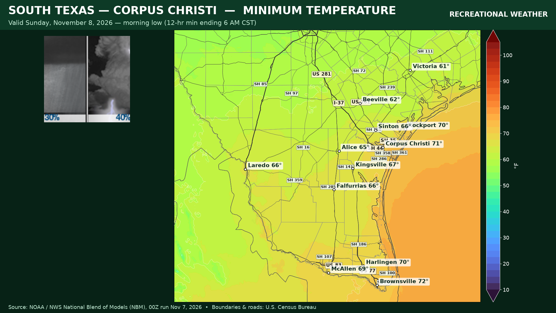
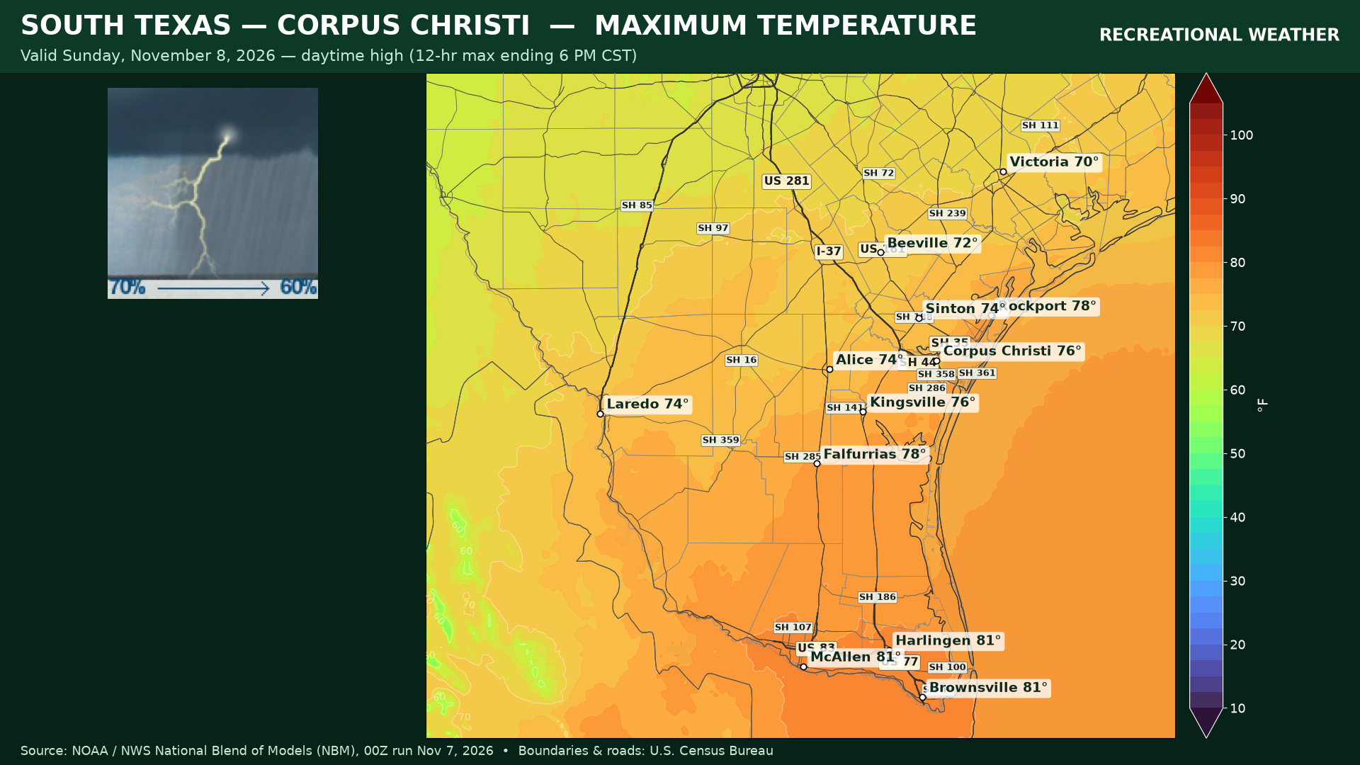
So the rain gets started late this afternoon, and increases overnight. Sunday, the showers and thunderstorms will be over the region.
Temperatures will be in the mid 70s to around 80 across South Texas today. Lows will be mid to upper 60s tonight and through the 70s with the rain and cloud cover on Sunday.
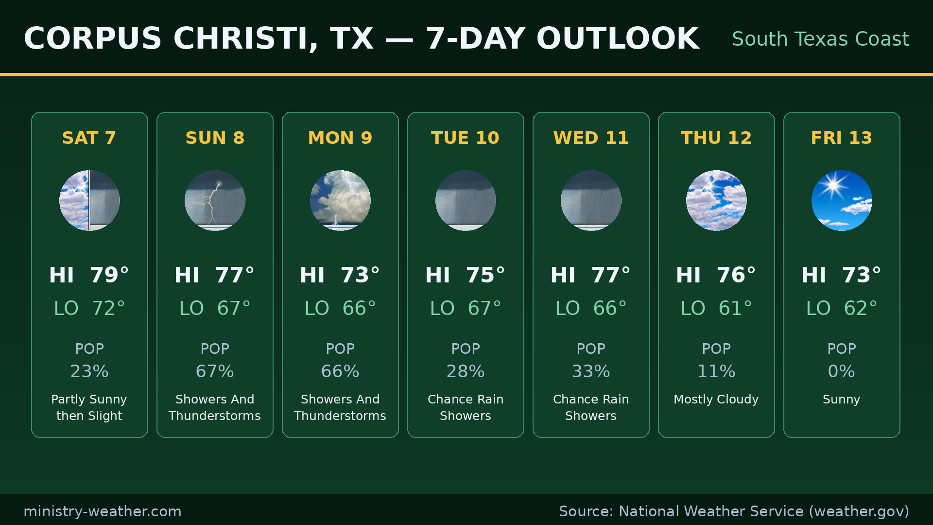
The rain continues into Monday. Tuesday and Wednesday the chance of rain fall off, with mid 70s for highs. Expect that any river flooding that occurs into the middle of the week.