I am a meteorologist and a former youth leader at church…I have a lot to say on both subjects…and then some
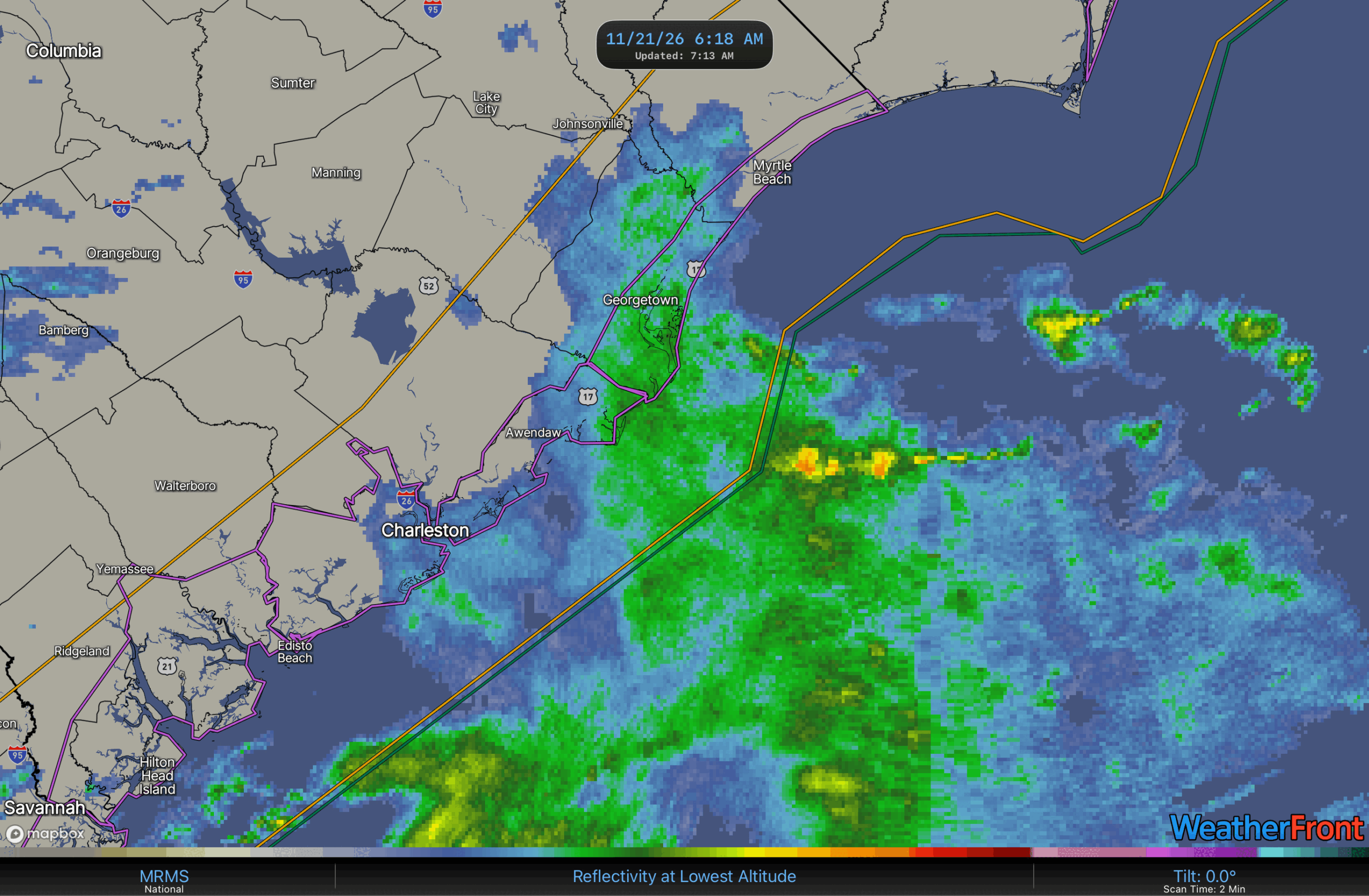
Good Morning! The rain is moving up the Atlantic Coast, with the rain (light) just starting to get into the South Strand, down by Georgetown.
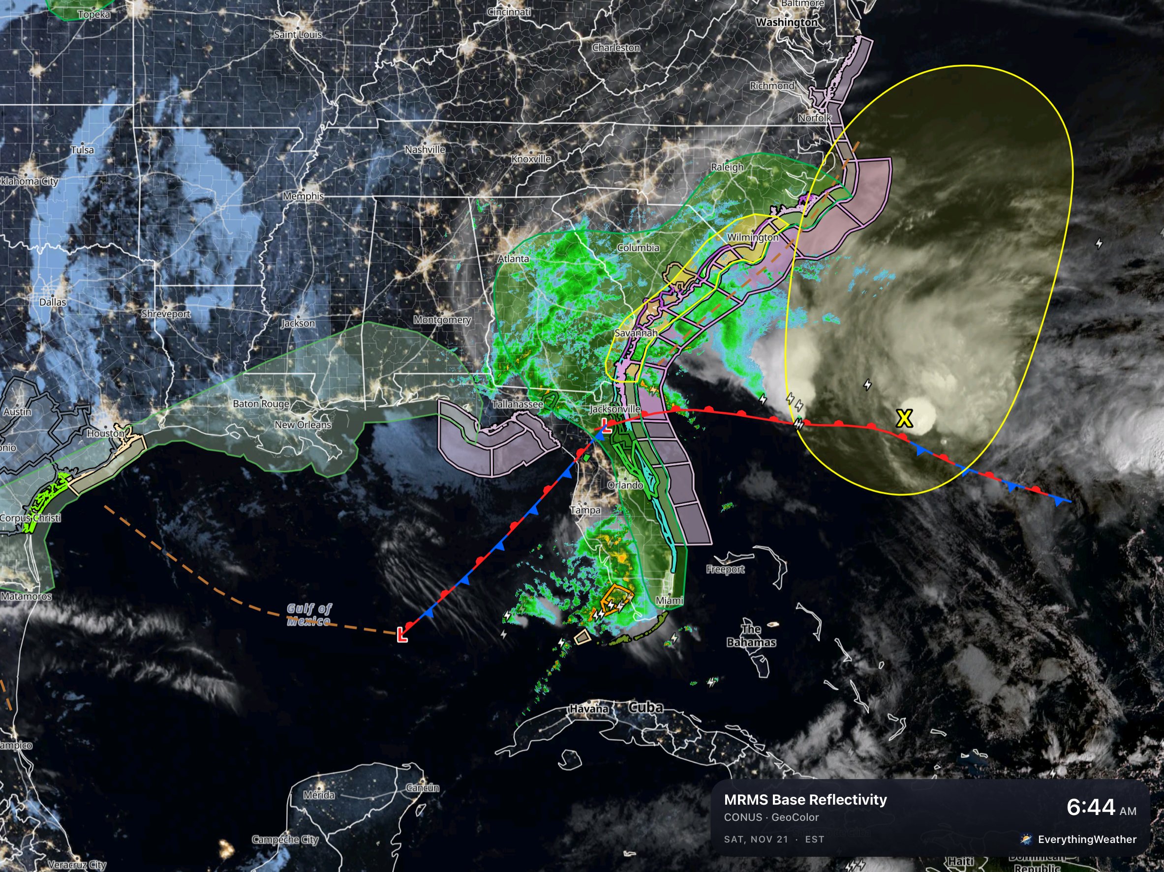
7 AM WPC front maps with the outlooks on it shows the slight risk (2 out of 5) of excessive heavy rain stretching up the Atlantic coast into North Carolina this morning. Heavy surf advisories are in effect as well for the beaches, and there are gale warnings from the coastal waters out into the Atlantic.
Last night, I saw that Levi Cowen (Tropical Tidbits) had this to say about the system…
He’s right about the system, and it’s still a mess this morning. You notice the low in the Gulf, the low over northern Florida, and the X out in the Atlantic (NHC Outlook), those are all the spin areas with this system. It will become a little more organized, but the models have different solutions on how that comes about. There is a bit of a consensus, that the Gulf system fades, or joins with the north Florida system. The wannabe tropical system moves out into the Atlantic, but north ahead of the Florida system.
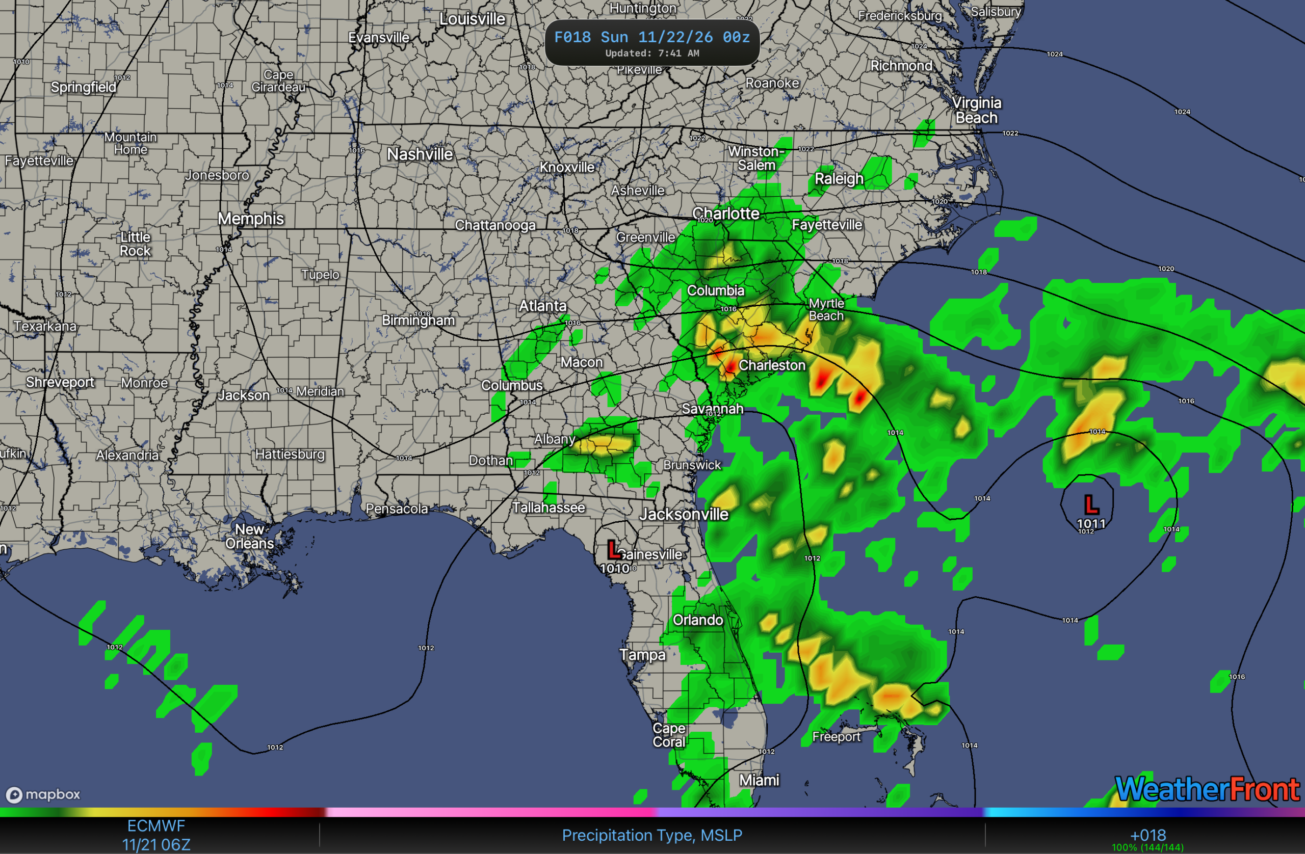
Best guess for timing of the long term possibly heavy rain to start is between 10 am and Noon, across Myrtle Beach and vicinity. The rain is expected to mainly rotate in from the Atlantic, while the whole system moves north. The bulk of the rain looks to fall between 7 pm tonight and 7 am Sunday.
Expected rain amounts over the next 18-24 hours look like this…
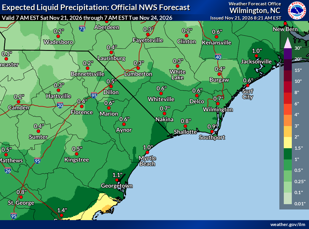
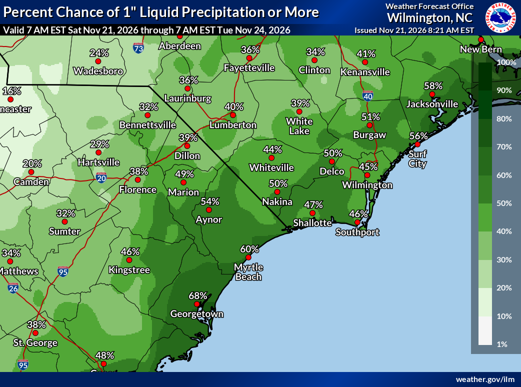
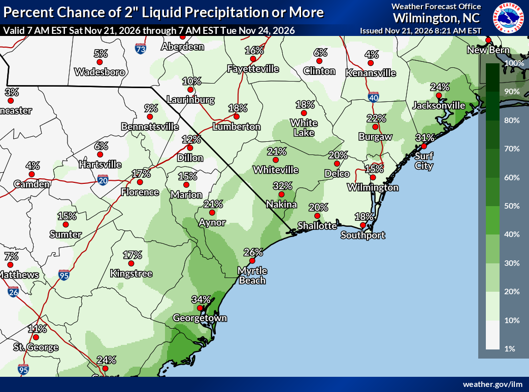
The maps here are from the NWS Wilmington, NC Page from the Probabilistic Precipitation Portal. The one of the left is the expected amount. Myrtle Beach and North Myrtle Beach are expected to be around an inch (1.0” and 1.2”) for the 24 hours ending 7 AM EST Sunday. The middle map is the chance for getting over 1.0” of rain, and the one on the right is for 2.0” or more. You’ll see more of these maps for the winter, mainly for northern Michigan snow this year. This is something that the NWS has been working on, and was just getting this suite of products online just before I retired in 2025.
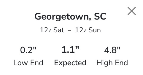
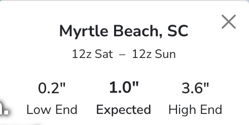
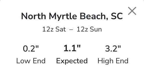
Here are the specifics for the points along the coast. There is a Pawley’s Island point as well, but it is very close to the Georgetown numbers, so I left it out. The only real fluctuation between the three sites, it the “high end” numbers. this is the number that shows the most reasonable worst case scenario (10% chance this could occur). So, don’t panic, just be prepared, if the worst case occurs. Stay tuned to local media or have a way to get the live NWS warnings, if they issue anything.
I’ll try and post updates on my Facebook and X accounts through the day.