I am a meteorologist and a former youth leader at church…I have a lot to say on both subjects…and then some
I was expecting to be home yesterday, but things didn’t go as planned. So let’s go through the forecast for today and Wednesday, with the outlook through early next week. Also, if you are interested in just your forecast, you can skip down past the map discussion to see it.
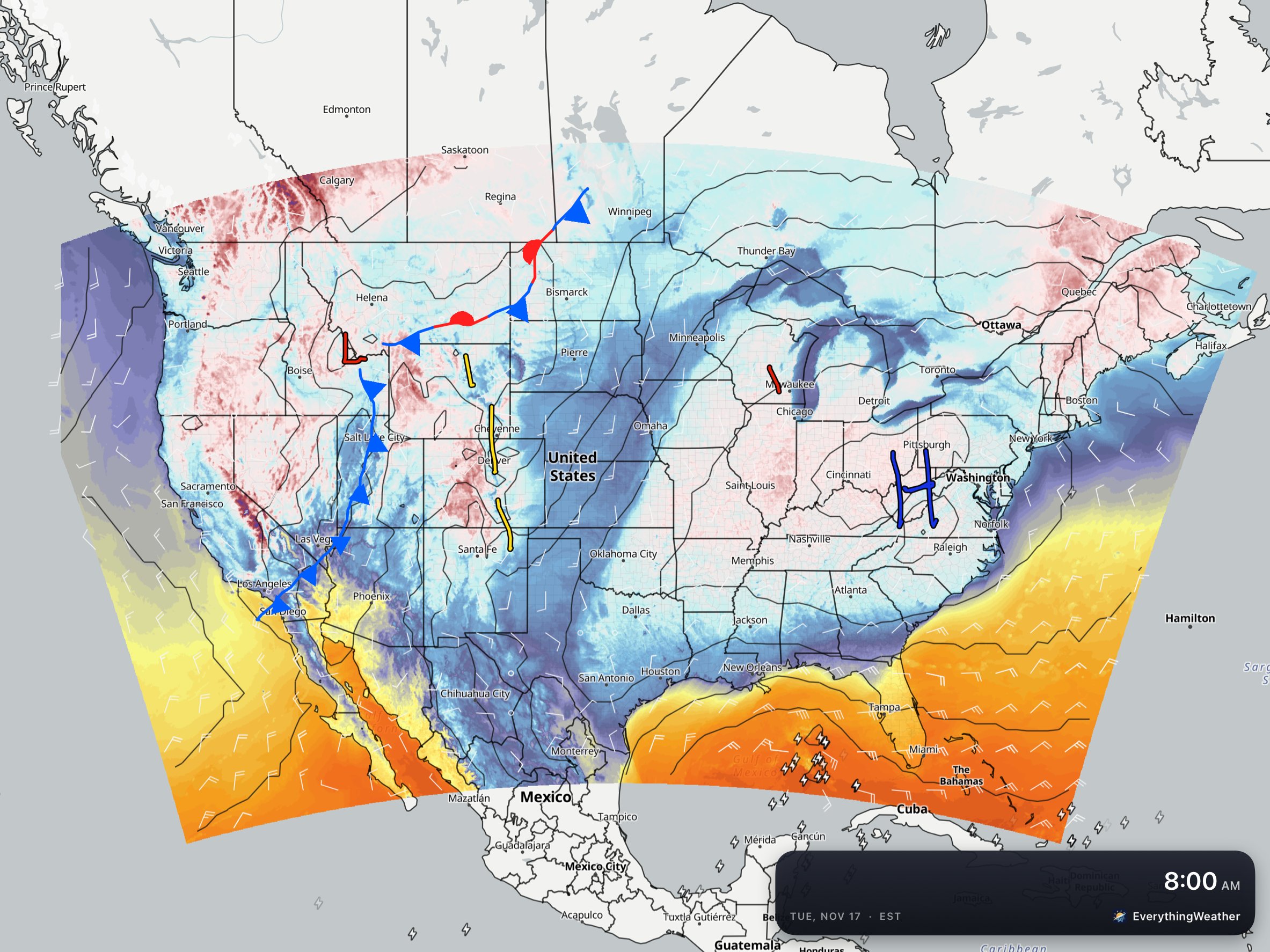
The pattern is beginning to get a little more active as the Pacific system has moved into the Rockies. High pressure still dominates the eastern half of the country. Which is also evident below, on the satellite/radar
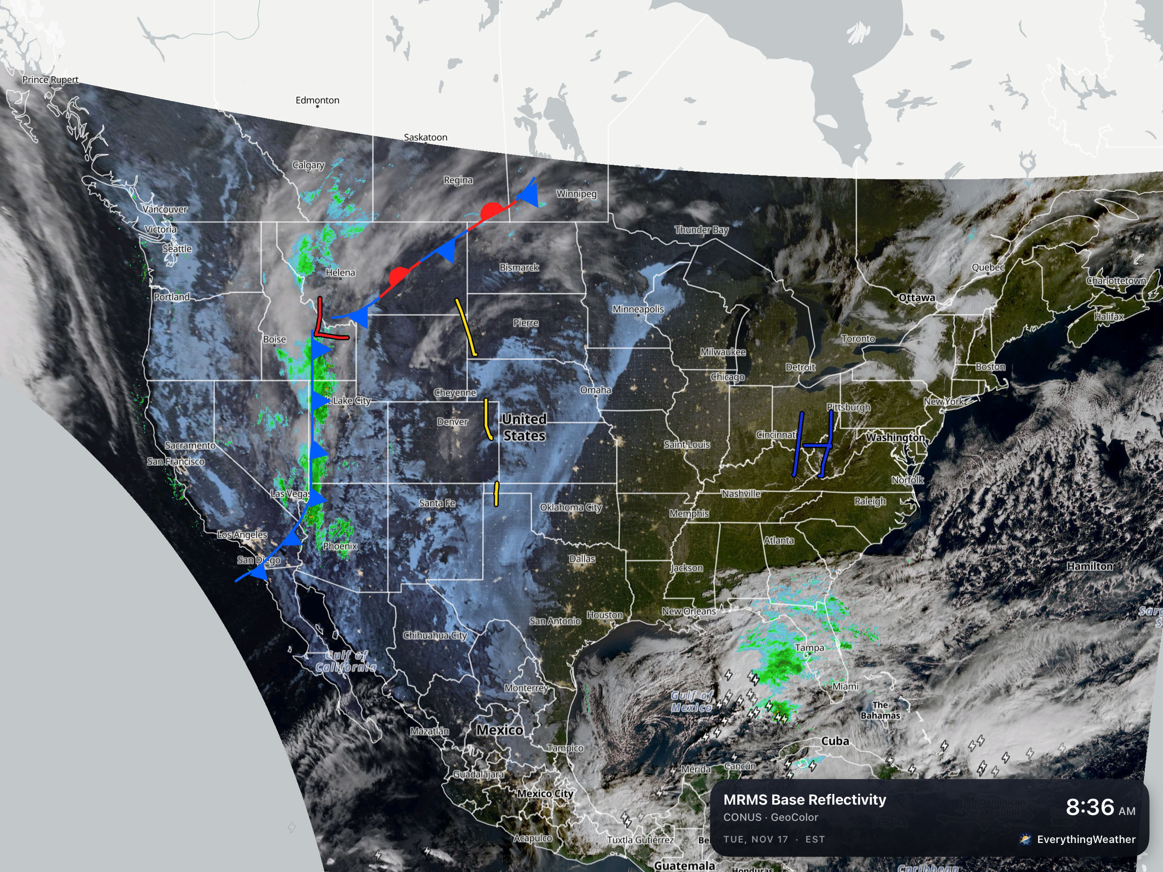
So, why is there rain in Florida? While most of the time a meteorologist will show the surface (sfc) map, other levels will also provide forcing to produce clouds and precipitation. In this case, below is the answer to the Florida question.
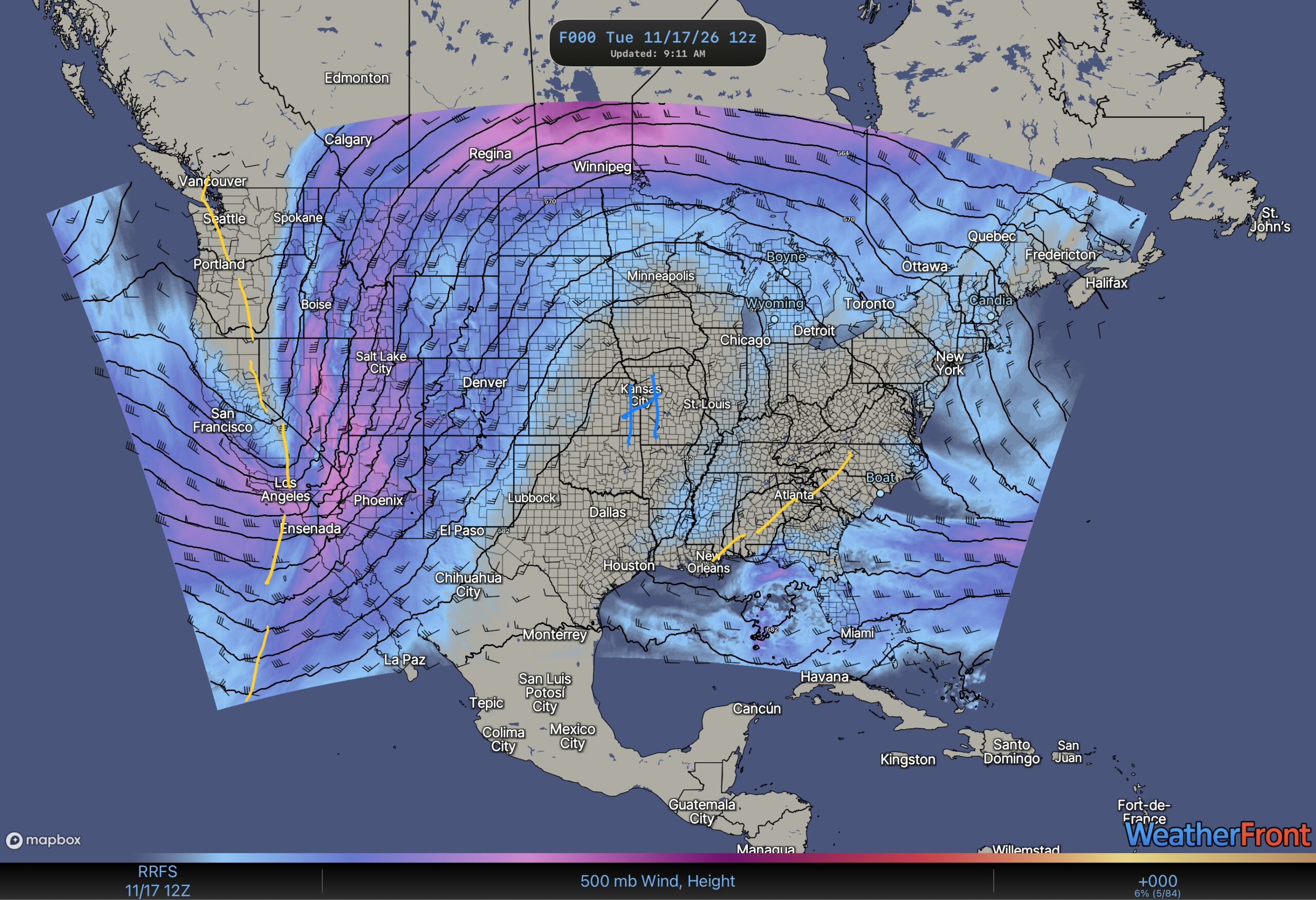
There is a trough of low pressure over the southeast part of the US. This can force upward motion to produce the clouds and rain (Thunderstorms) going on over Florida, even though there is high pressure at the surface.
So let’s look at today through Thursday…
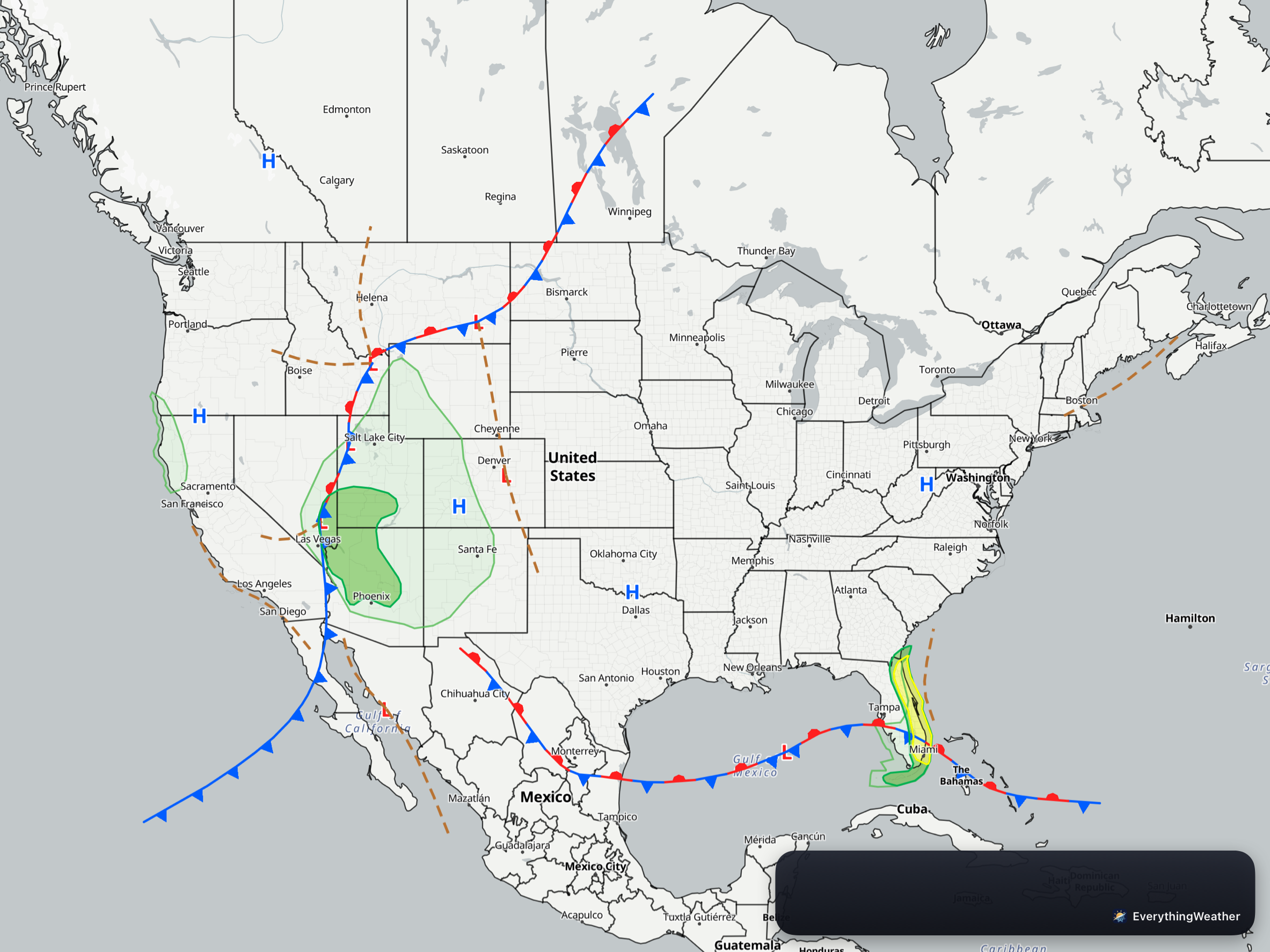
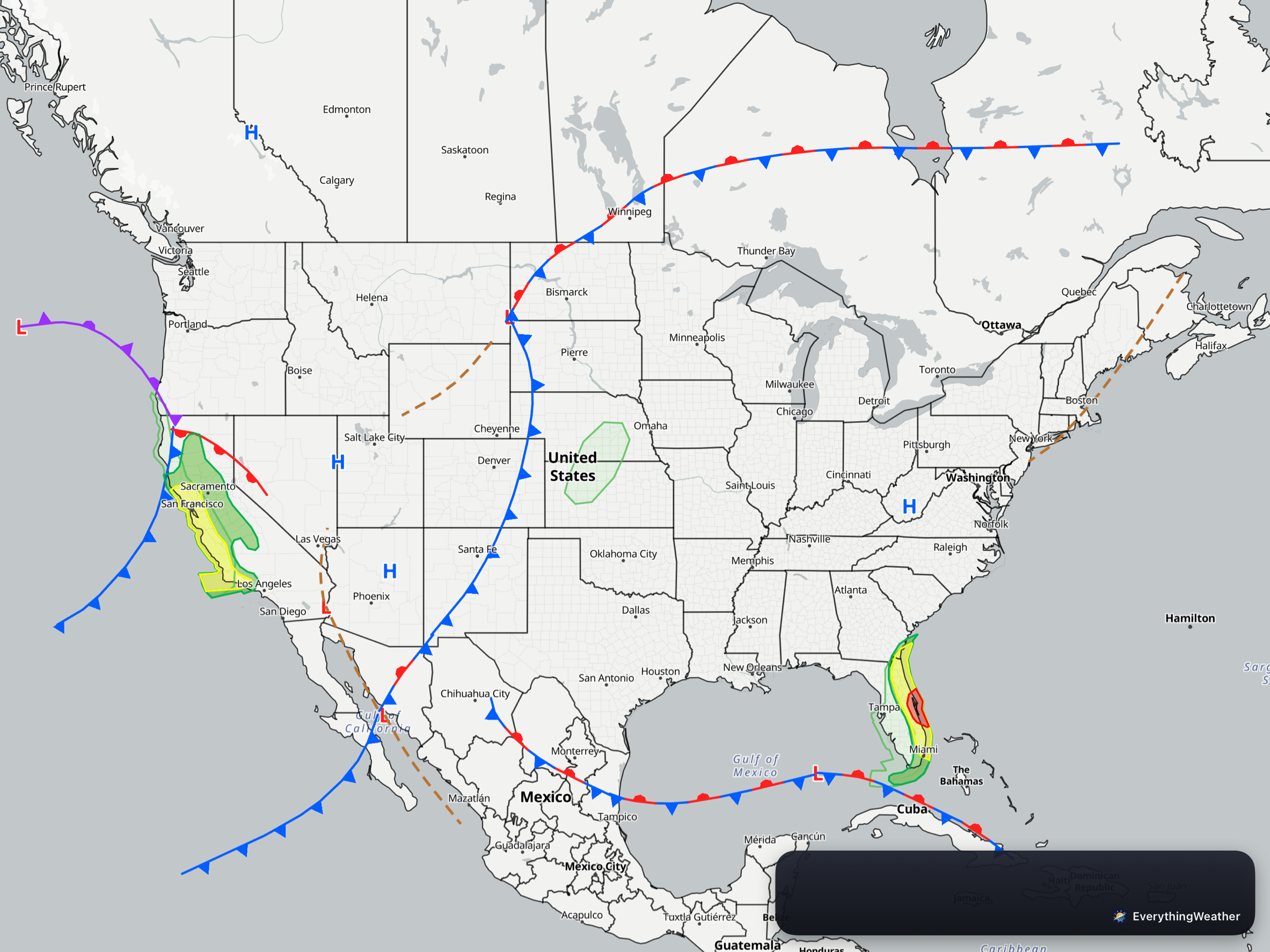
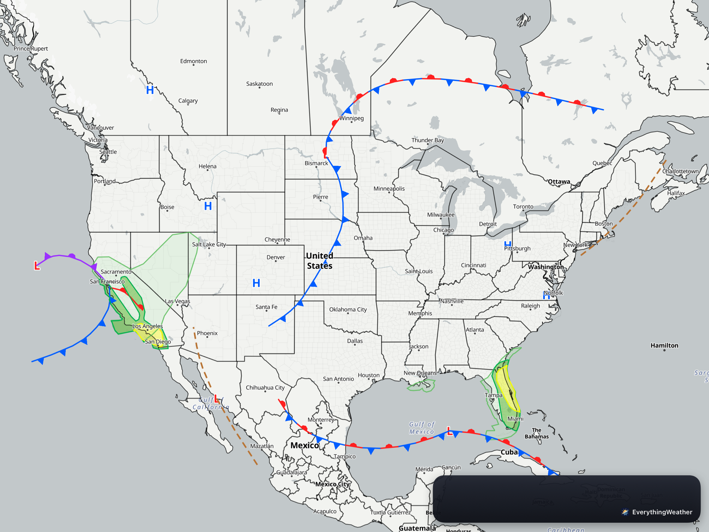
Day 1 (today) is on the left(you can tap it to make it bigger) and the map shows High pressure still dominates the eastern half of the US except in the Gulf. Day 2 (Wednesday) is much the same, and Florida is showing a moderate risk of flash flooding. However, for the rest of the eastern US, dry weather. That dry weather for the eastern US continues into Day 3 (Thursday) as well. The front and low pressure in the Rockies today, moves into the Northern Plains, and then slows as the high amplitude pattern (the jet stream goes north and south) slowly moves east. So here are the specifics…
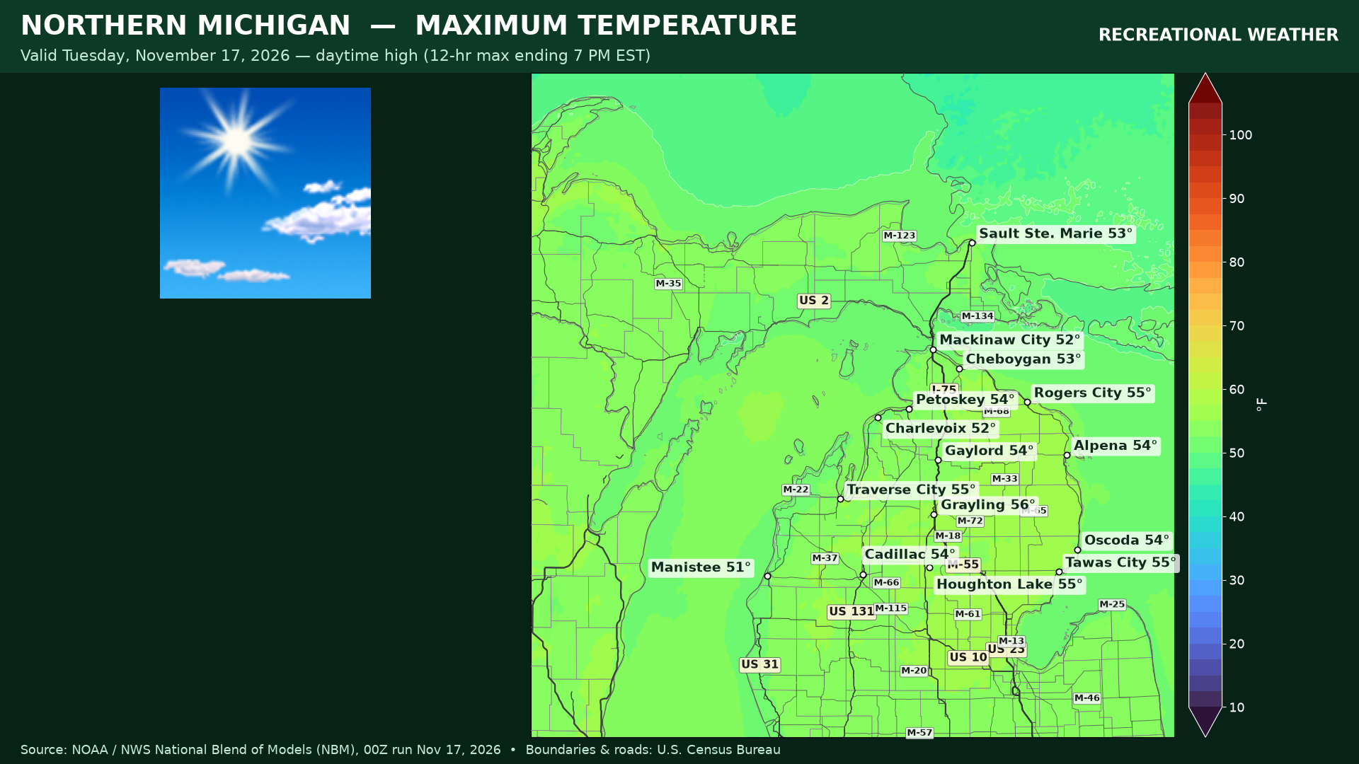
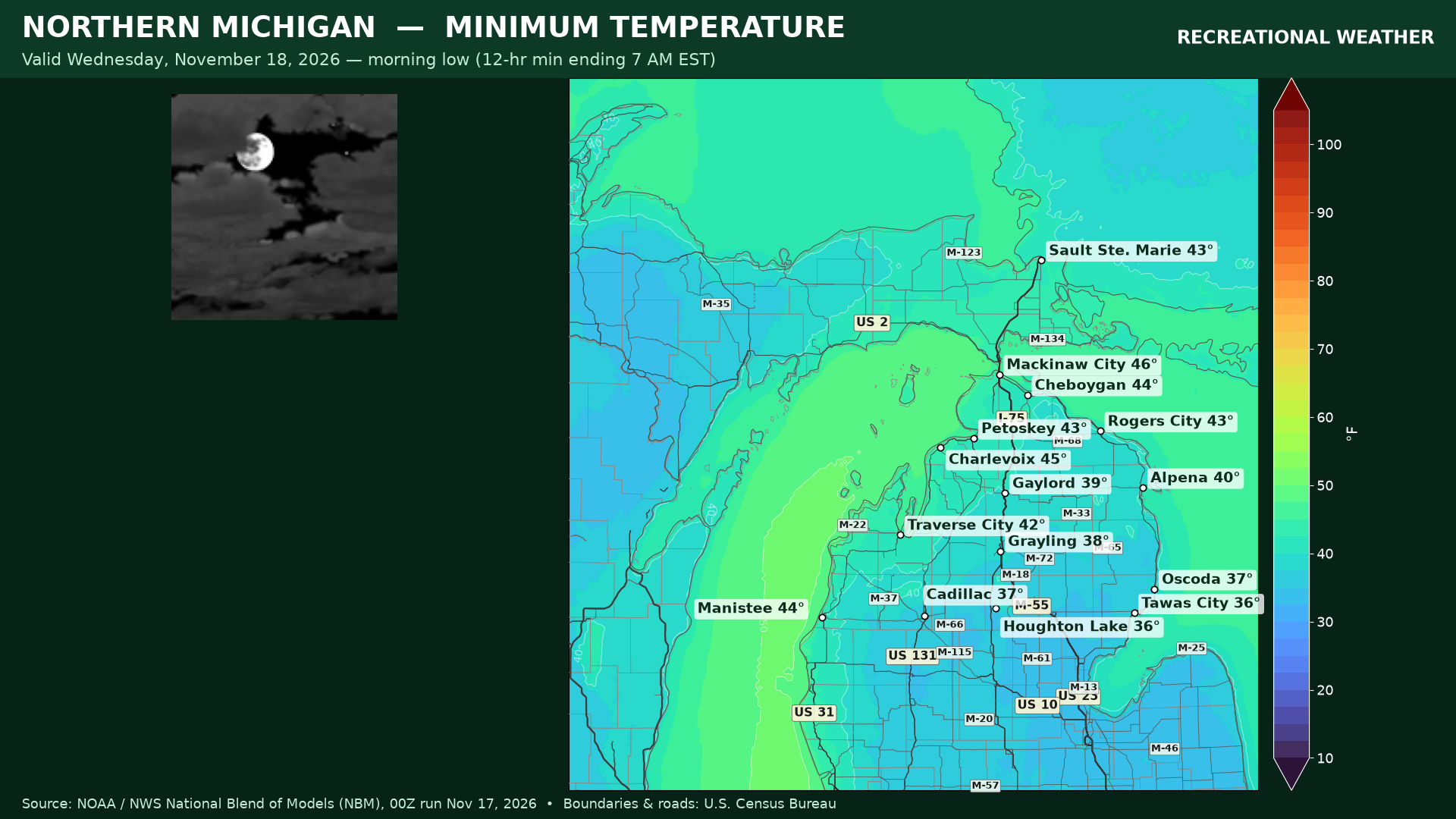
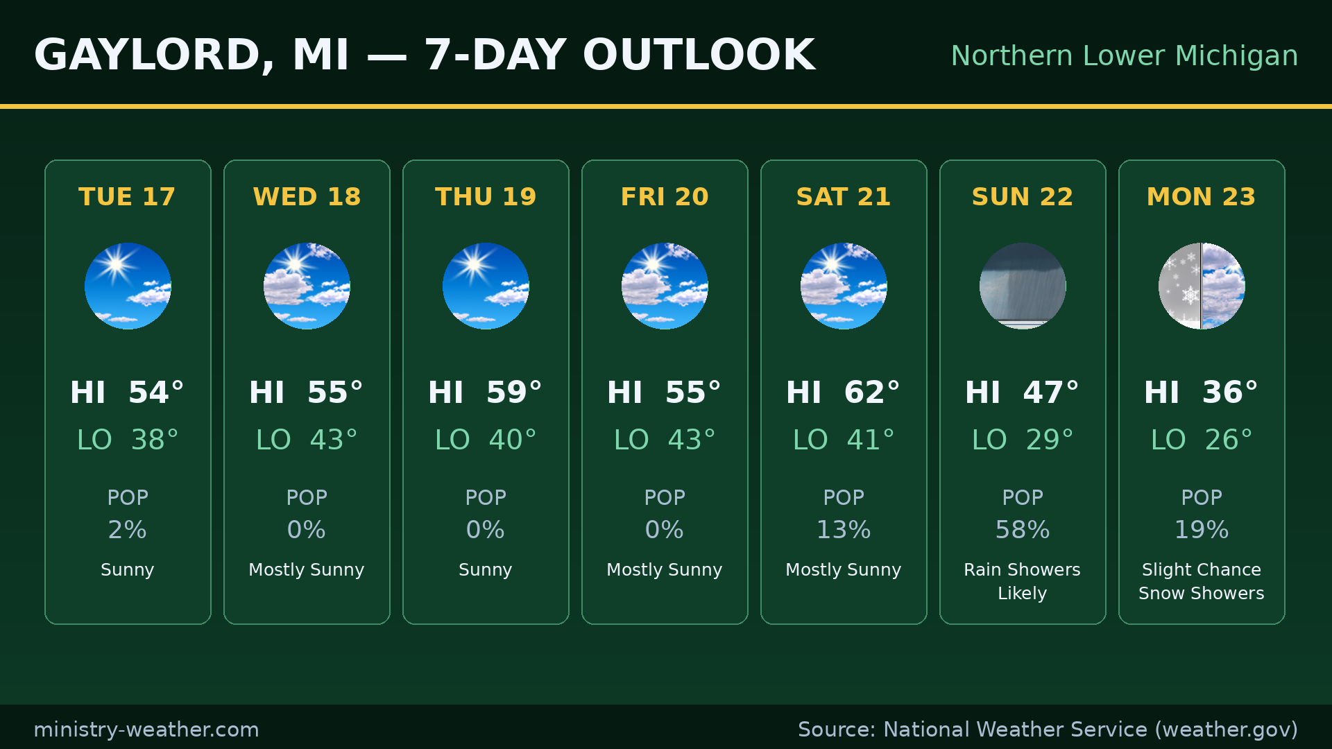
NORTHERN MICHIGAN — Gaylord
Today: sunny, high 54°, low tonight 38°.
Wednesday: mostly sunny, high 55°, low 43°.
Sunny Thursday (59°), mostly sunny Friday (55°), mostly sunny Saturday (62°), then rain showers likely Saturday night into Sunday (47°), a chance of rain and snow showers Sunday night, and a slight chance of snow showers Monday (36°).
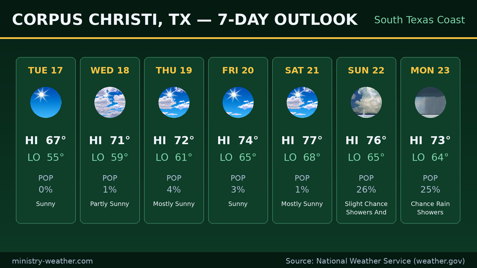
SOUTH TEXAS — Corpus Christi
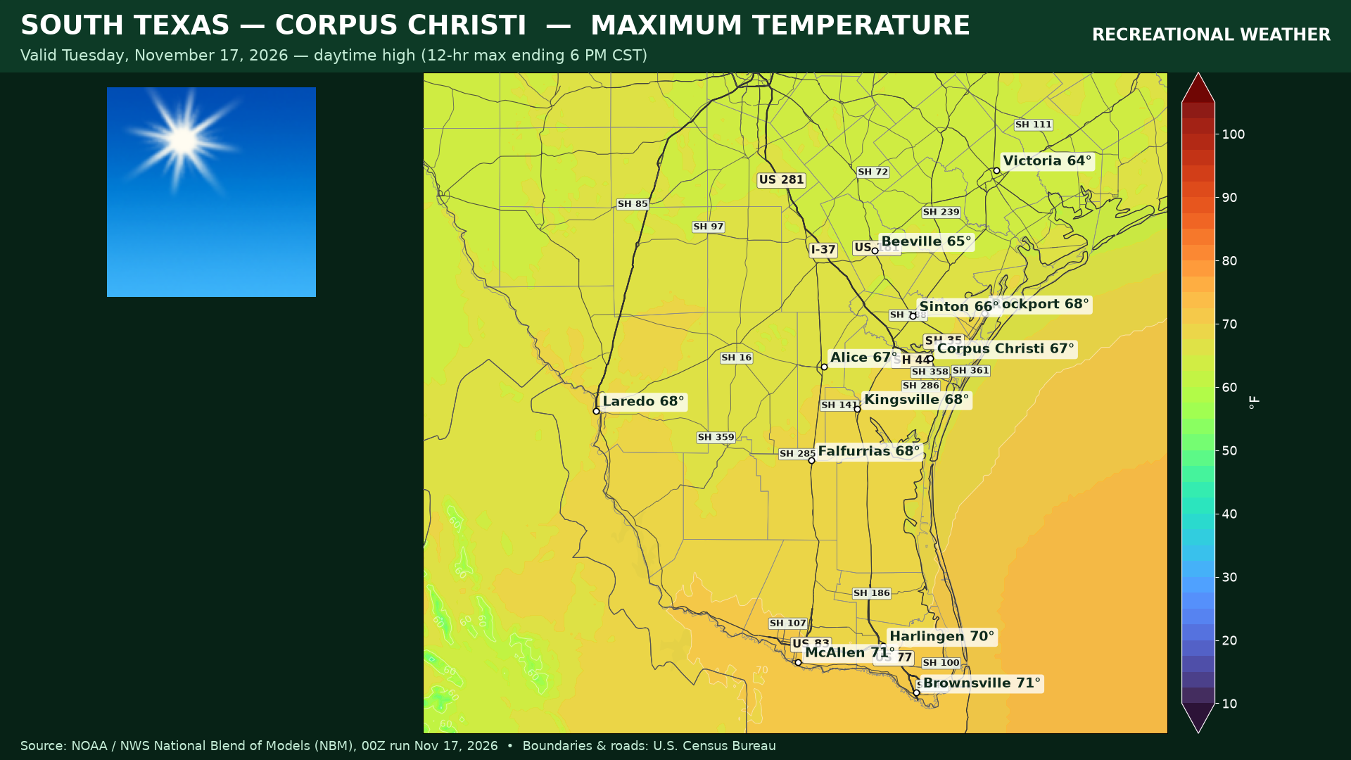
Today: sunny, high 67°, low tonight 55°.
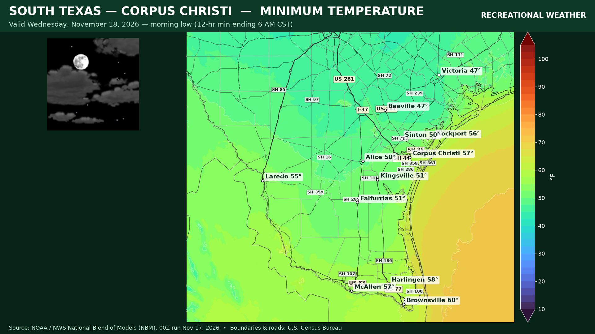
Wednesday: partly sunny, high 71°, low 59°.
Mostly sunny Thursday (72°), sunny Friday (74°), mostly sunny Saturday (77°), a chance of showers and thunderstorms Sunday (76°), and a chance of rain showers Monday (73°).
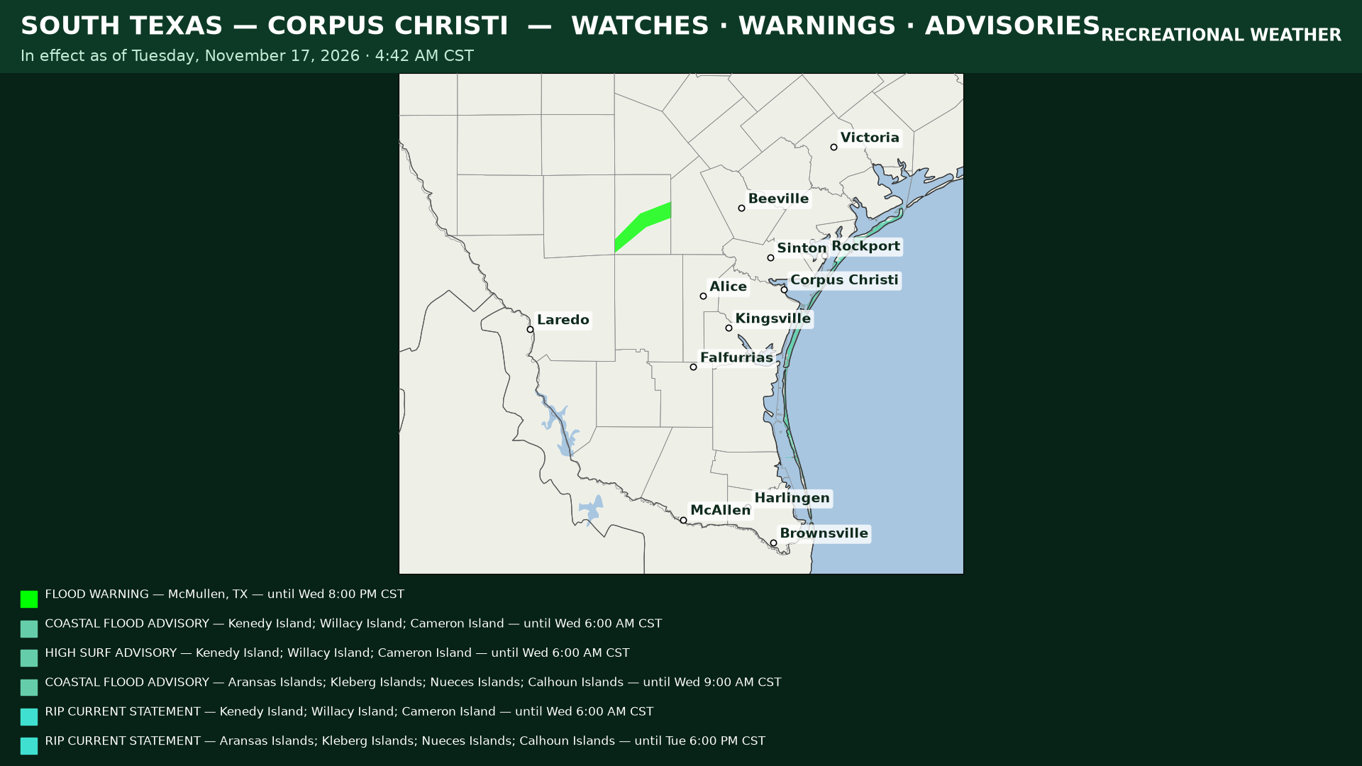
Alerts: a Flood Warning for the Nueces River near Tilden (McMullen County) — minor flooding forecast, warning runs through Wednesday 8:00 PM CST. A Coastal Flood Advisory for the Aransas, Kleberg, Nueces, and Calhoun island areas through Wednesday 9:00 AM CST, and a Rip Current Statement for the Corpus Christi coast through 6:00 PM CST today. For the southern islands (Kenedy, Willacy, Cameron): a Coastal Flood Advisory, a High Surf Advisory, and a Rip Current Statement, all through Wednesday 6:00 AM CST.
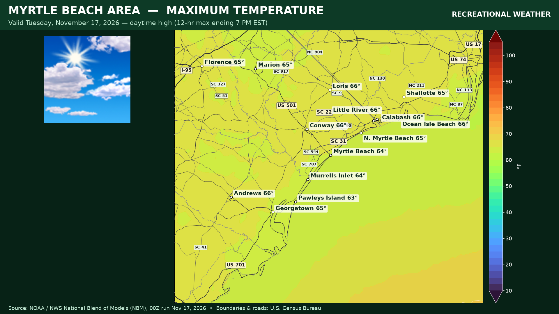
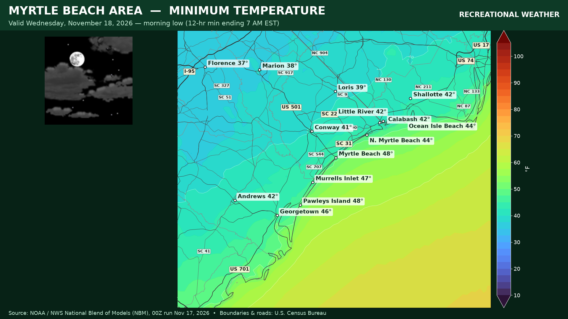
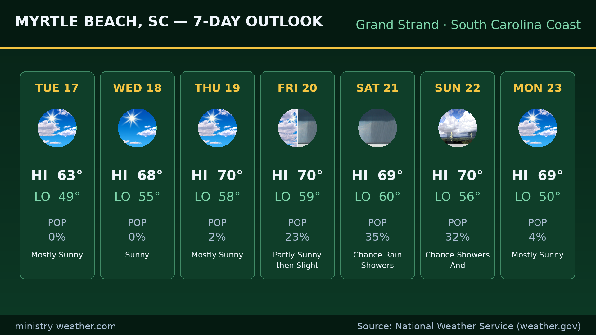
MYRTLE BEACH AREA — Grand Strand
Today: mostly sunny, high 63°, low tonight 49°.
Wednesday: sunny, high 68°, low 55°.
Mostly sunny Thursday (70°), partly sunny Friday (70°) with a slight chance of rain showers late, a chance of rain showers Saturday (69°), a chance of showers and thunderstorms Sunday (70°), and mostly sunny Monday (69°).
Data and imagery: National Weather Service (weather.gov), NBM 00Z run Nov 17, 2026. Graphics: ministry-weather.com.