I am a meteorologist and a former youth leader at church…I have a lot to say on both subjects…and then some
Since I originally started my weather podcast about 20 years ago, and it was titled “Northern Michigan Recreational Weather”, I decided today that I would try and keep that theme to a point for the places I have lived. This morning, one of my grandsons, Snapchatted me his picture out hunting, and this is the first day of the unofficial state of Michigan holiday known as “firearm deer season”. This goes back to before I was a boy growing up in southern lower Michigan (downstate), as friends of mine would be gone with their dads to go hunting on November 15th. I looked up the deer seasons in Texas (nov.7th to Jan.1) and South Carolina (Oct. 11-Jan.1) Bare in mind, that these forecasts can be used for any type of outdoor activity. Except for maybe boating on major bodies of water, like the Gulf, for Texas or the Great Lakes, for Michigan. I realize that I need to probably incorporate that into my videos, but as I have said before, this is a work in progress, and I’m getting my workflow down so that I can tailor the forecasts for everyone in these areas, or add more areas.
With that all said, let’s look at today’s weather and what to look for this week…
I always start with how the weather looks currently.
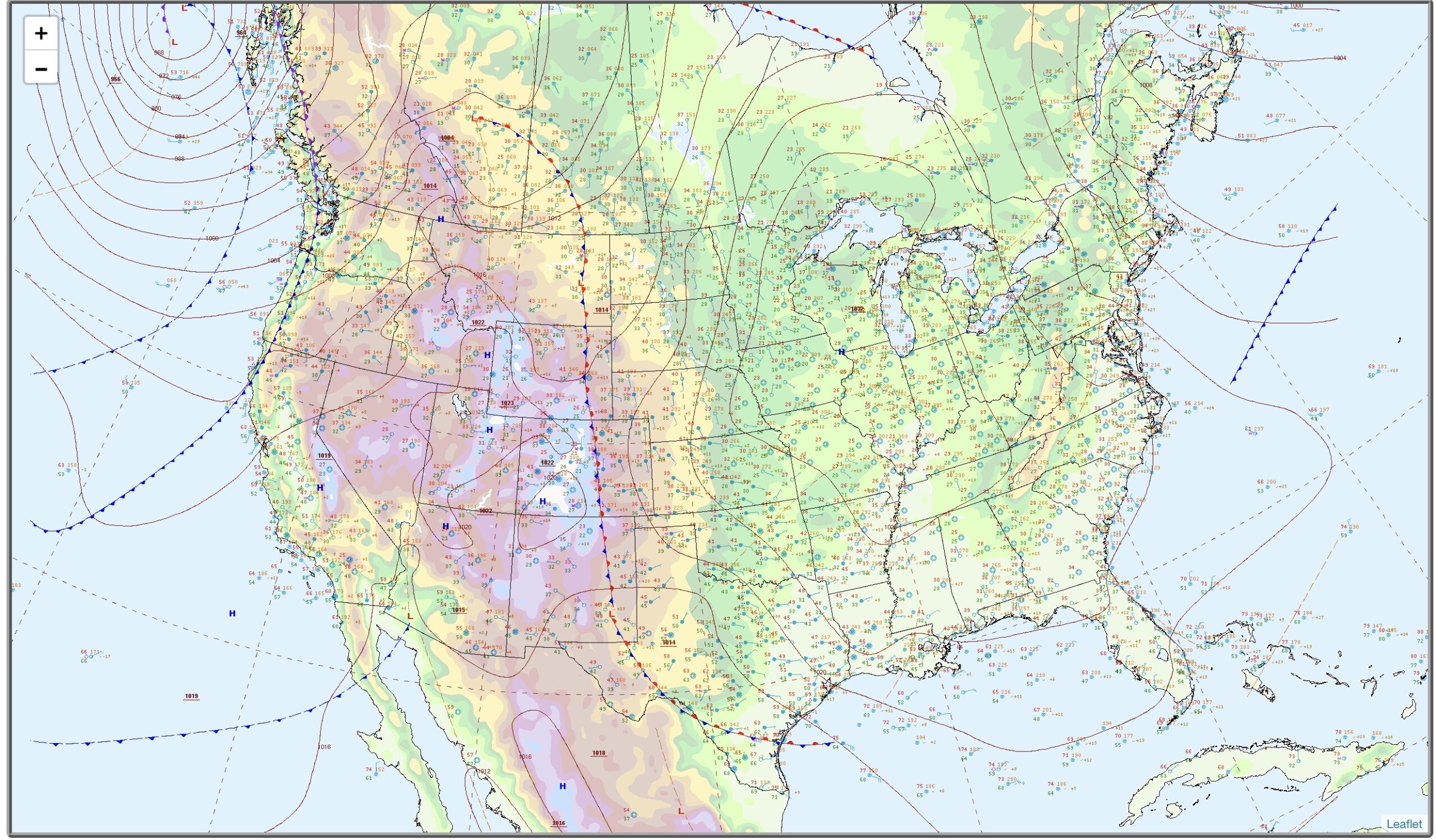
The map above is for 7 am today (11/15/2026). High pressure is over the eastern have of the US with a stationary front that runs down the front range of the Rocky Mountains, and then begins to hook east into the Gulf part way down the Rio Grande Valley in Texas. West of the Front, high pressure is over the Intermountain West and the Desert Southwest. There is also a series of front along the Pacific coast. So as far as maps look, this is fairly boring for the fall.
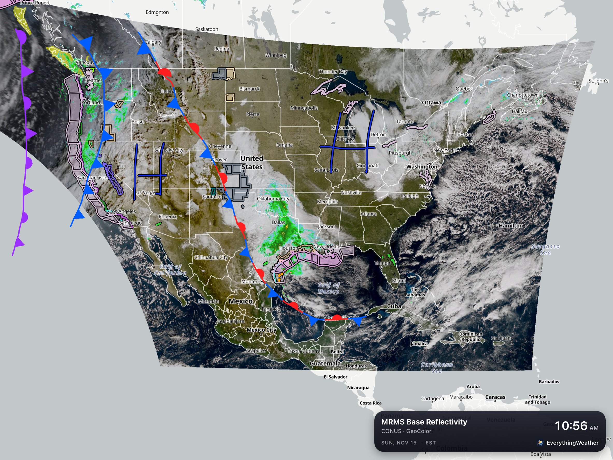
Here’s the more up-to-date map using Everything Weather. I’ve overlaid the current watch/warnings/advisories (WWA) over the US. The frost/freeze issues in the southeastern states have expired. It is starting to get breezy, along the Texas and Louisiana Gulf coasts as Low pressure begins to develop in the western end of the Gulf today. Not to mention, there looks to be some coastal flooding from the onshore flow.
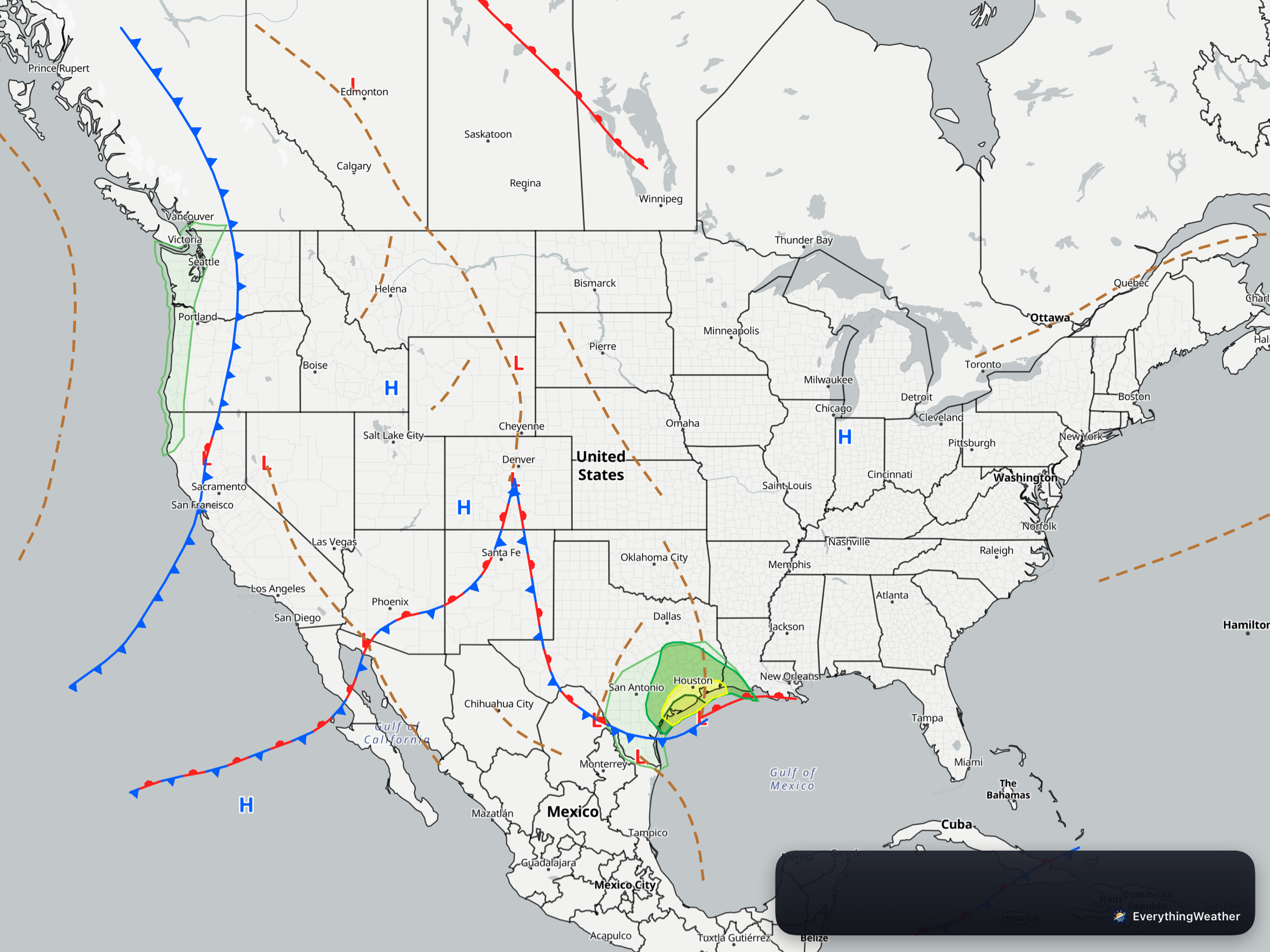
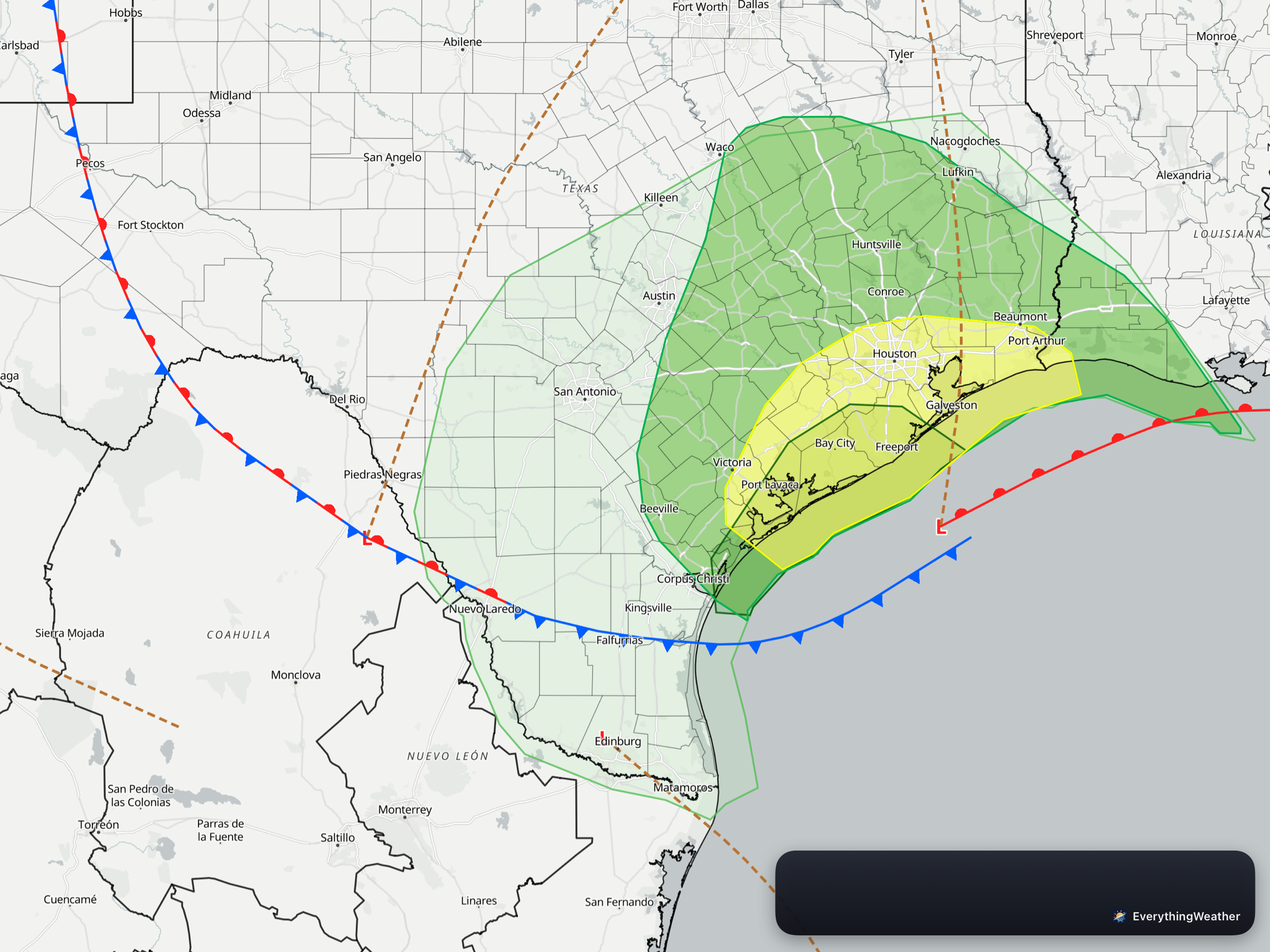
The map to the left, is the rest of the day and tonight’s look (day 1) for heavy rain and severe weather. The eastern part of the US is clear of threats. There are general thunderstorms expected in the Pacific NW. The main concern through 7 AM EST (6AM CST) is the Middle and Upper Texas Coasts (map on the right. As the low develops in the Gulf, the heavy rain threat and severe weather threats are mainly along the coast from Corpus Christi and areas north and east, into Louisiana.
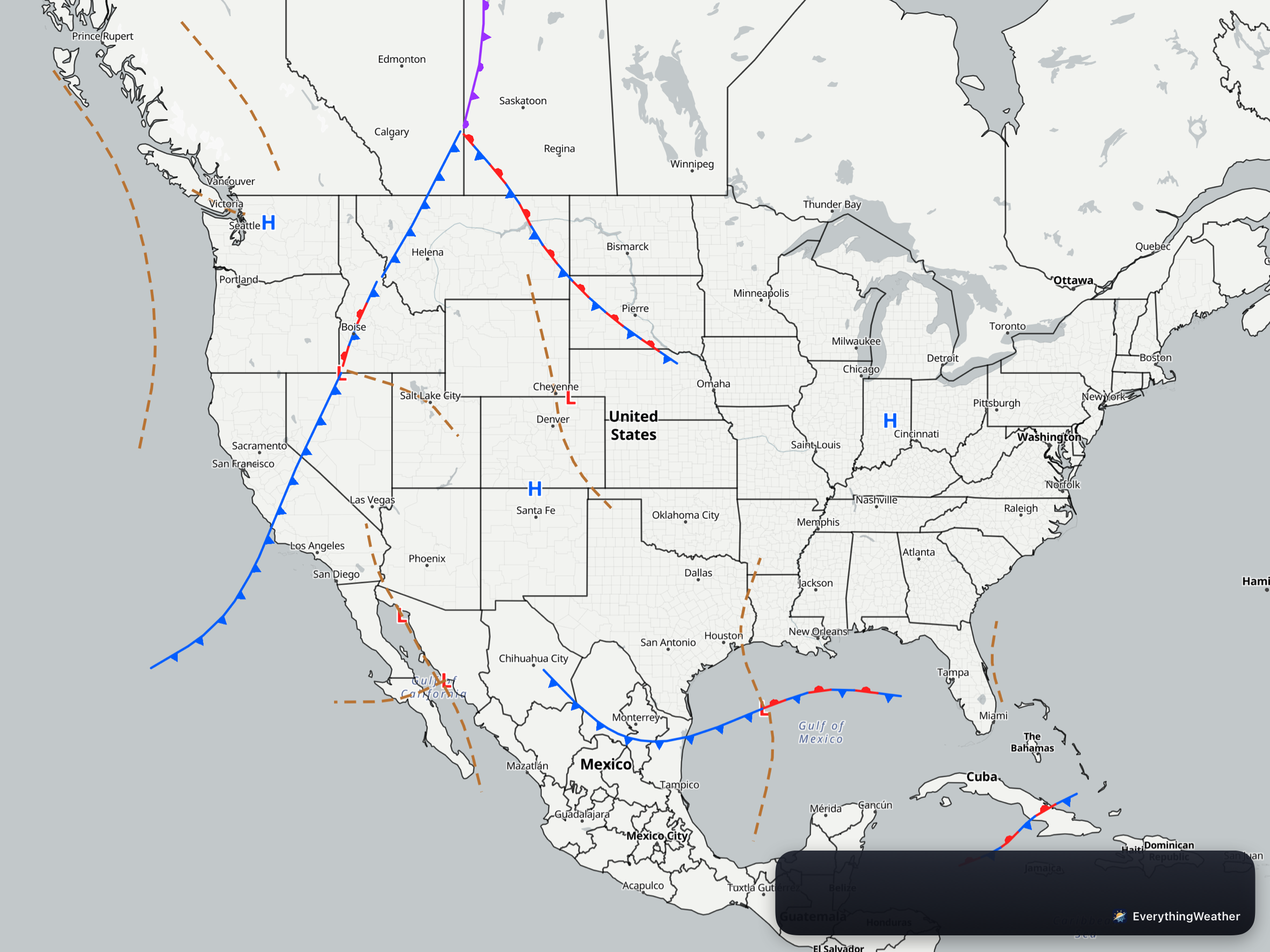
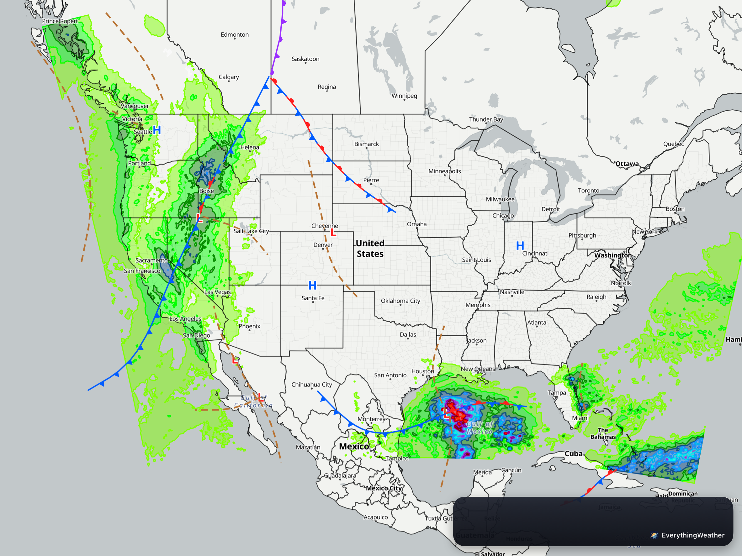
There are no outlook areas tomorrow (day 2), but that’s not to say there won’t be precipitation. Rain is expected along the Pac NW coastal areas, with rain, and snow in the mountains. High pressure continues over the eastern half of the US, with rain along the Gulf coast from the low moving across the Gulf. Rain continues over Florida as well.
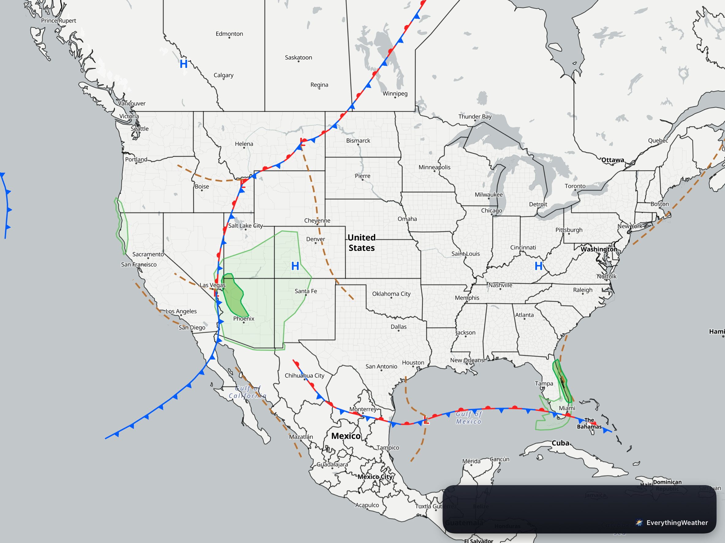
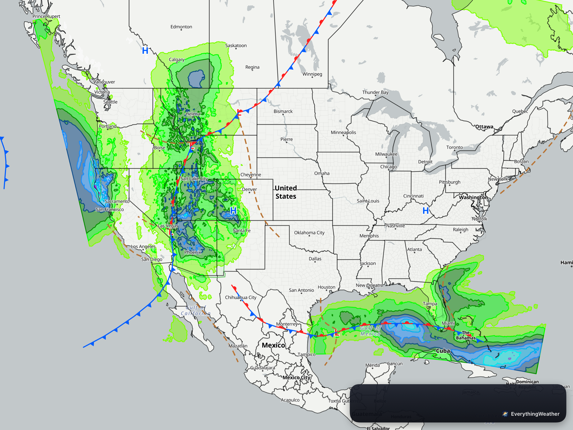
On Tuesday (Day 3), rain continues along the Pacific coast. The outlook for heavy rain is marginal in the Desert Southwest and along the Florida Atlantic coast. Rain and snow, falls along the Rocky Mountains and across the Gulf as well. Texas, Michigan, and South Carolina looks to begin to get dry. Well, SC and MI should remain dry.
Okay so were are the details…
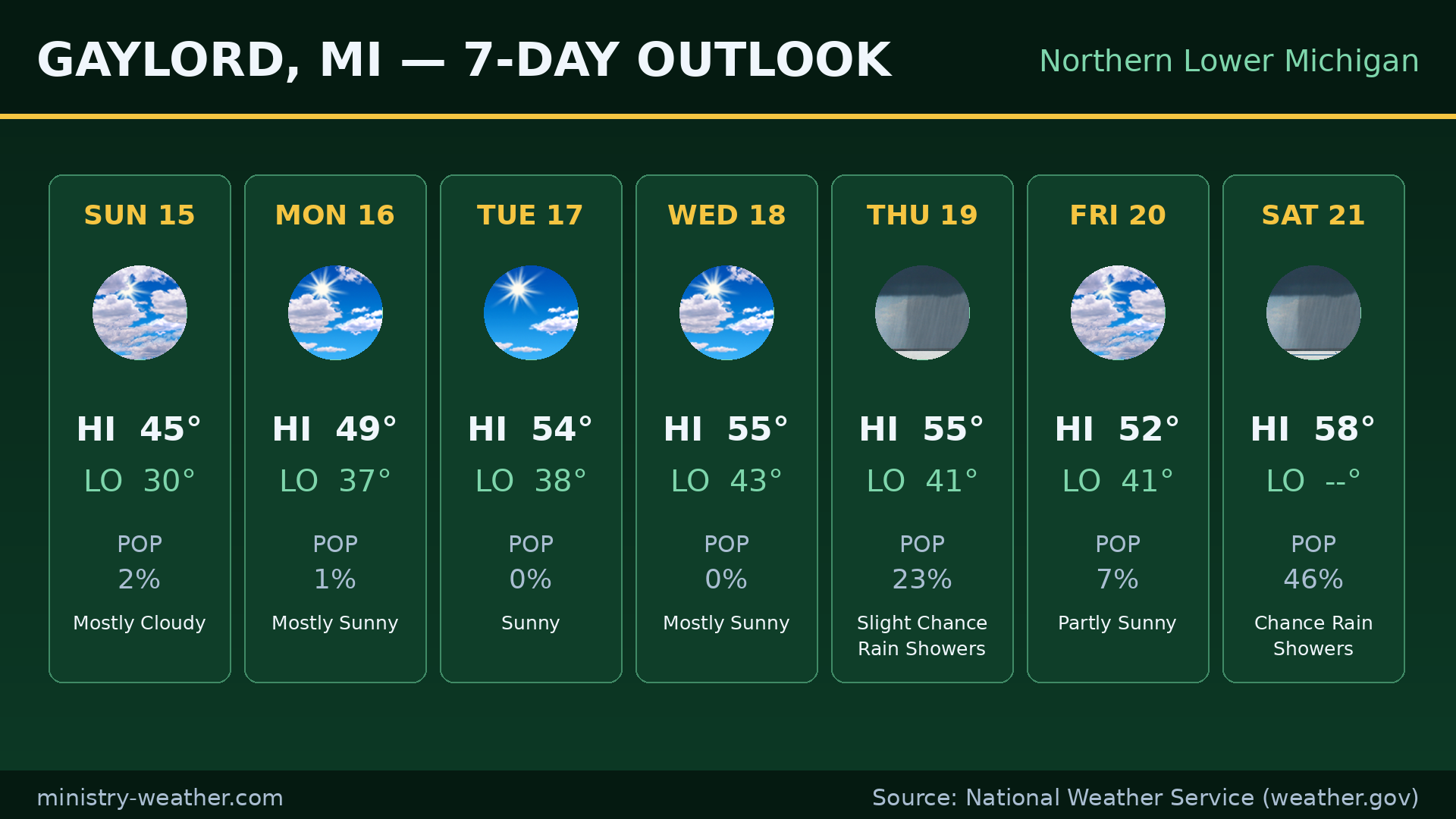
NORTHERN MICHIGAN — Gaylord
Today: mostly cloudy, high 45°, low tonight 30°.
Monday: mostly sunny, high 49°, low 37°.
Sunny Tuesday (54°), mostly sunny Wednesday (55°), then a slight chance of rain showers Thursday (55°), partly sunny Friday (52°), and a chance of rain showers Saturday (58°).
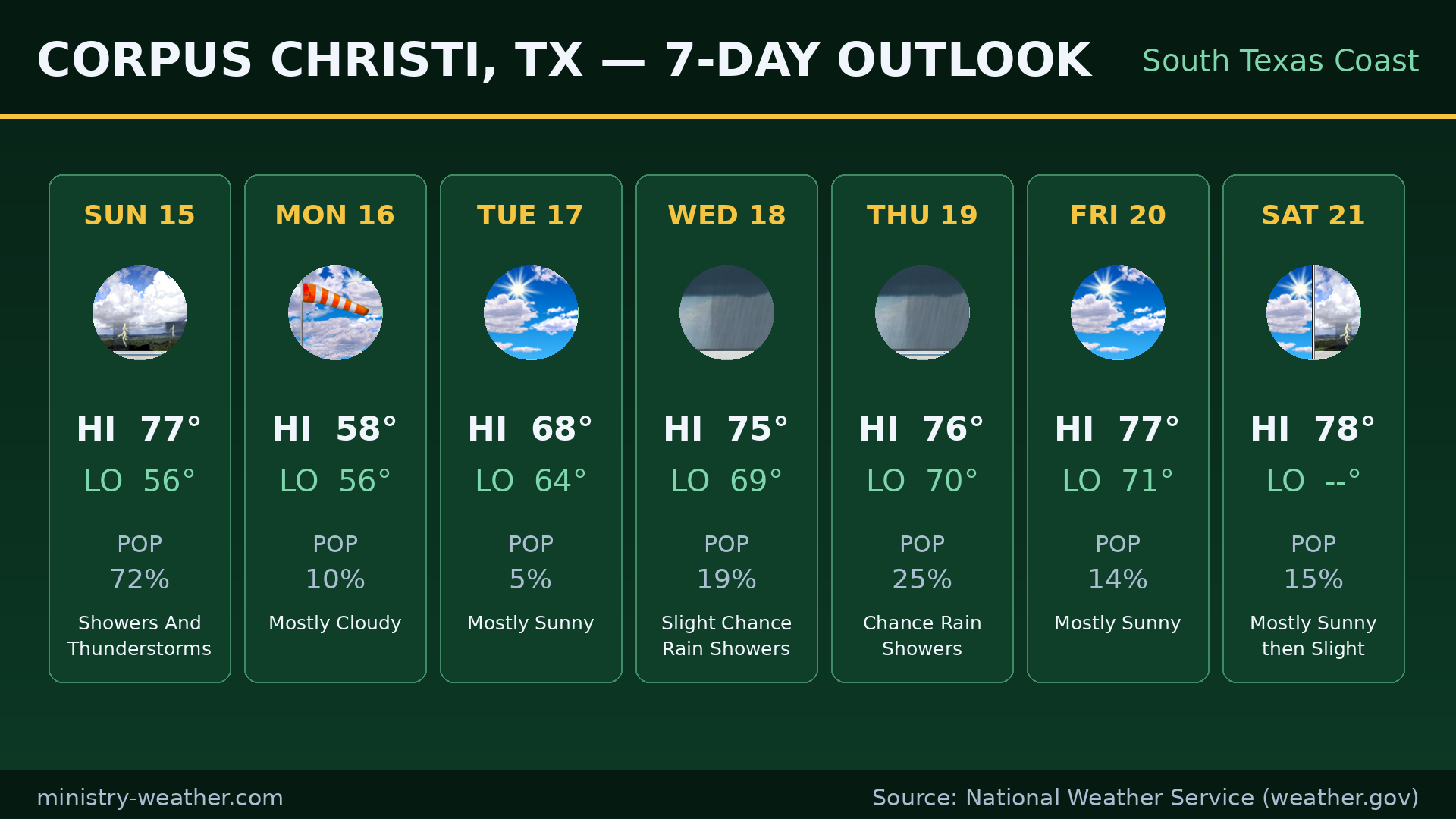
SOUTH TEXAS — Corpus Christi
Today: showers and thunderstorms likely, high 77°, low tonight 56°.
Monday: mostly cloudy and much cooler, high 58°, low 56°.
Mostly sunny Tuesday (68°), then a slight chance of rain showers Wednesday (75°) and Thursday (76°), mostly sunny Friday (77°) and Saturday (78°).
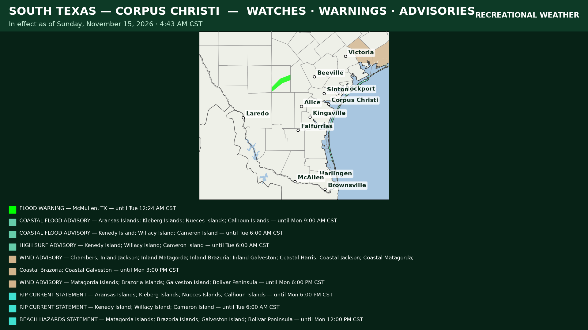
Alerts: a Flood Warning for the Nueces River near Tilden (McMullen County) — minor flooding forecast through late Monday night, warning runs through Tuesday 12:24 AM CST. Coastal Flood Advisories along the coast (Corpus Christi area until Monday 9:00 AM CST; Kenedy/Willacy/Cameron Islands until Tuesday 6:00 AM CST), a High Surf Advisory for the southern islands until Tuesday 6:00 AM CST, and Rip Current Statements for both the Corpus Christi and southern coasts. Wind Advisories and a Beach Hazards Statement also cover the Houston/Galveston area at the far eastern edge of the map through Monday afternoon/evening.
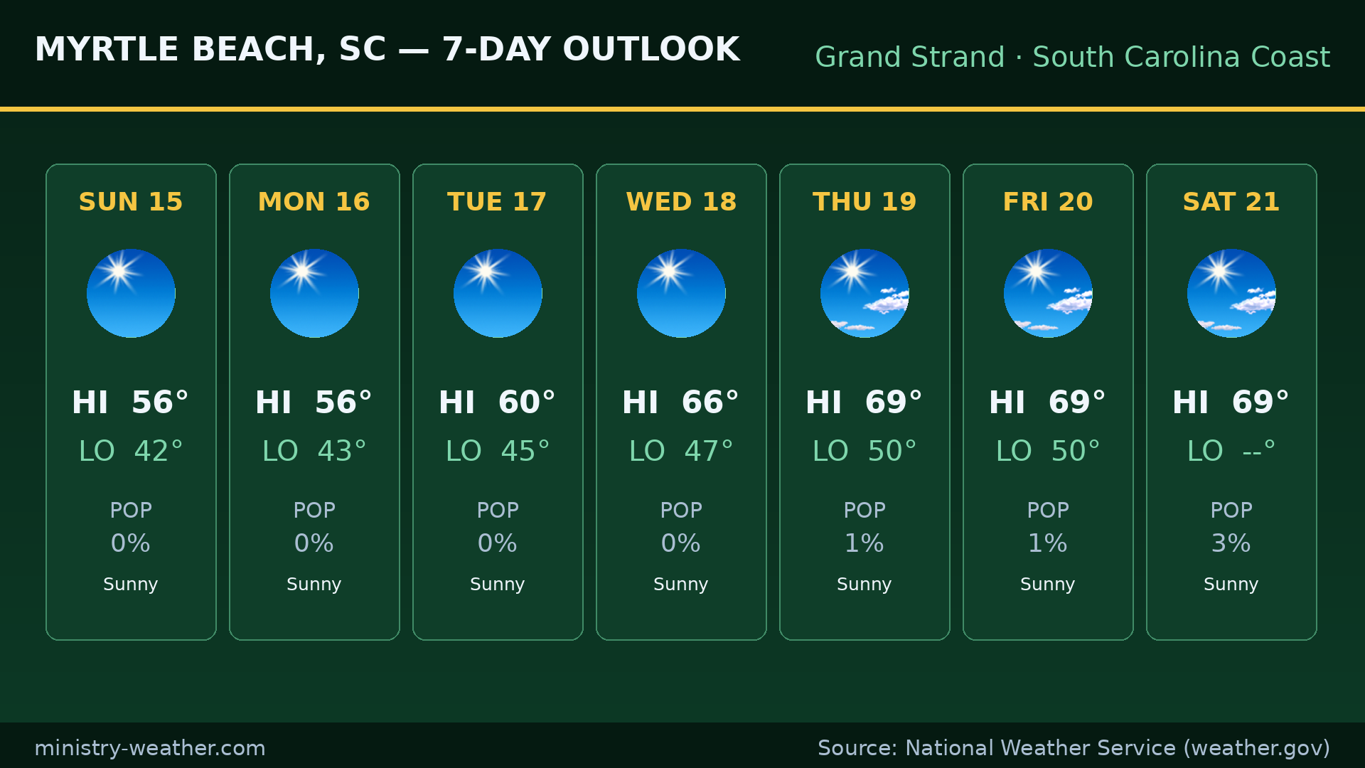
MYRTLE BEACH AREA — Grand Strand
Today: sunny, high 56°, low tonight 42°.
Monday: sunny, high 56°, low 43°. Sunshine holds all week — 60° Tuesday, 66° Wednesday, 69° Thursday, 69° Friday, 69° Saturday.
Data and imagery: National Weather Service (weather.gov), NBM 00Z run Nov 15, 2026. Graphics: ministry-weather.com.