I am a meteorologist and a former youth leader at church…I have a lot to say on both subjects…and then some
I wasn’t sure this morning, if I was going to update the South Texas Rain, but how could I not. I’m a weather nerd. Okay, let’s jump into it.
I’m typing this a little before 800am and should have the most up to date graphics and such at that time.
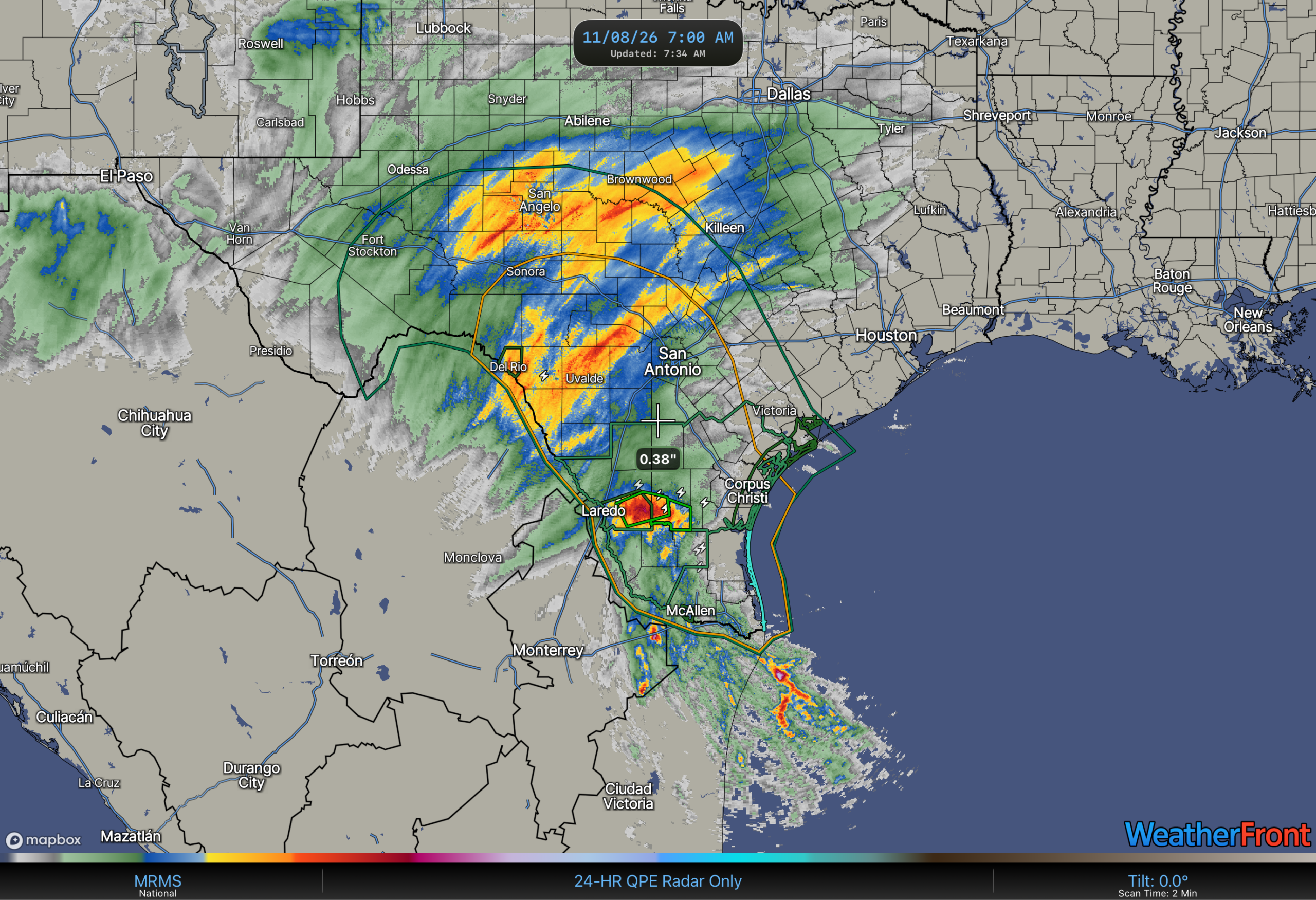
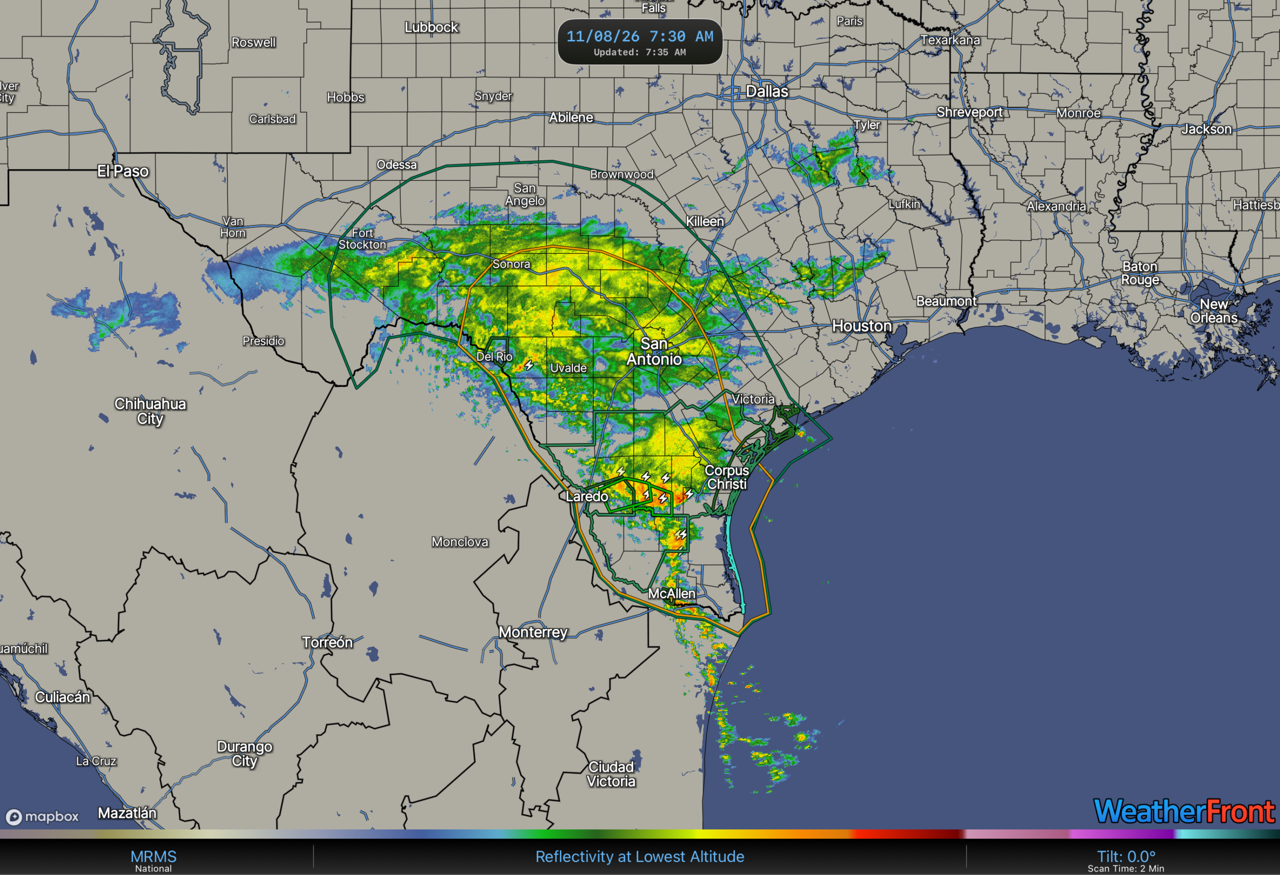
Before I left the NWS (April, 2025), one of the best tools that was finally delivered (it was promised for a long time) was Multi-Radar Multi-Sensor (MRMS). The radars aren’t only put together, but also quality controlled so that the estimates are consistent and fairly accurate. In this case, Here’s the 24 hour rainfall estimate ending at 12z(7am EST/6am CST) this morning. Most of the rain, as was expected, fell mainly in the Rio Grande Plains, and the Pacific energy spread 1-2” rain in the Hill Country, and the Upper Nueces River valley(Uvalde area). Some of the rain also fell in the Frio River headwaters as well. There is also a hot spot just east of Laredo, and the NWS CRP office issued a Flood Advisory. The flood advisory means that small streams and tributaries may flood in places with that area. The problem we often run into no matter the office, is the lack of real time reports in rural areas. It doesn’t matter if it’s South Texas or Northern Michigan, we don’t know if a river or stream is flooding unless there is a gage or someone reports it. The NWS isn’t omniscient, and neither are the private sector companies.
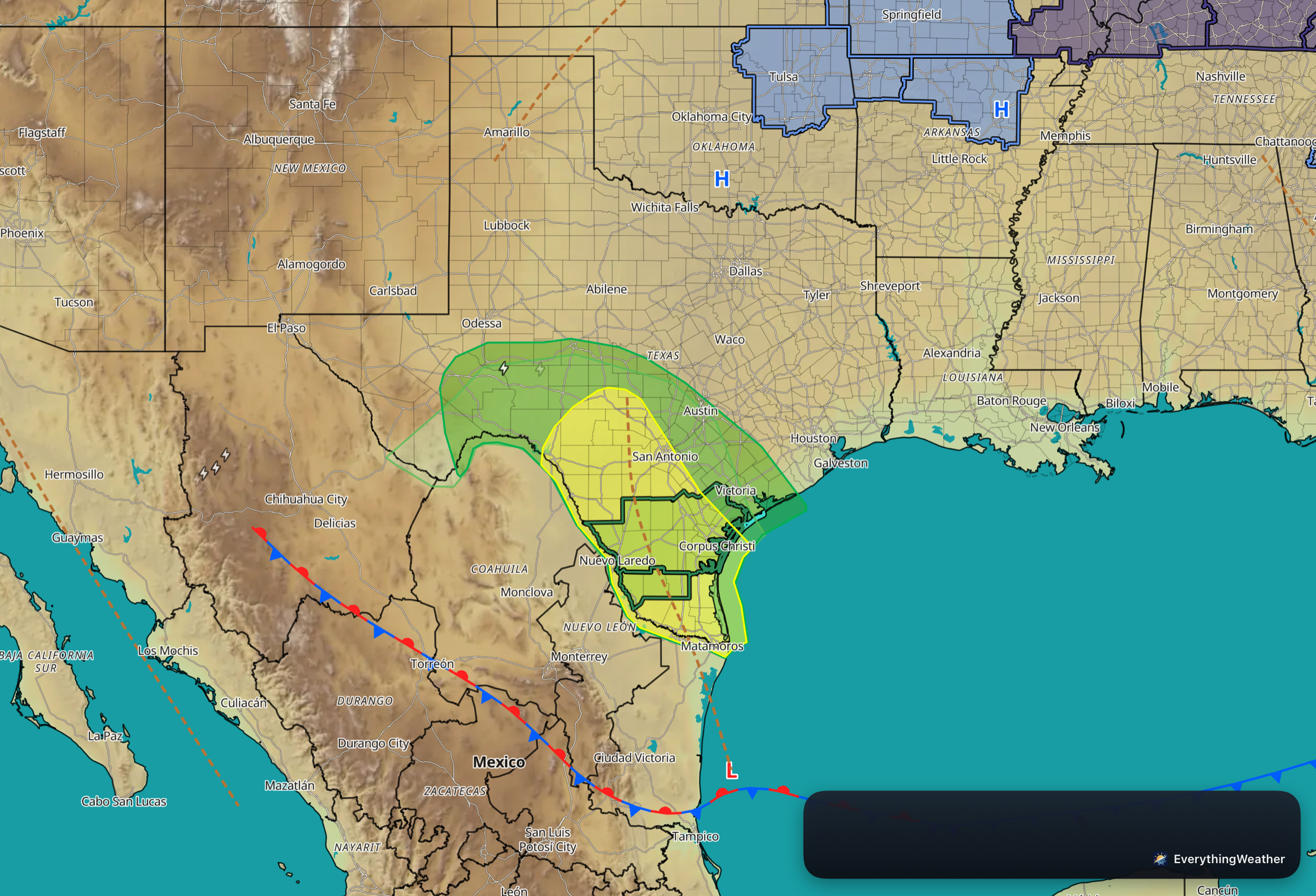
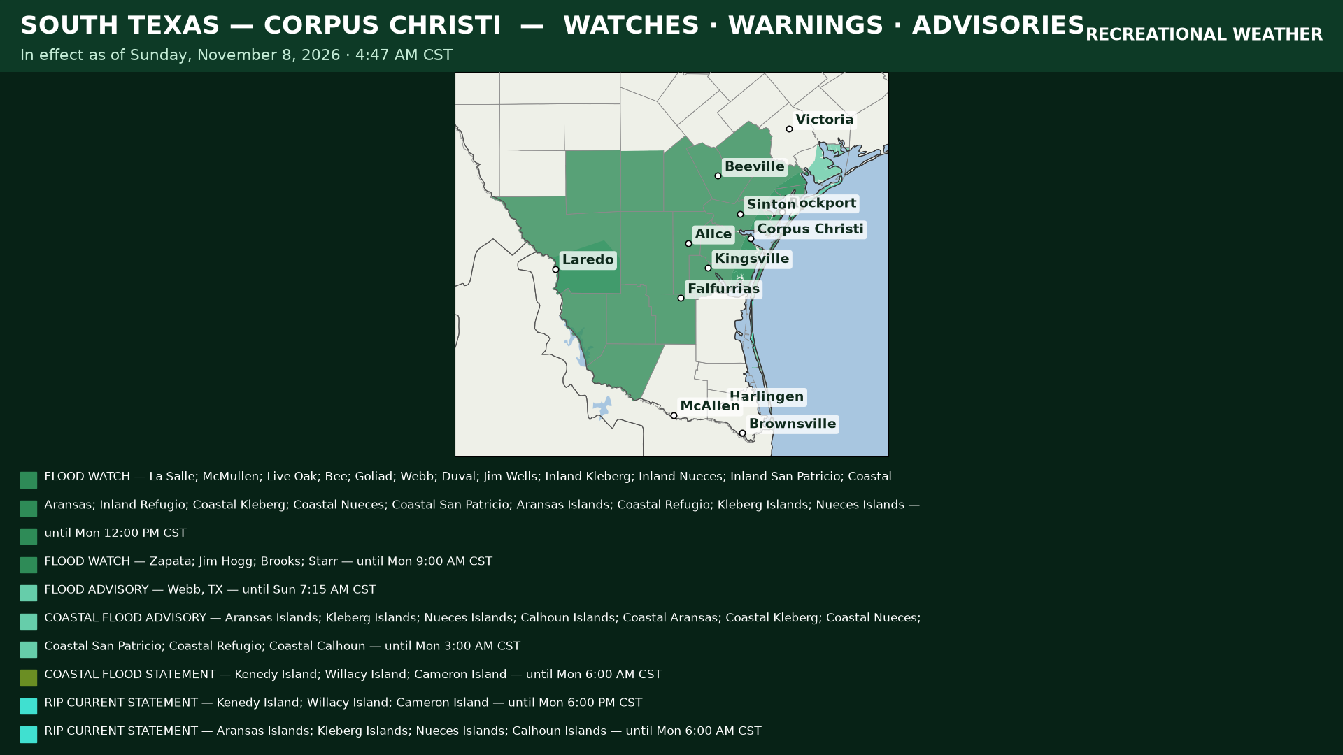
Here’s the current front and outlook situation with the trough, as expected, slowly shifting to the east over the next two days (today and Monday). Today, the flash flood threat is higher, with a 15% chance or higher within 25 miles of a point of flash flooding. You can look at this as the potential for a couple of flash flood warnings being issued with the next 24 hours. I also have the latest Flood Watches (there is a potential for flooding). I’ll show that graphic in a minute.
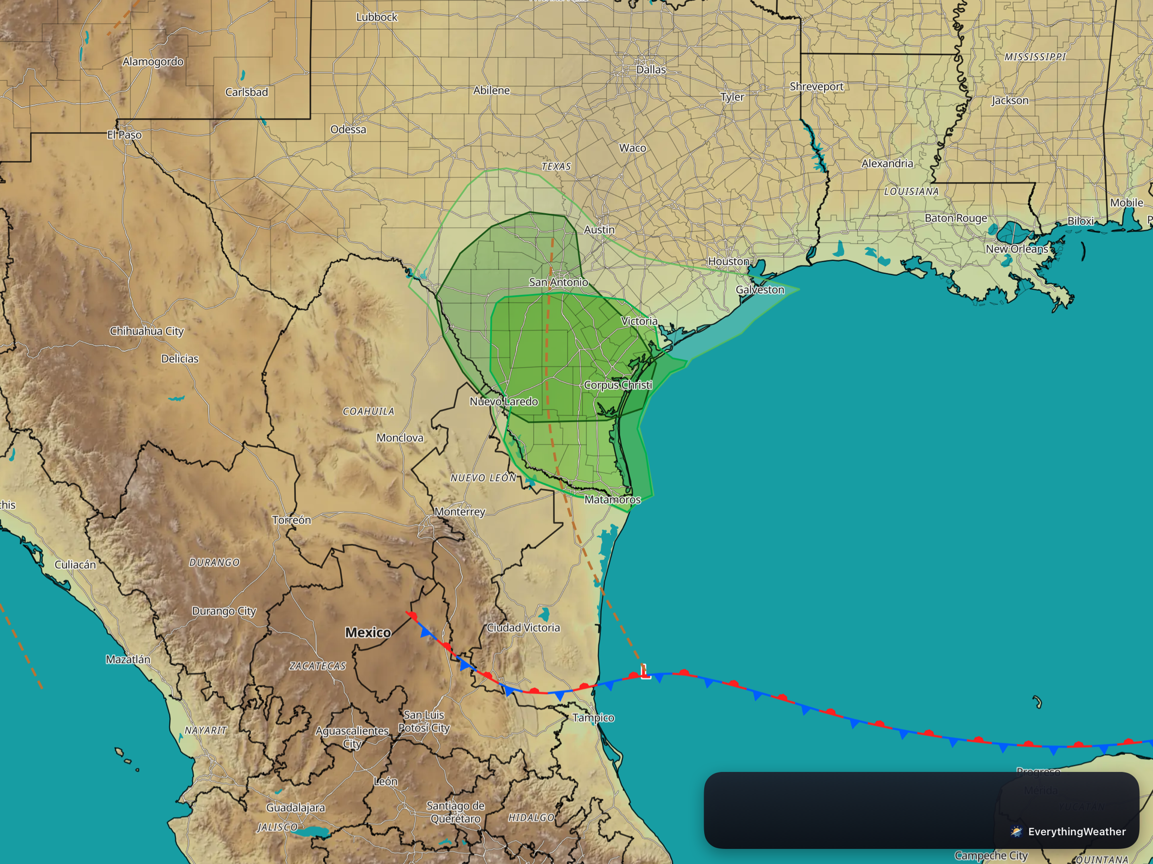
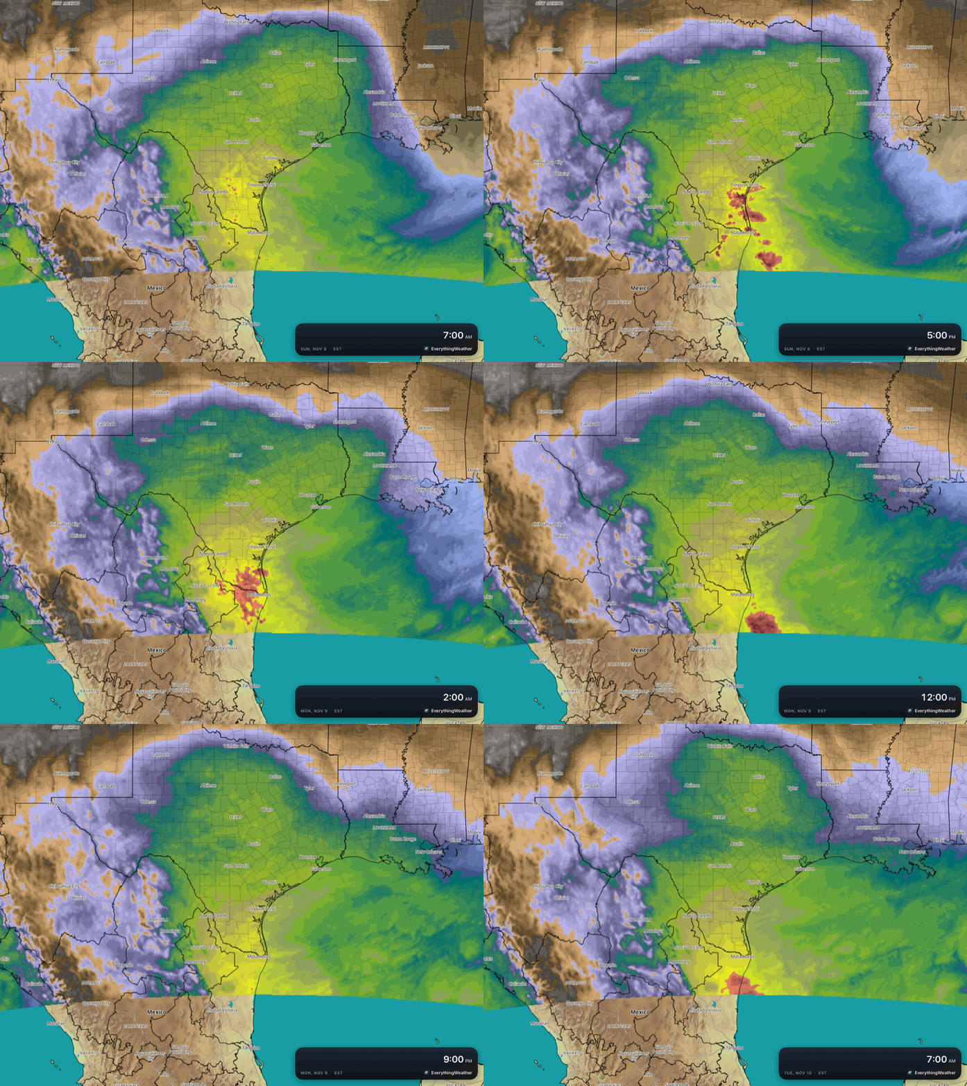
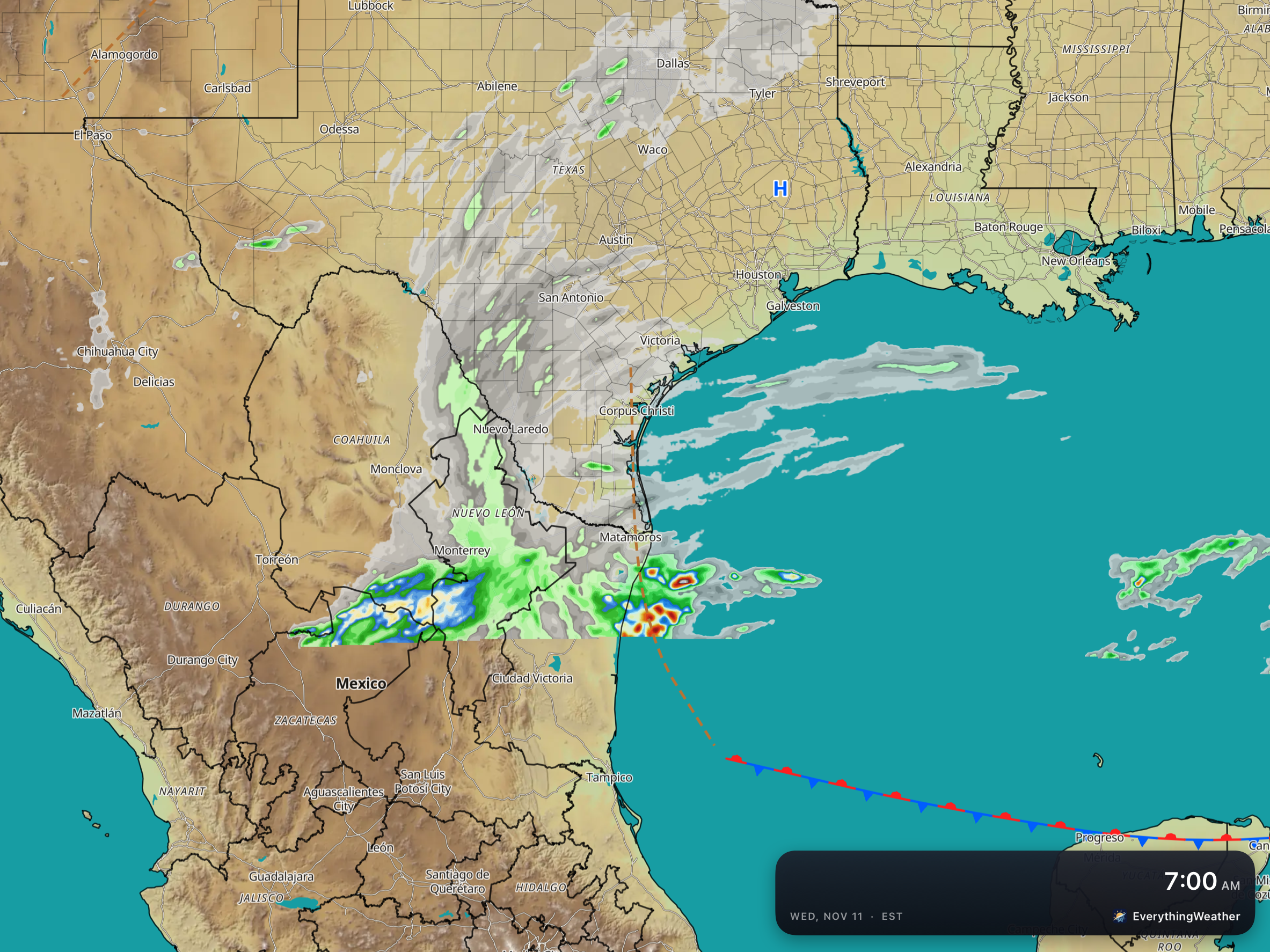
The map on the right is the front and trough for 7AM on Monday, with the excessive heavy rain outlook and the severe weather outlook for 7am Monday-7am Tuesday. So the threats begin to ramp down, as the moisture (in the middle and in inches of PWat) begins to lower. The trough is expected to be along the lower and middle Texas Coasts on Tuesday morning, and with the moisture having lowered, the image on the right is 24 hour rain for Tuesday (ending at 6am CST Wednesday morning).
So with all that let’s look at the specifics…
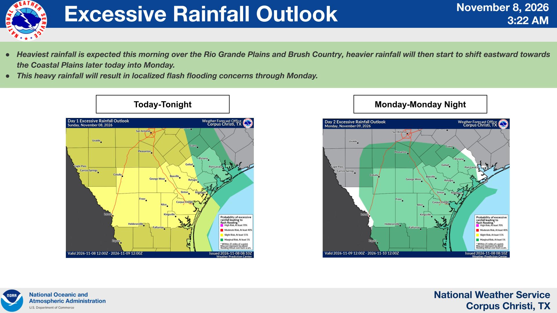
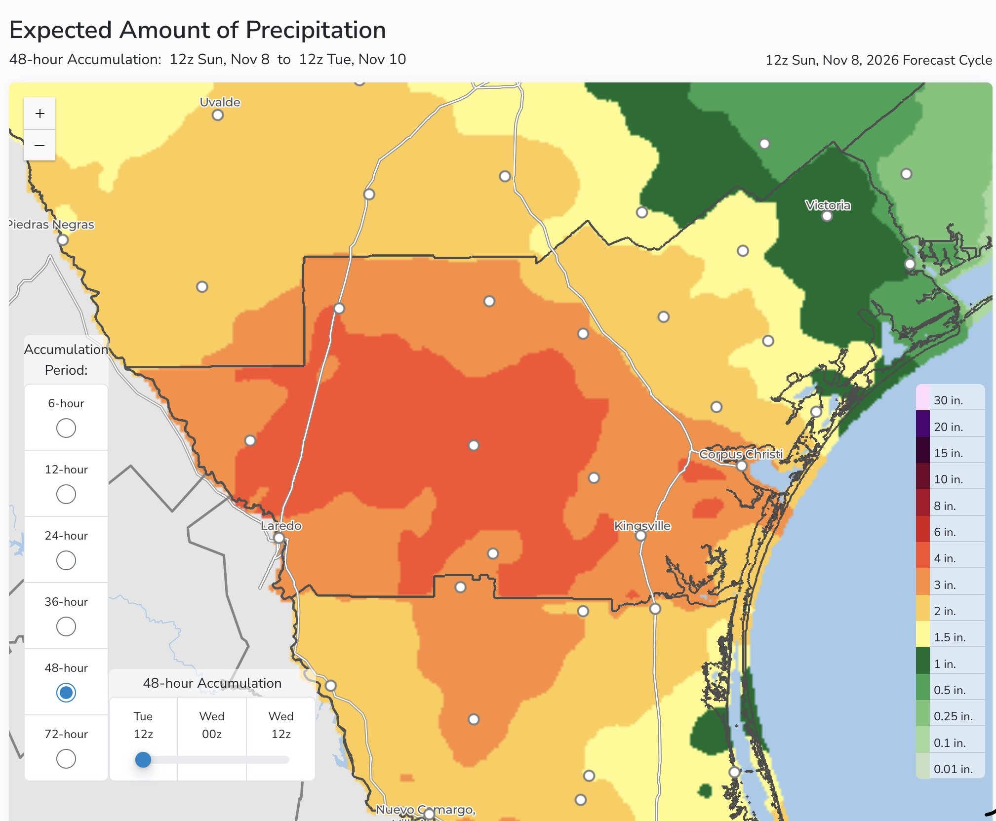
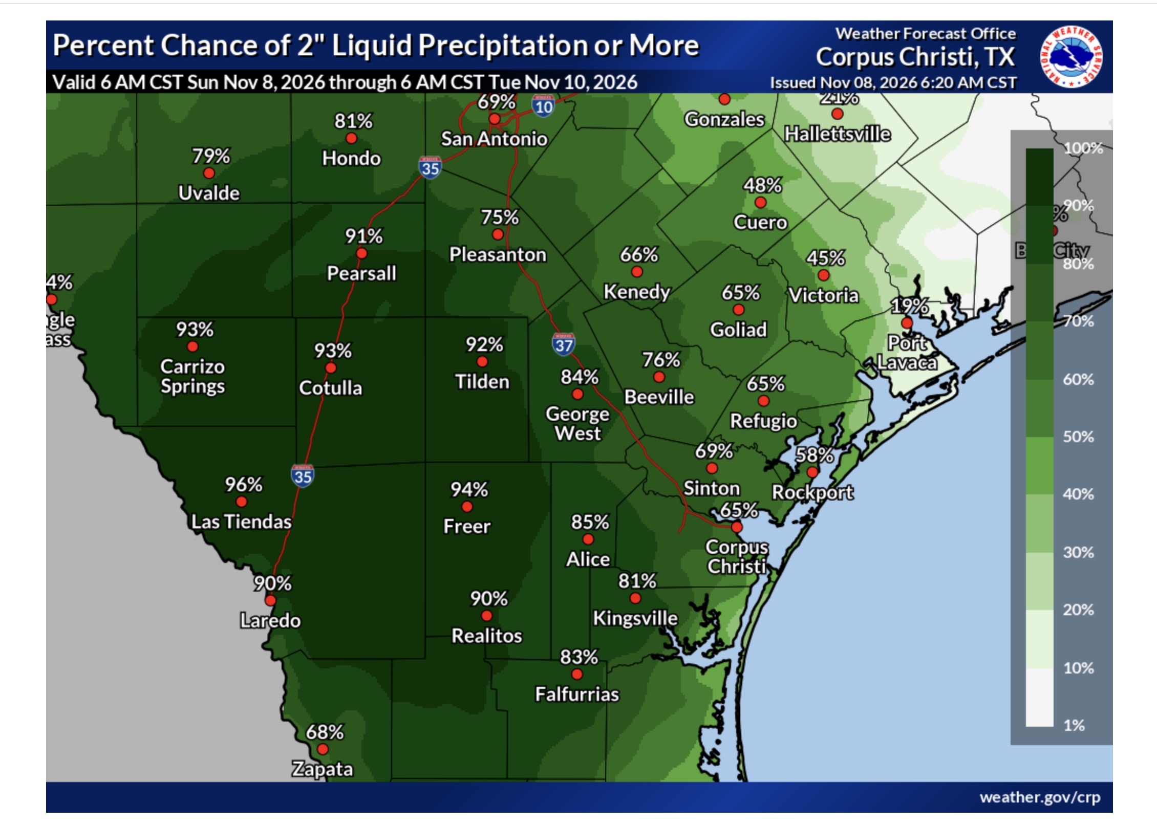
These are South Texas specific, and we lead off with the ERO for Today and Monday. Most of South Texas is in the Slight risk for today, except the Victoria Crossroads. Monday, the marginal is only for part of South Texas. We have the expected rain fall amounts for South Texas over the next 48 Hours (yesterday was 72 hours) you can see that not much changed, as yesterday was the ramp up to the heaviest rain, which is expected today. The graphic on the right is the chances for rainfall exceeding 2.0”. Just like yesterday, the least likely rain is in the east, and the mosture in the west.
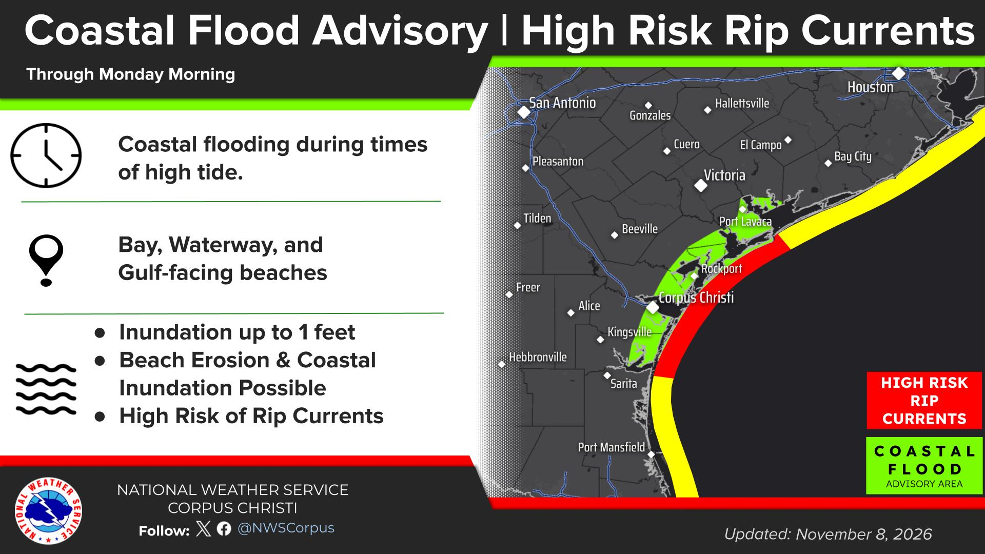
And last, but not least, there is a coastal flood advisory, and a high risk of rip currents later today, with all of the easterly wind flow.
So to sum up the weather for today…
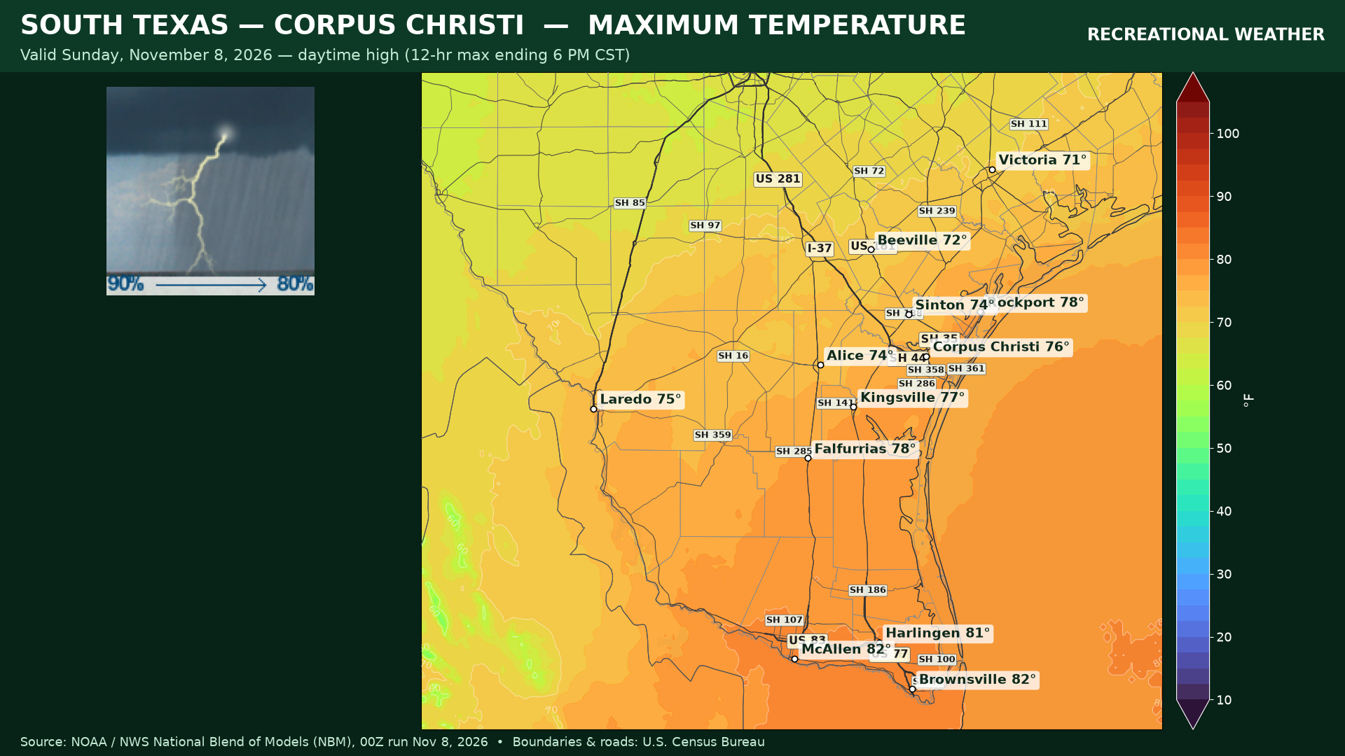
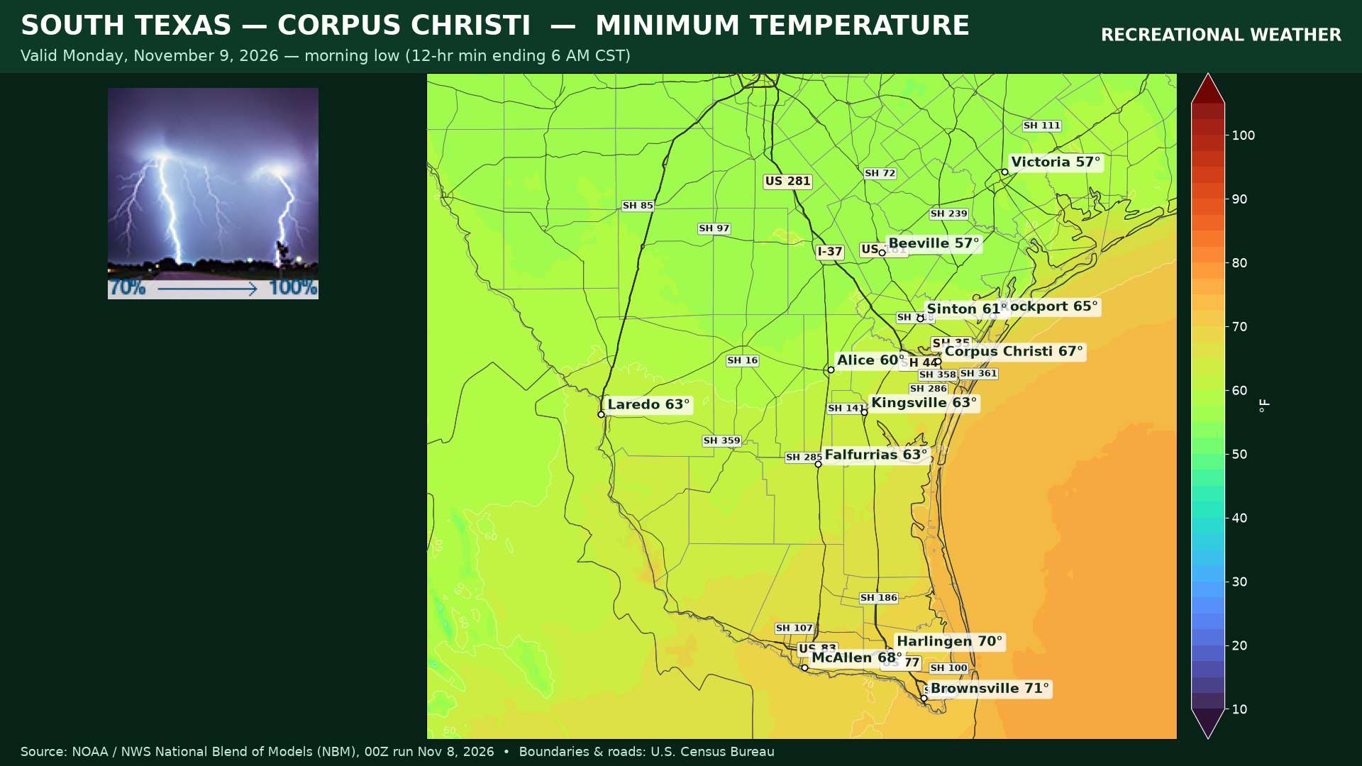
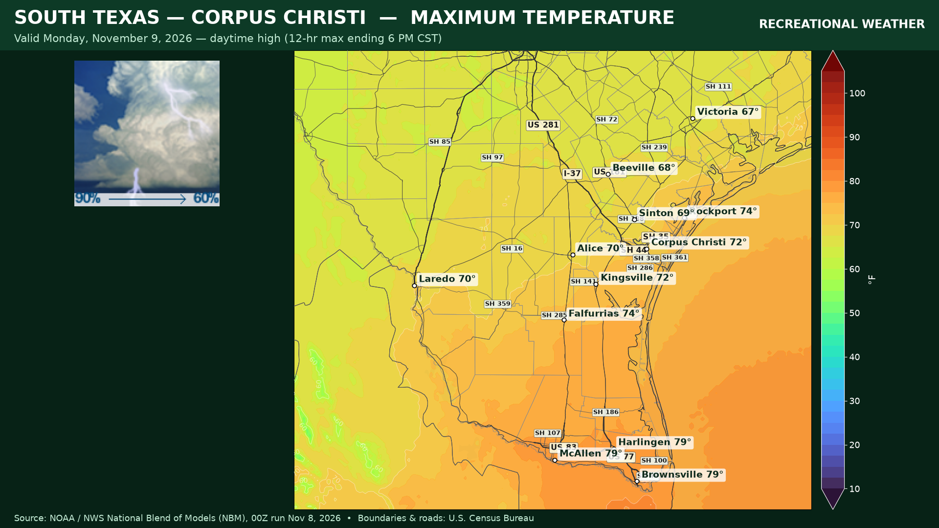
The Flood watches remain in effect until noon (CST) Monday for South Texas, and until 9am Monday, for portions of Deep South Texas. Highs today will generally be in the 70s with the warmest close to the Gulf coast. Lows will be in the 60s, with upper 50s near the Victoria Crossroads. There will still be some rain and clouds on Monday, so temperatures will again remain in the 70s, with some cooler temperatures in the northern Brush Country and Victoria Crossroads in the upper 60s.