I am a meteorologist and a former youth leader at church…I have a lot to say on both subjects…and then some
This morning, my website died for a bit, and we had to go to Gaylord today. So I put the post on social media. So as Erin heats back up, I thought I would put some recreational impacts over the next few days for the Atlantic Coast.

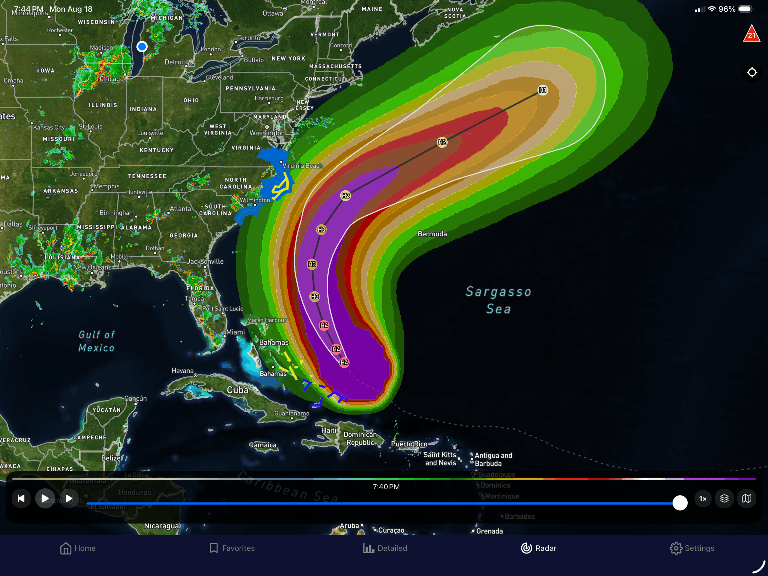
So looking at the graphic on the left is the whole path through the next 5 days with the probability for Tropical force winds (34+ knots). The purple color are 90-100% chance with each color 10% less.
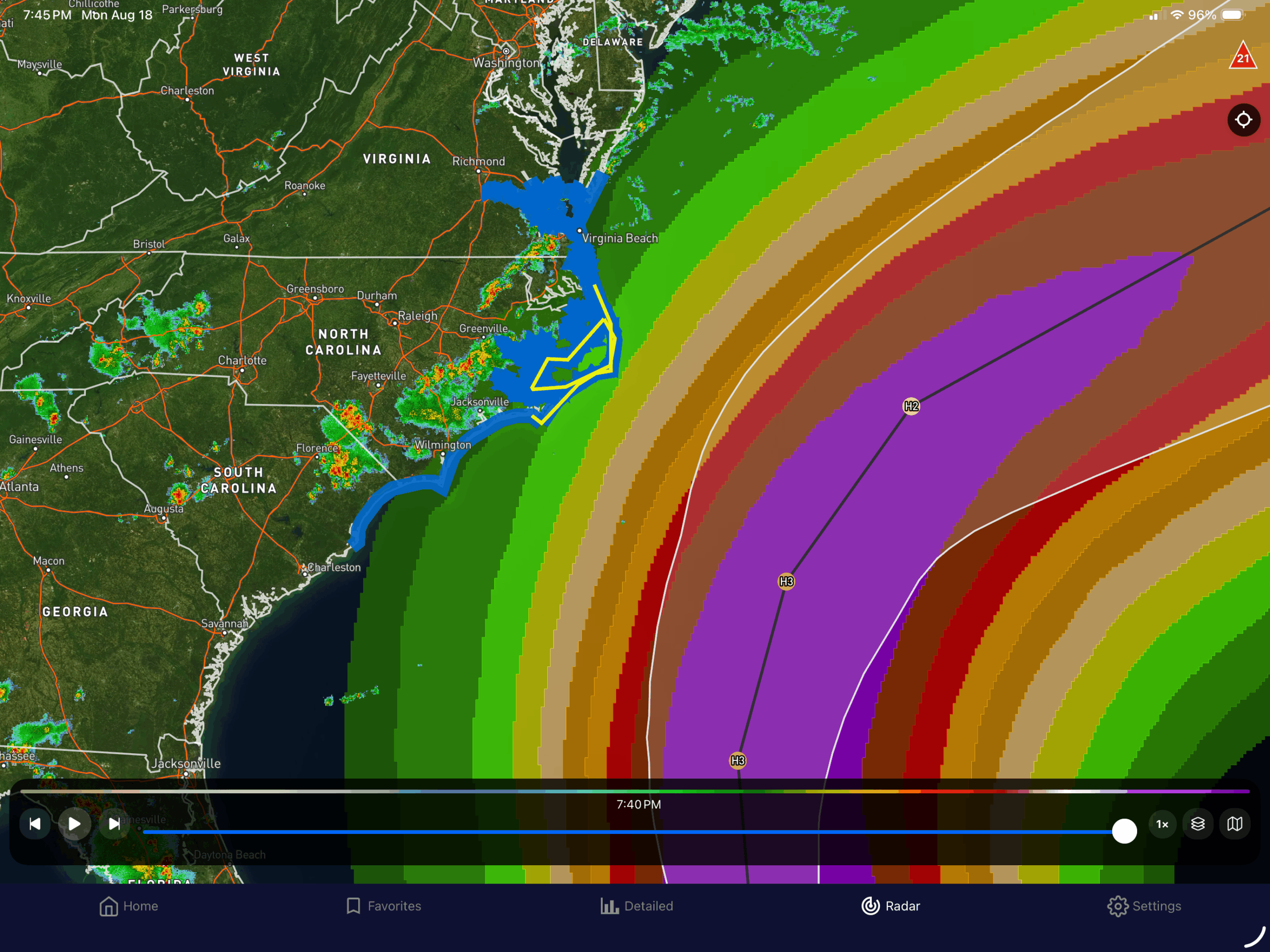
The middle graphic is the current effect on the islands with the Turks and Caicos, and Southeast Bahamas having tropical storm warnings and watches in the central Bahamas. The graphic on the right shows that there are now tropical storm warnings for the Outer Banks and there is a storm surge forecast for 1-3 feet along South Carolina’s Grand Strand and Northern Strand. 2-4 foot surge along the Outer Banks, and 1-3 north of there into Norfolk, VA.
With the wave action (16-30ft offshore), the rip currents are going to be high.
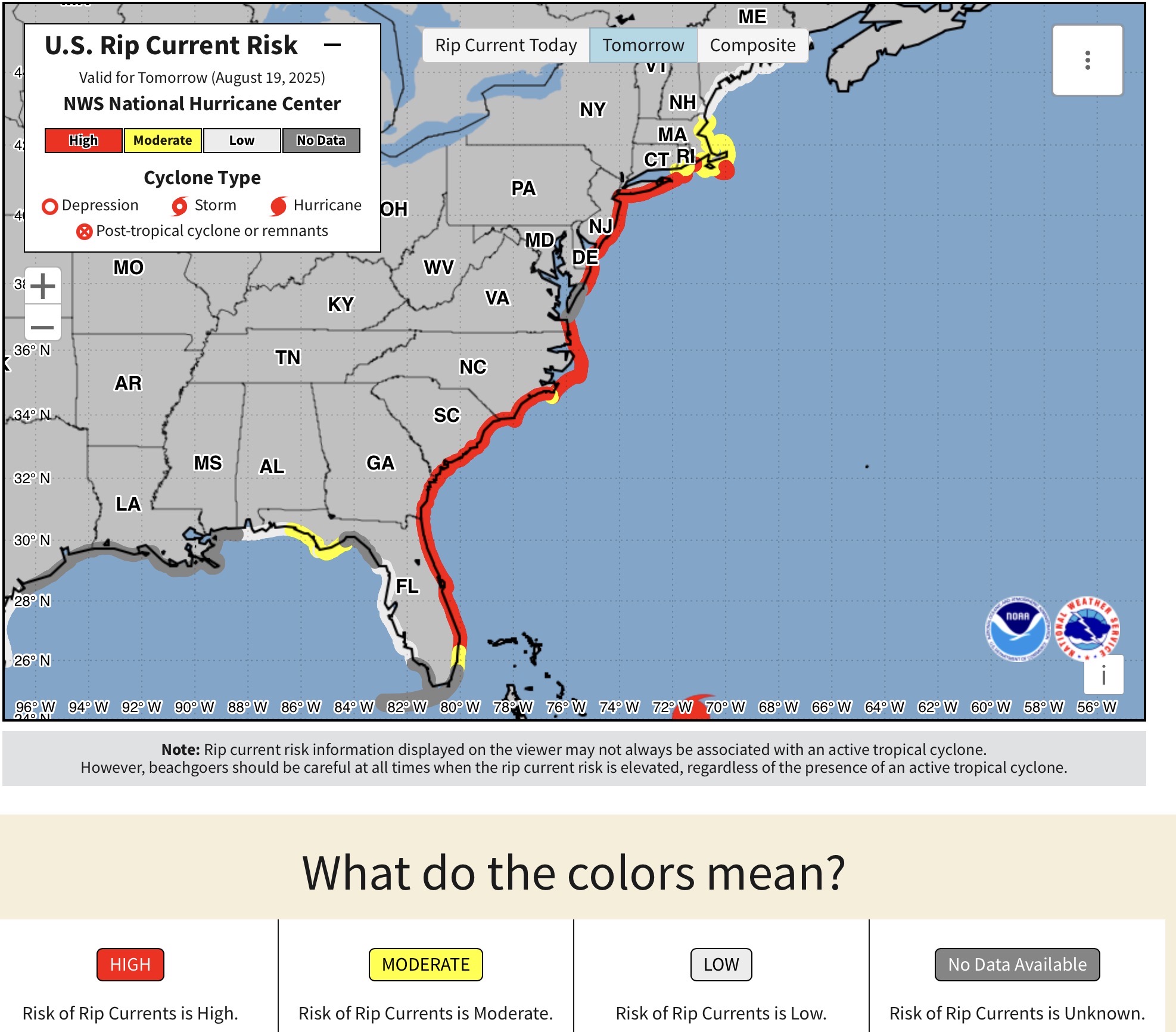
Currently, and mainly tomorrow (which will probably remain for the next few days), There are High Rip Current Risks from around Boca Raton, FL north to Nantucket Island. That means, that even if the weather looks good, the rip currents will begin to form along the coast as the swell periods increase (more wave energy). So stay out of the water. I know with the Waves big, surfs up! Just be careful and stay with your surfboard, and surf with a buddy. But you too, should stay out of the water.
Then there’s this…
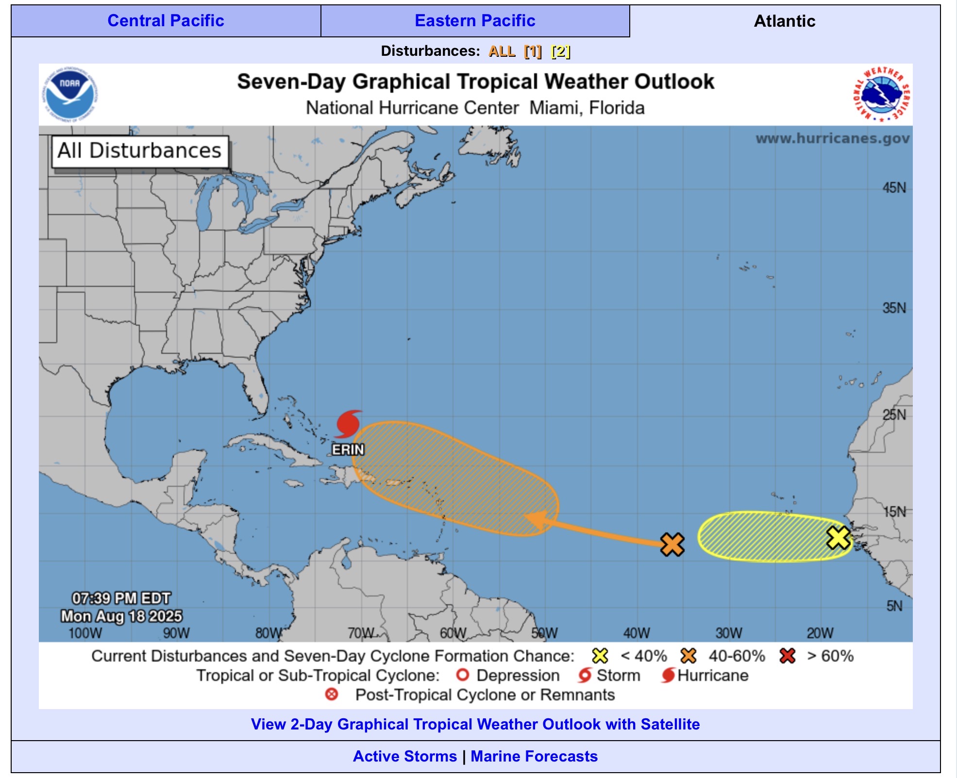
Obviously Erin leads the train, but second is the 60% chance (Orange) for development. We’ve been talking about that for the last few days, as it looks like it will shift north, and follow Erin to a point. The GEFS (GFS Ensemble) shows the member low centers scatter by 180 hours (early morning Aug 26) with some following the same path as Erin, and some move inland into Georgia/Carolinas/Florida. Then on the 7:30 pm there is now a 10% chance development for a wave that has just come off of Africa. This will be interesting over the next 2 weeks.