I am a meteorologist and a former youth leader at church…I have a lot to say on both subjects…and then some
Got behind with a few errands this morning, and now I’m in Grand Rapids, so no video today.
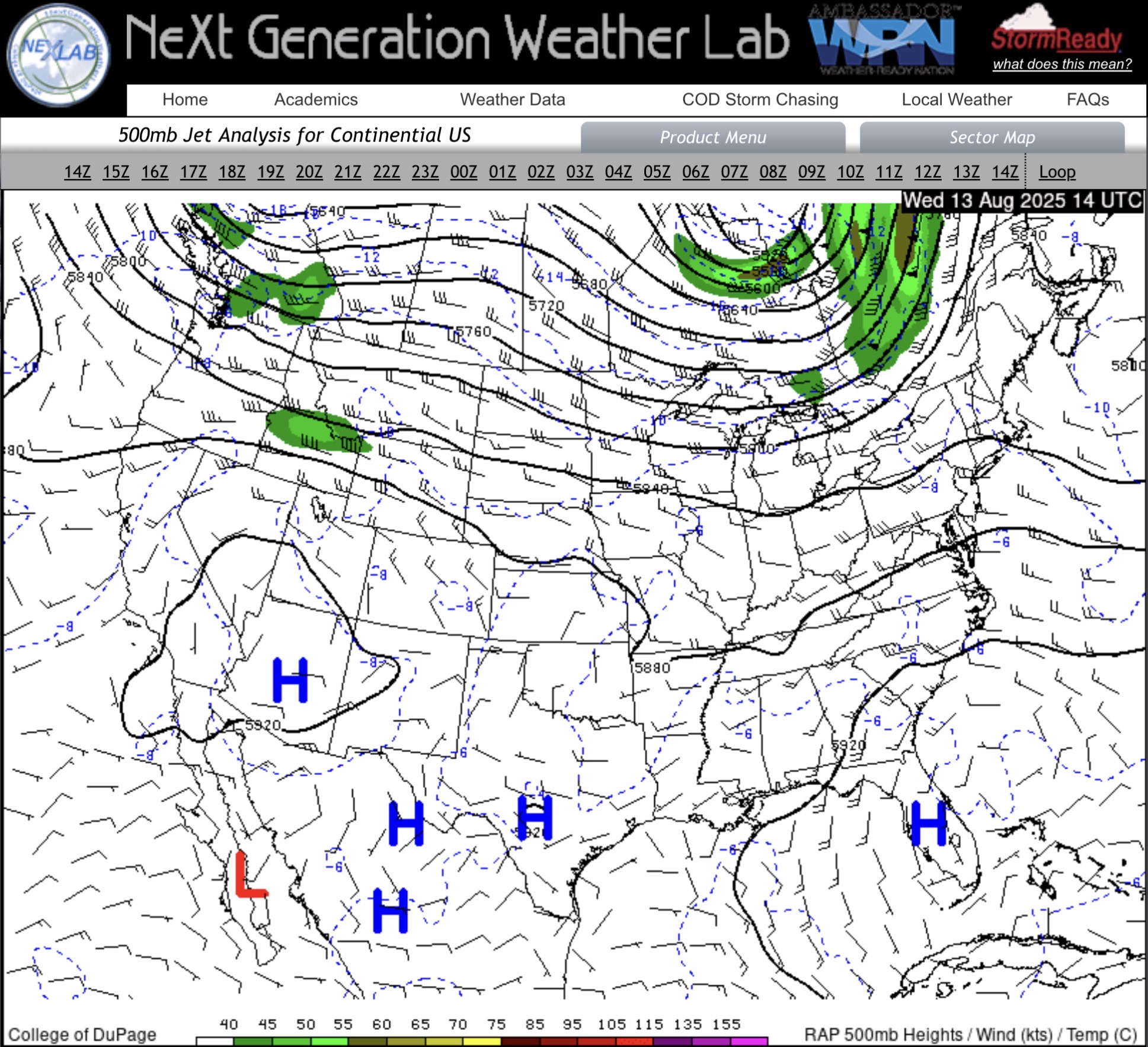
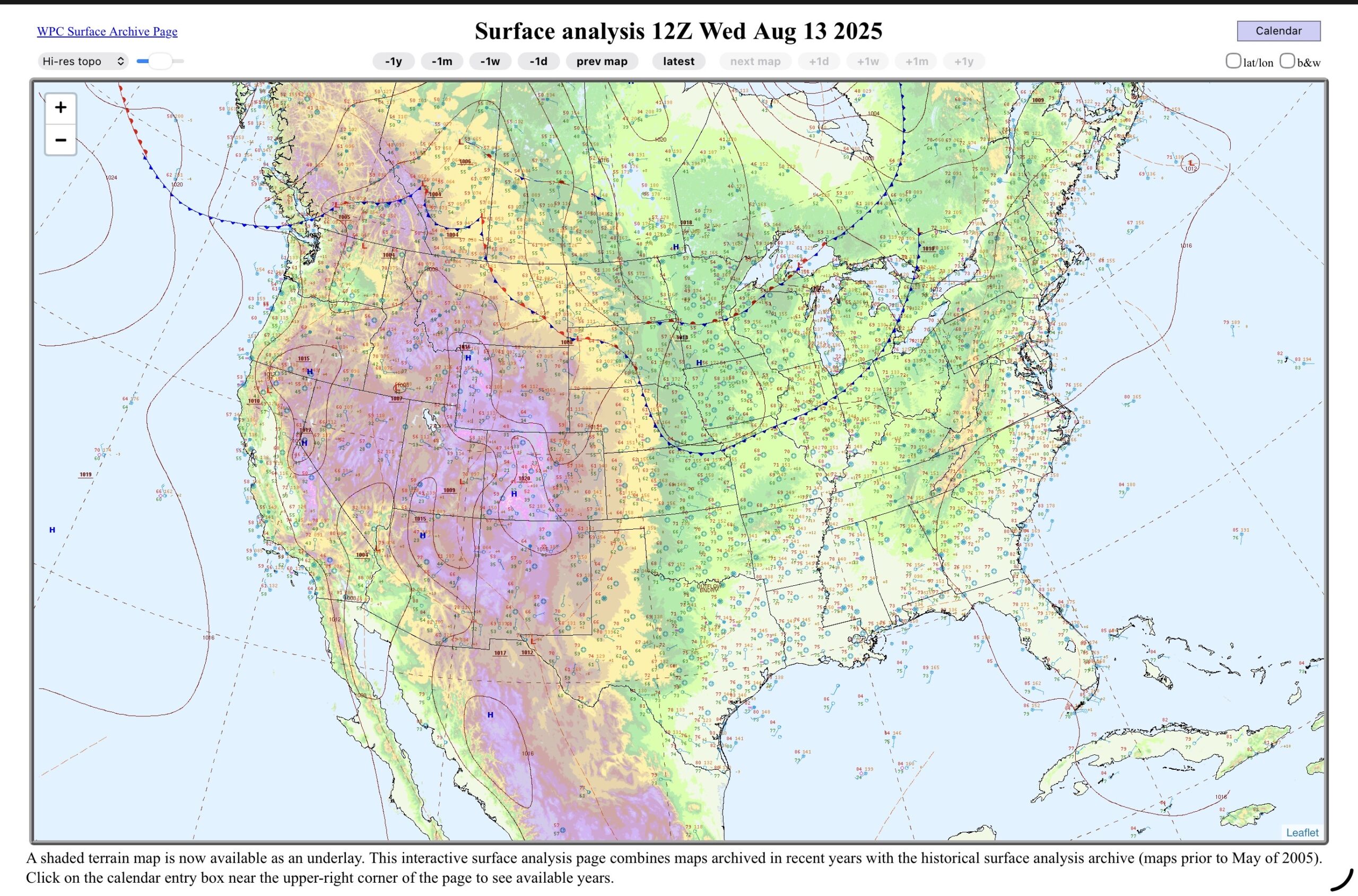
The upper level low (trough) is through Lower Michigan, and the main cold front, as well.
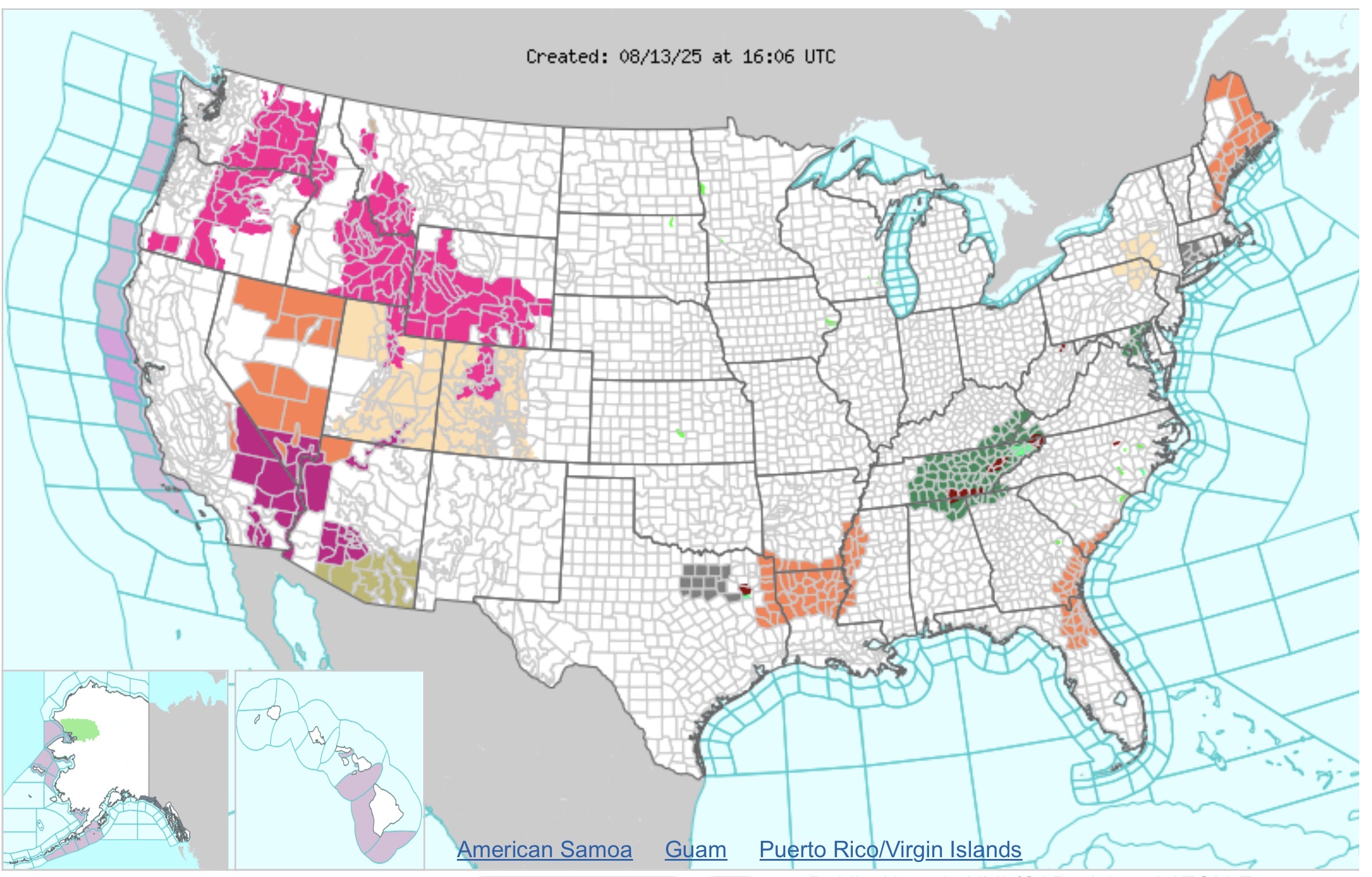
Looking at the WWA (Watch/Warning/Advisory) map,
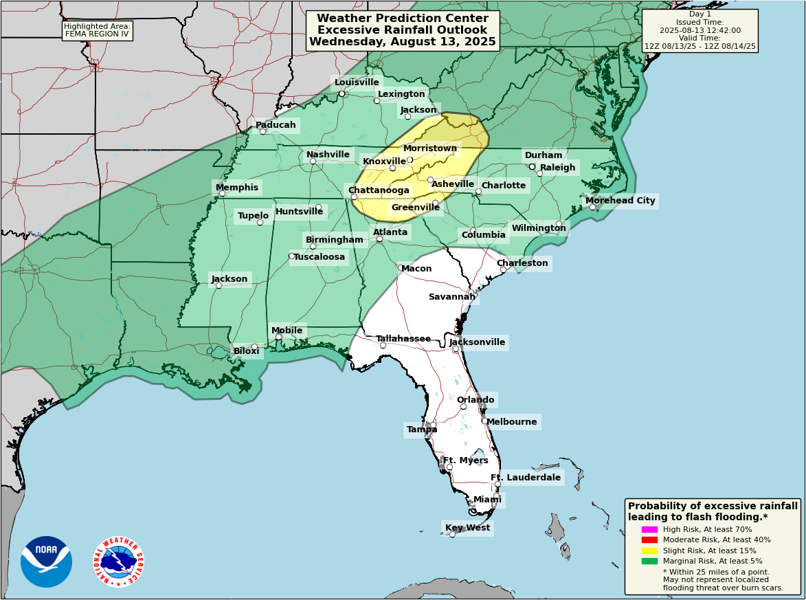
The East Coast has Heat Advisories, while the Central and Southern Appalachian mountains as well as middle Tennessee has flood watches as the rain continues to train over the region.
Heat is also an issue in the Lower Mississippi Valley and the Desert Southwest.
There are wild fire issues (Red Flag warnings and Fire Weather watches) for the Rocky Mountains and the Intermountain West.
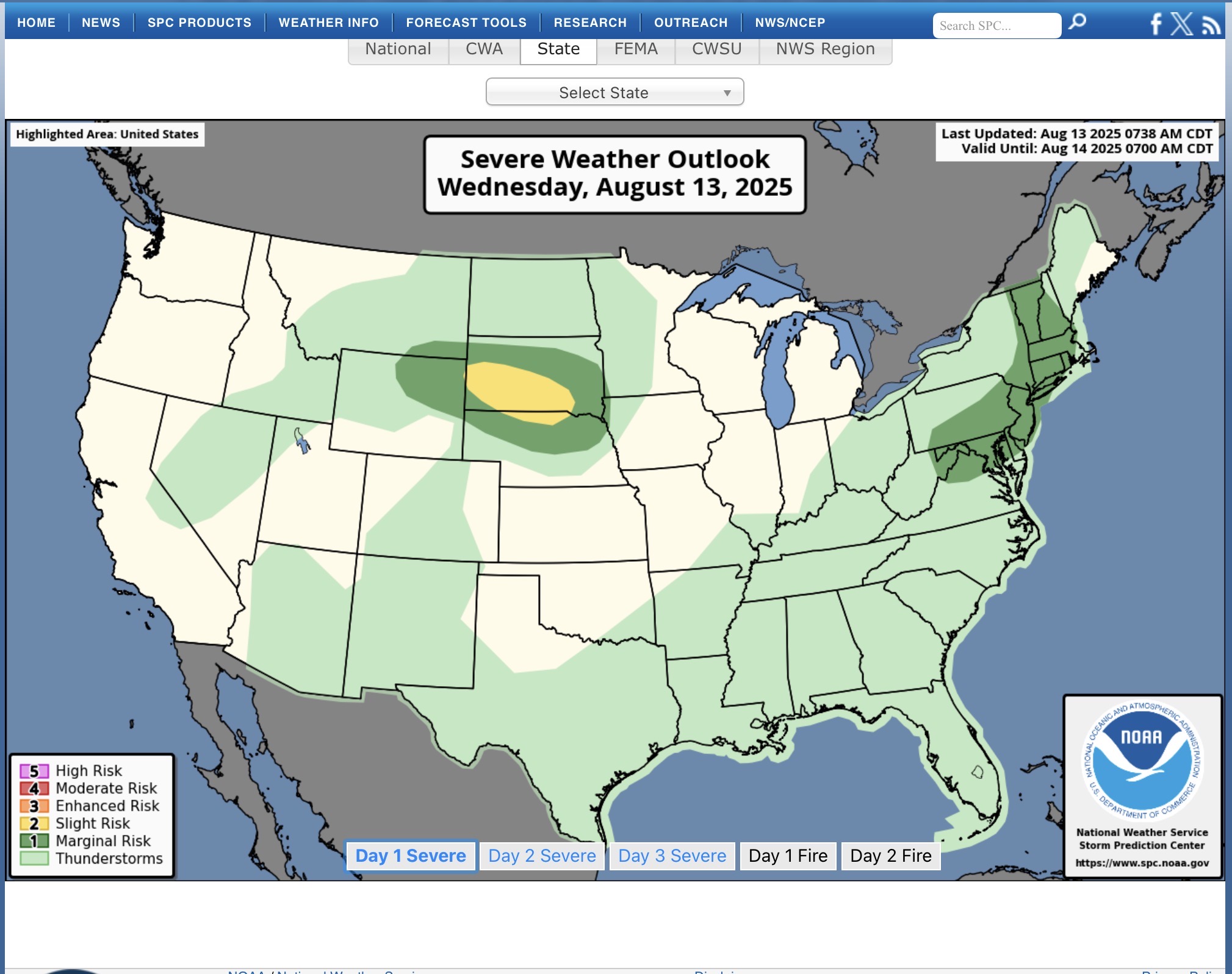
SPC today has a slight risk in South Dakota, with a marginal in the Mid-Atlantic states and portions of New England.
WPC has a slight risk of excessive rain today in the area that has the flood watches.
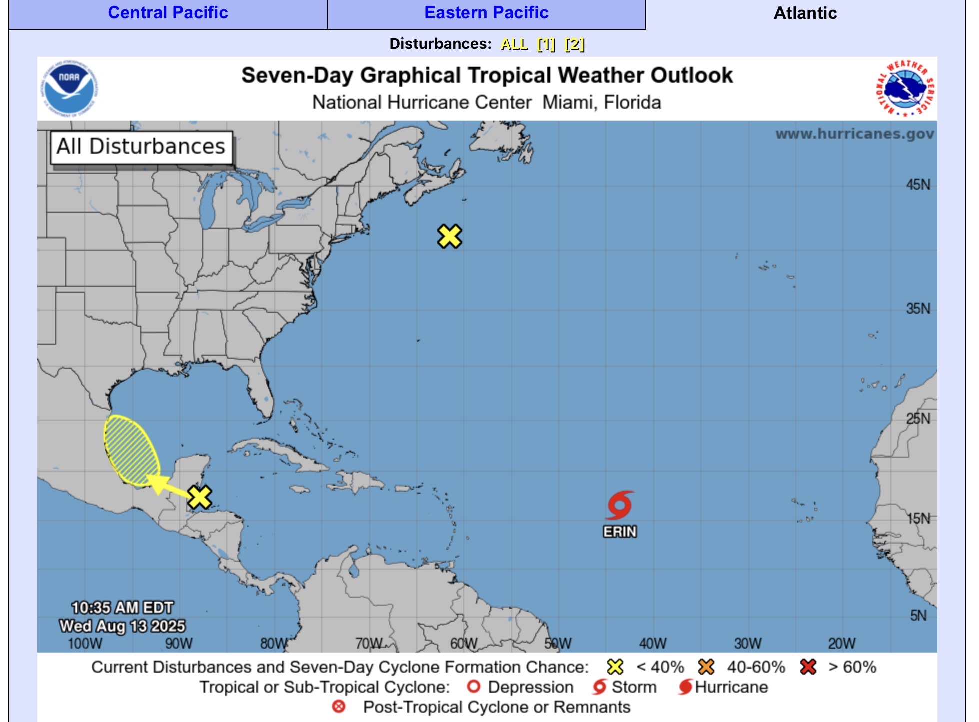
NHC has a new area to watch in the Gulf, south and east of Texas. It has a 20% chance for them next 7 days of development, and a 10% for the next 48 hours. It’s a pretty disorganized wave, so far. It could cause issues with the Middle Texas Coast, in a few days with the possibility of heavy rain and rip currents. TS Erin is still quite a ways out, but in the 6-10 day range could begin to produce rip currents and beach flooding. The X near the Canadian Maritime Provinces, has gone to 0% chance so it is will continue to move out to sea.

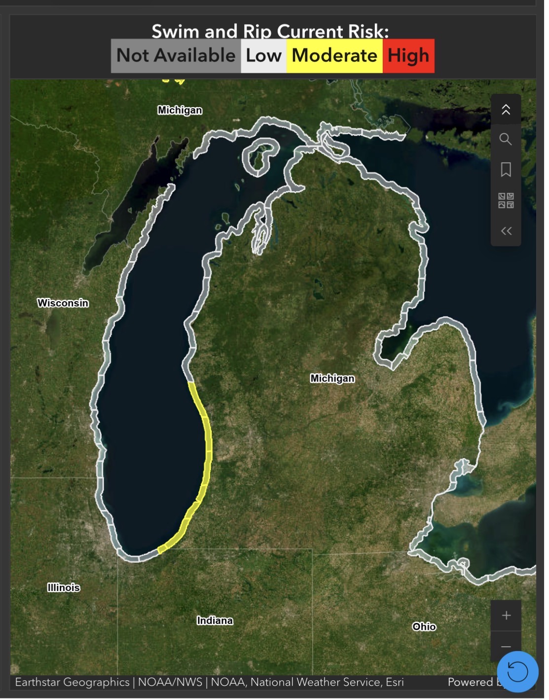
In Lower Michigan, it’s going to be sunny and a little less warm than it has been through Friday. So beach weather through Friday, in northern lower Michigan, will be good. The West Michigan beach today, still has a moderate rip current risk.
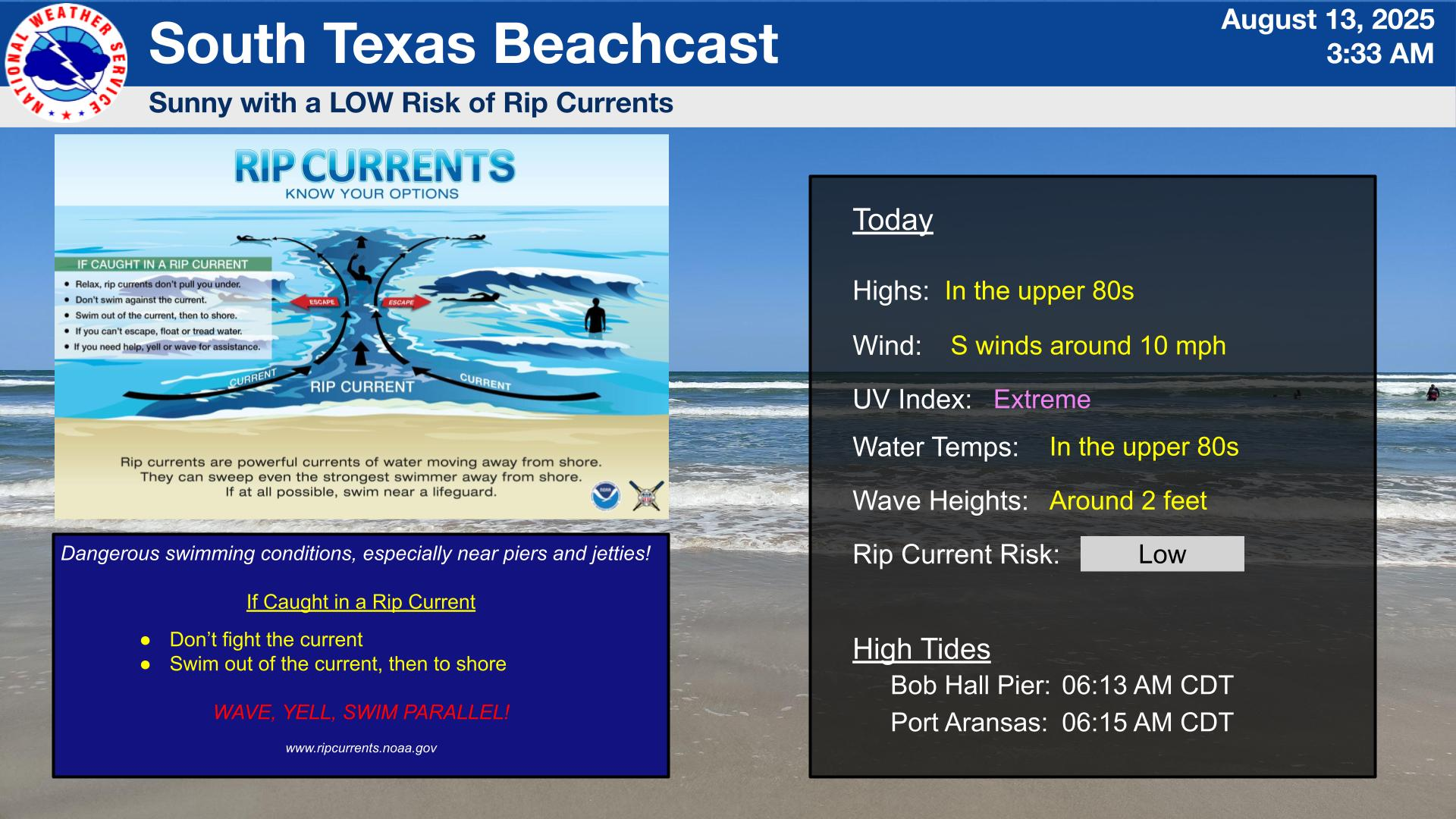
In South Texas, it looks sunny, with a low rip current risk.