I am a meteorologist and a former youth leader at church…I have a lot to say on both subjects…and then some

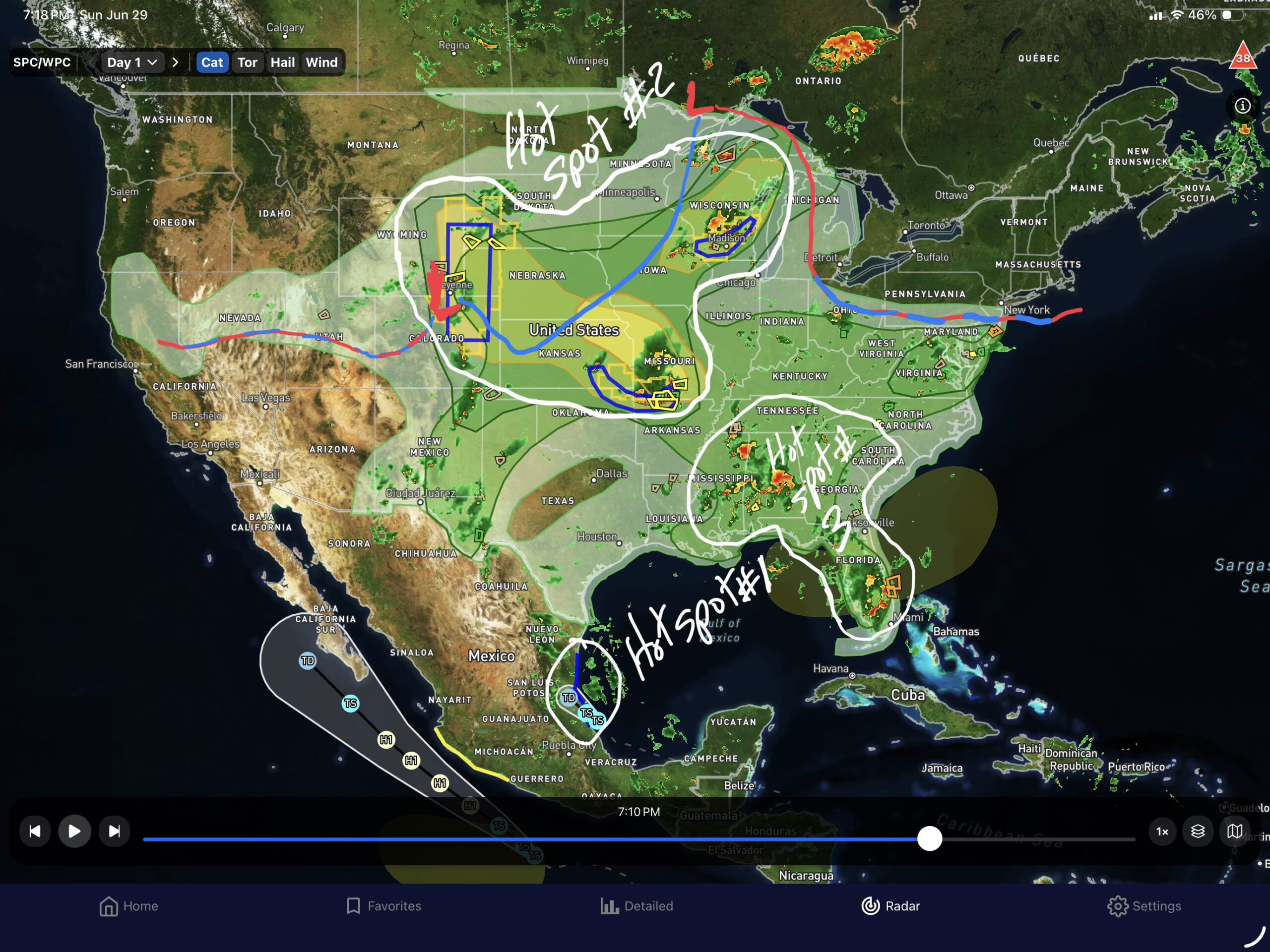
In the gallery, I have three graphics. The one on the right is the 5PM (EDT) map analysis that I traced onto the Hot Spot Map that screenshotted (the center graphic) from Everything Weather app, authored by Cory Mottice. I really like the radar map, and the overlays. It includes a lot for the radar part, and the forecasts are all from the NWS NDFD(National Digital Forecast Database). This allows forecasts down to a point. Let’s jump into the Hot Spots, and then look at a possible hot spot for the weekend.
Hot Spot #1…The Mexican coast south of Brownsville, TX will have Tropical Storm (TS) Barry, the second tropical storm of the season.

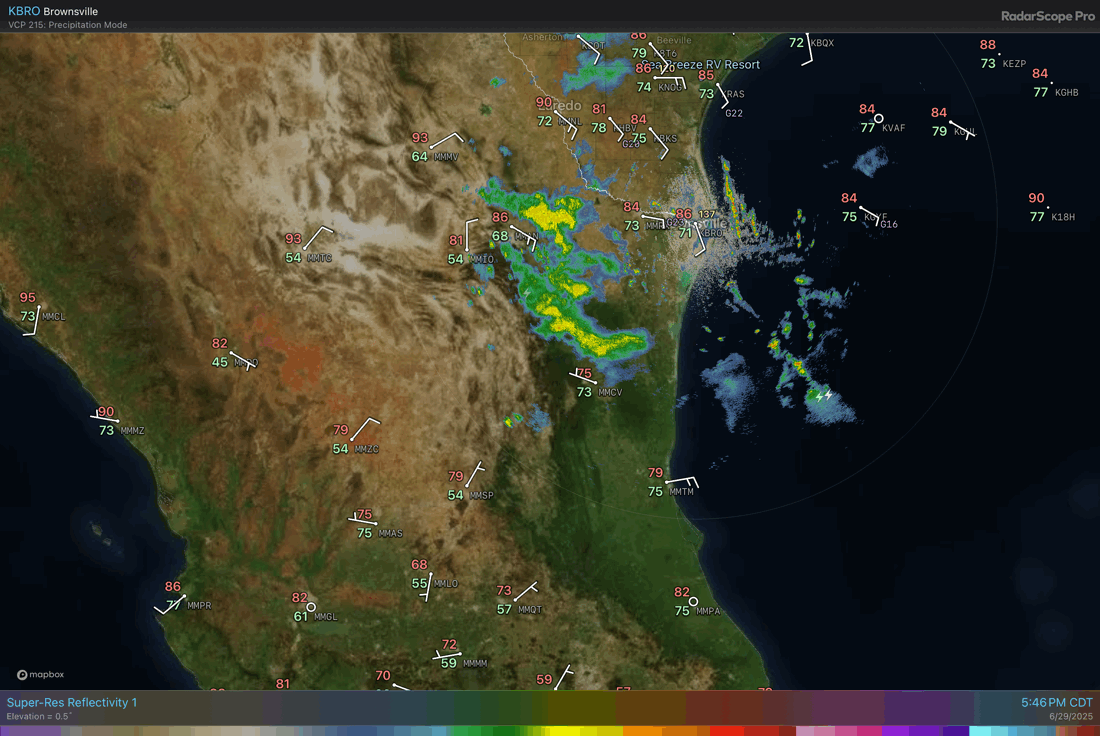
The biggest impact will be the rain from Barry as it comes ashore. The BRO radar (Brownsville, TX) on the right, shows some of the rain beginning to show up along the mountains of the Sierra Madre Oriental 10” of rain are possible, inland with 2-6 inches around the region.
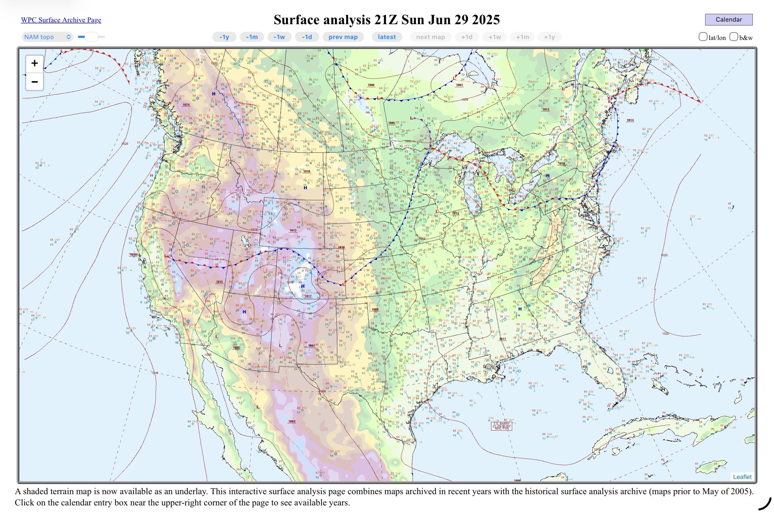
Hot Spot #2…the cold front, low pressure, and the three slight risks (levels 2 of 5) for severe weather. It looks like there is currently 3 Severe Thunderstorm watches along this front, with some corresponding slight risks for exceeding the flash guidance. The thunderstorms are running into some very juicy air with 1.50”+ precipitable water values. Except the storms in Wyoming and Colorado, where they are still above normal with 0.75 to 1.25” of PWAT(precipitable water) which is above the 75th percentile for moisture this time of year.
Hot Spot #3 is related (the moisture) to #2, but without the fronts…Instead of fronts, there is a low moving 500 mb shortwave low moving through the southeastern states, with 1.75 to 2.0+” of precipitable water. The fronts are expected to push through the southeast, causing more heavy rain in the region, and the potential for severe weather.
Which leads us to a possible Future Hot Spot(graphic on the left)…As mentioned, the cold front in the Plains States, is expected to move into the southeastern states, and then offshore along the Atlantic and the Gulf Coast, across the Florida peninsula. The models haven’t nailed down a particular wave, but with the front stalled, and low shear, a tropical wave/depression could (currently 10% chance of development within the next 7 days). The ECMWF and the GFS have ensemble members that show development off the coast of Georgia, but most over the Big Bend (FL) region of the Gulf. So, that area is to be watched. Are the tropics heating up? Well, it’s possible, we usually see an uptick by the end of July, climatologically, but each year is different. I guess it’s time to start watching the MJO forecast to see if there are any longer wave disturbances coming.