I am a meteorologist and a former youth leader at church…I have a lot to say on both subjects…and then some
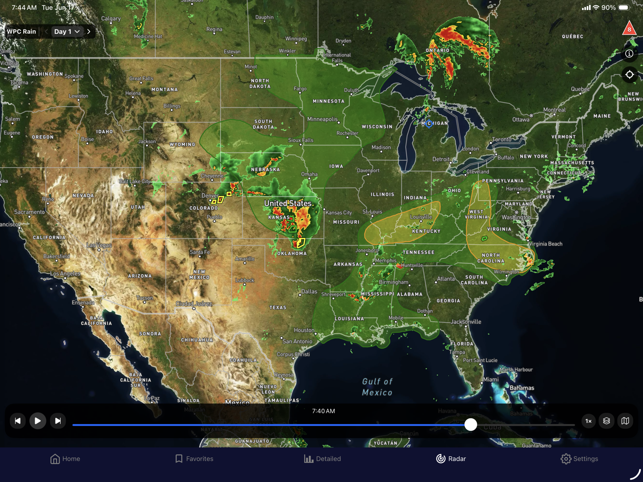
I decided to show just the eastern half of the country, because it was easier to show where all of the main action in the country. South Texas continues to get its southeast flow off of the Gulf. In Northern Michigan, an area of low pressure continues to slowly move east which increases the chance of rain for today. The main action is in the center of country with the thunderstorm complex that is moving through Kansas.
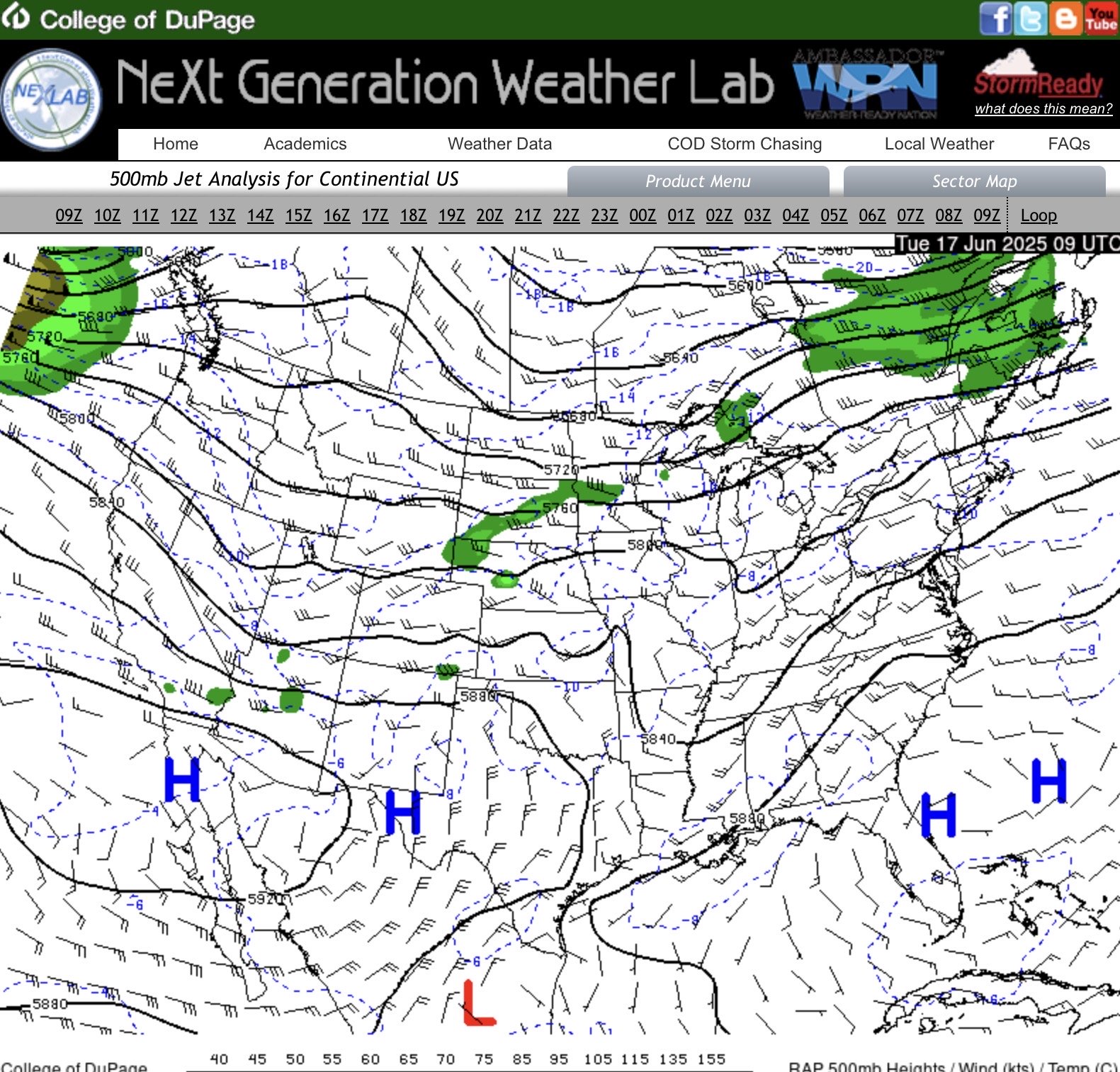
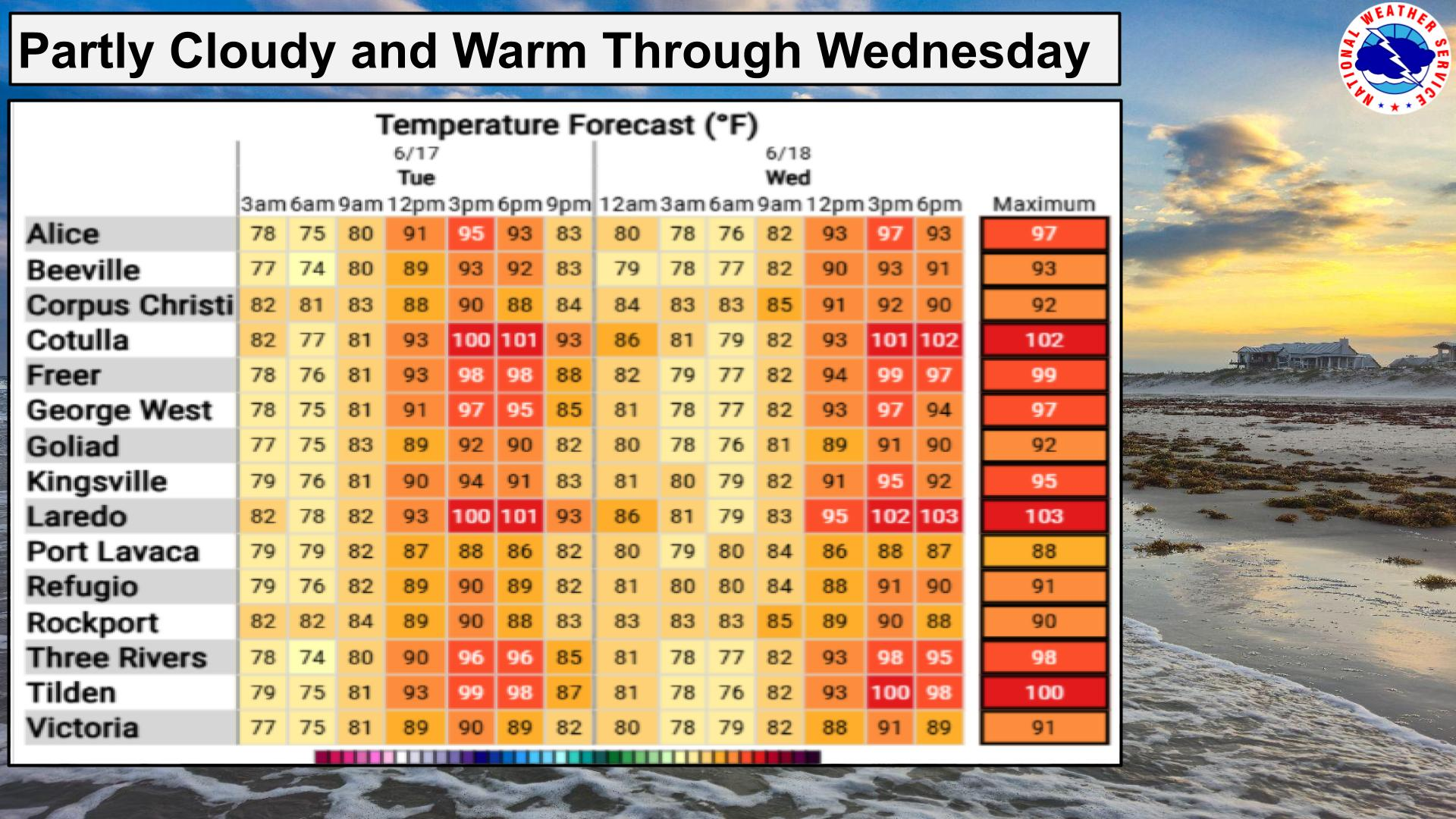
The only thing that has changed in the upper air pattern is the ridge (high pressure) continues to build in to the Texas, which is building some heat. The upper air pattern is still a bit weak today, so nothing big is expected up north. Again the main action is the Central US where a trough of energy will move out of the Four Corners area and into the Plains. The other area of concern is the stationary front in the east where heavy rain is again an issue.

You can see the fronts from all of the clouds are grouped together.
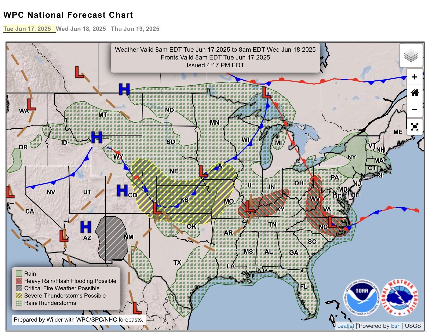

So for the outlooks, it’s very busy looking in the Central Plains this morning with the complex of thunderstorms. There’s a moderate risk (level 4 of 5) from the Storm Prediction Center in Kansas, and that’s a surrounded by the Enhanced area (level 3 of 5).
As I said before, the fronts in the east (which are stationary now, are expected to move east a bit so that they are warm fronts. This is again going to fire off more rain in the lower Ohio Valley and the Mid-Atlantic States.
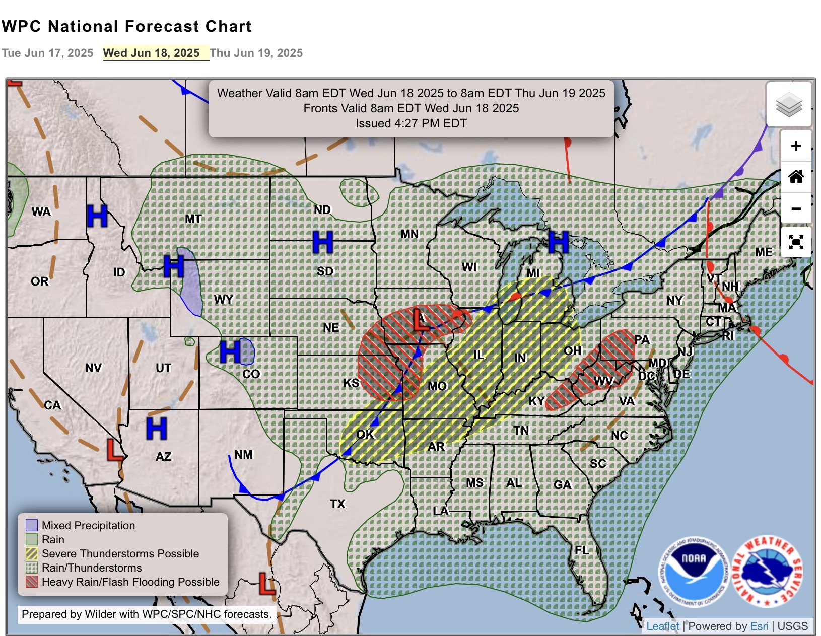
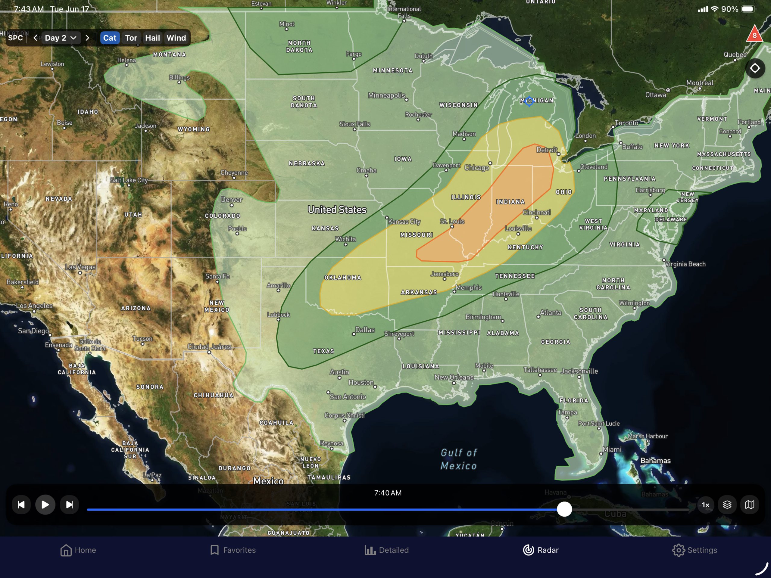
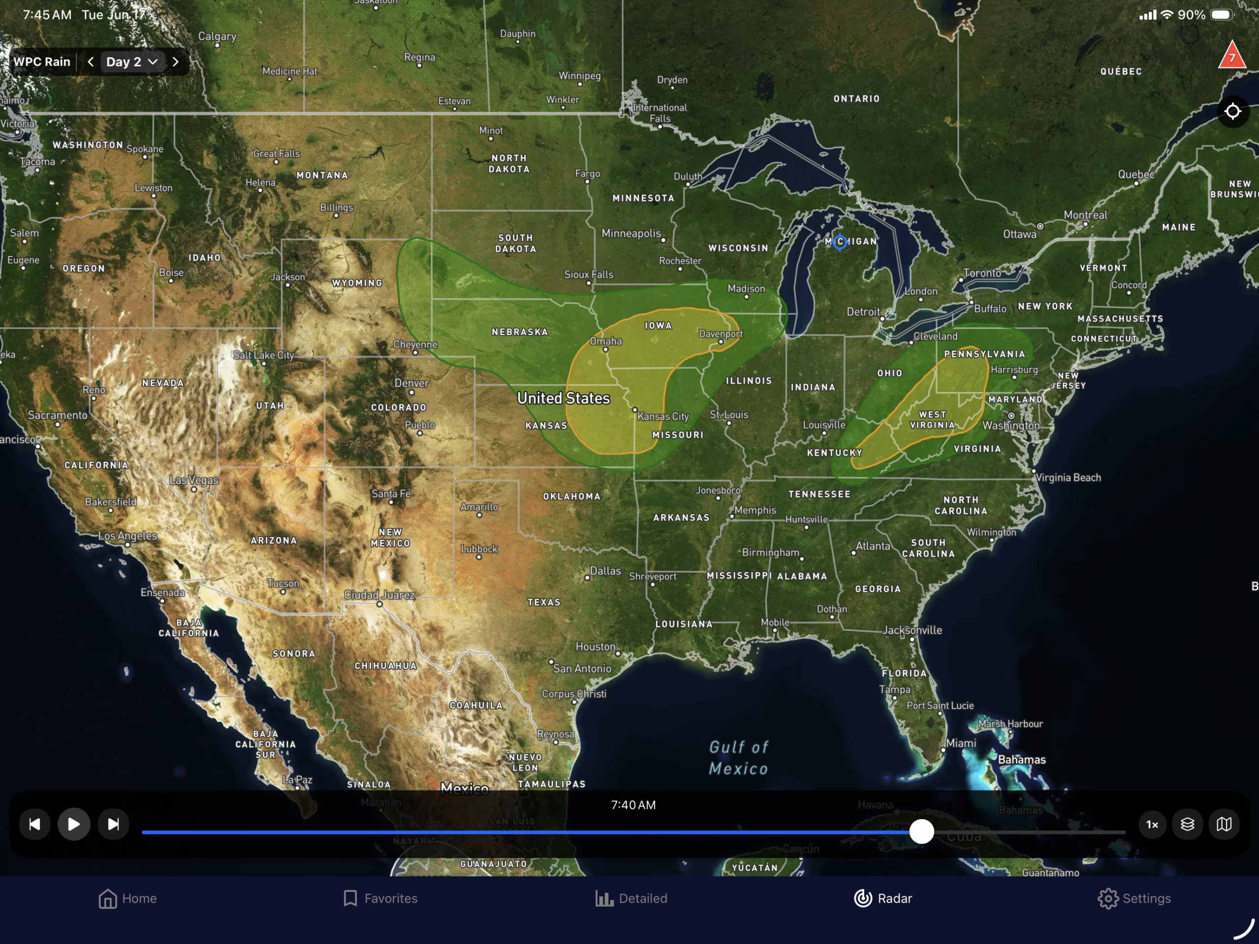
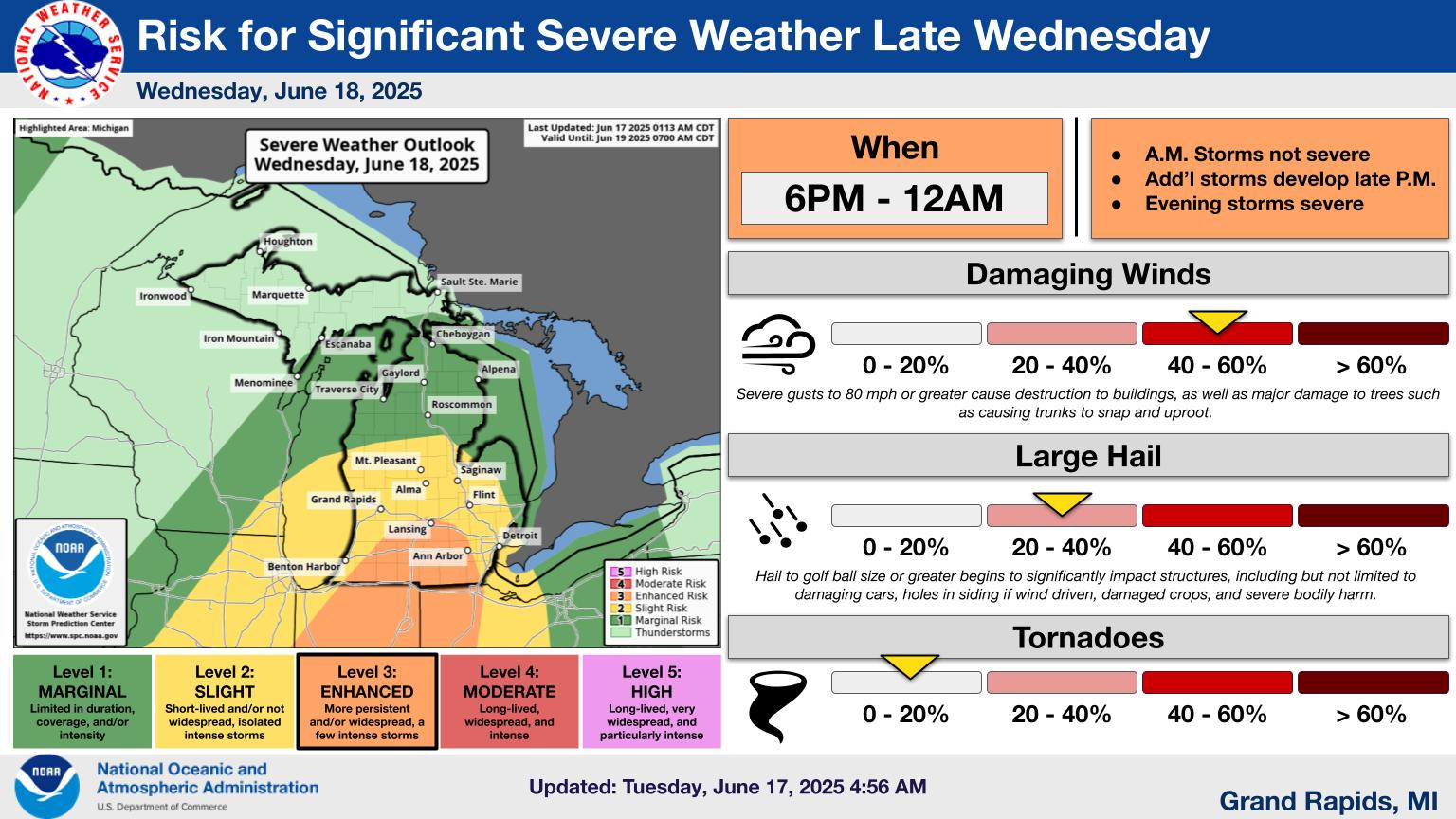
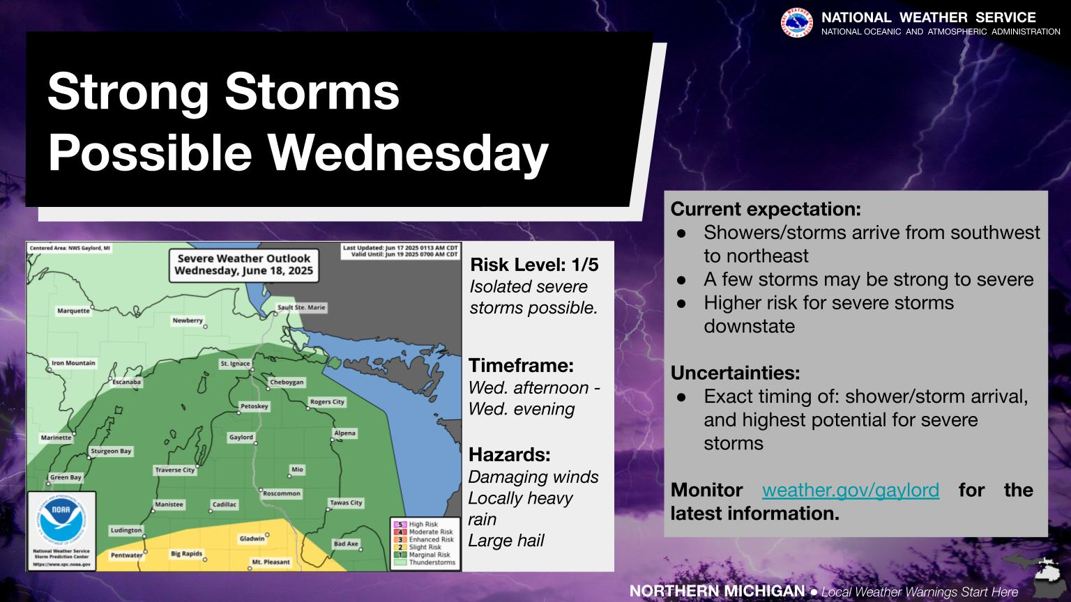
All of that energy moving through the Central Plains today will move into the Mid-Mississippi Valley and the Upper Great Lakes tomorrow (Wednesday). The enhanced (level 3 of 5) will poke into southern lower Michigan, with a decent sized are of slight risk (level 2 of 5) covering most of southern lower Michigan. Marginal (level 1 of 5) goes up to the Straits of Mackinac. On the backside of the low moving through the central part of the US, rain could be heavy at time with the slight risk of exceeding flash flood guidance. That’s also the case in the central Appalachians again. With all of the rain that has fallen in that area, more on top of it increases that chances that flooding will occur.
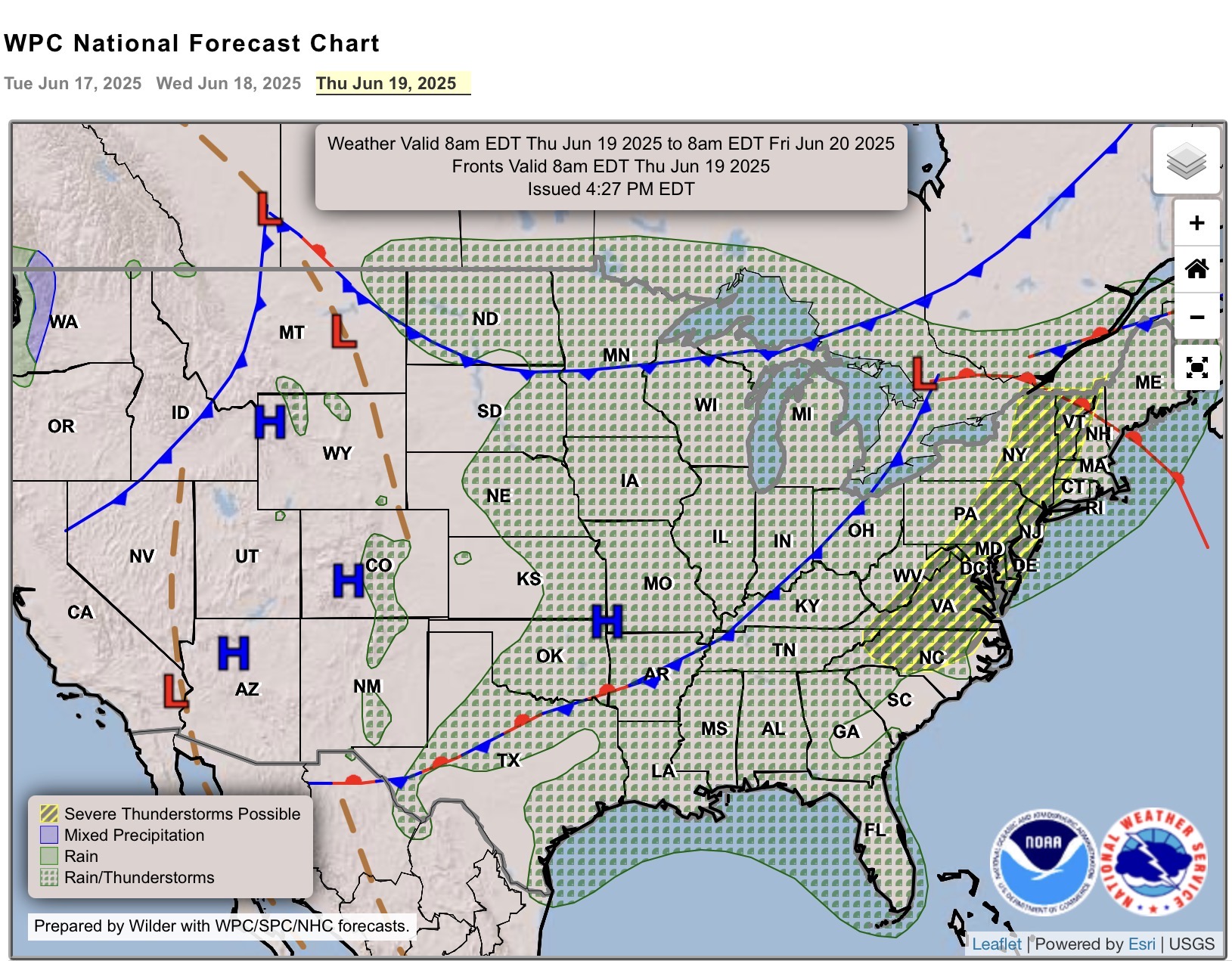
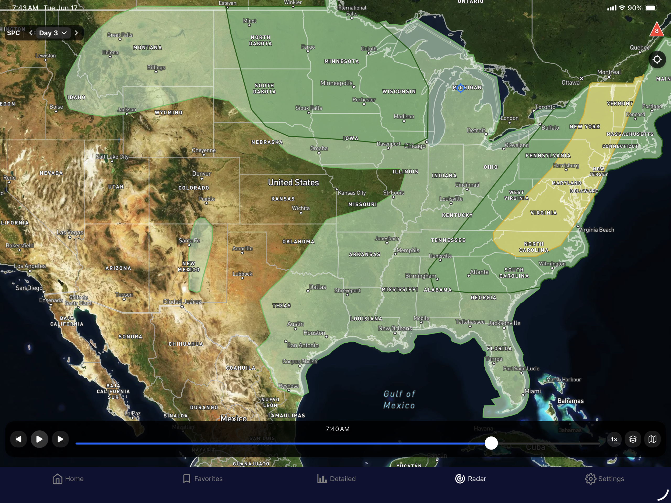

Things look like they settle a bit, although, this being the summer months, the cold fronts don’t move as fast, or they even stall out. That seems to be the case for Thursday, as the front that has been somewhat stalled in Canada moves slowly in the Great Lakes, which means rain, and back closer to the lows in the Northern Plains, the severe weather should remain tamped down a bit. However, with the stalled fronts, WPC has outlined a marginal risk for heavy rain in the Great Lakes.
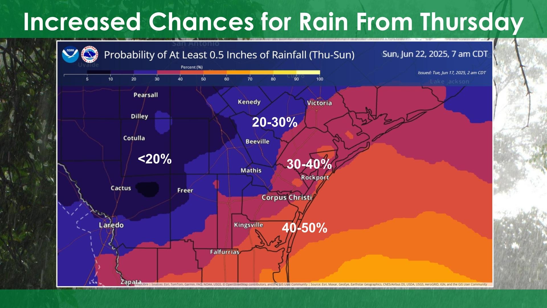
South Texas looks to remain in a pattern with a chance for thunderstorms each day, but no expectation of severe weather from them. Hopefully, they’ll continue to get more rain for the Nueces River Basin and the reservoirs.
Here are the graphics from the individual offices for more details…