I am a meteorologist and a former youth leader at church…I have a lot to say on both subjects…and then some
First and foremost, Let me take this time to wish my wife Happy Birthday!
With the electricity issues and watching the little grandkids, I’ve been out for the past week. I was trying to record, and fell short of time, so now that I’m back from birthday brunch for my wife, I’ll put a post up, and maybe later, I’ll put up a YouTube short/Tic Toc/Reel.
So for the National Stuff…
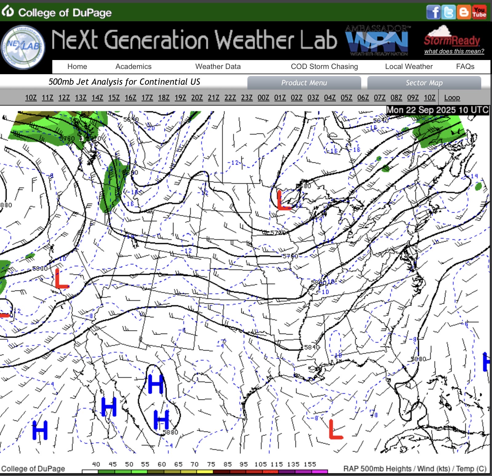
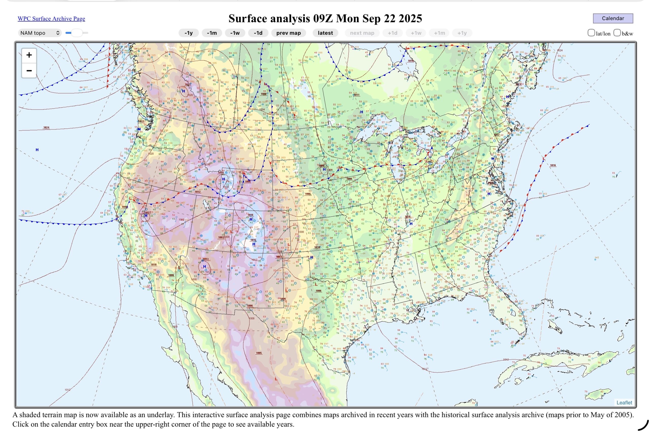
There is an upper low near the Upper Great Lakes, that give a low chance for showers and thunderstorms. There is also a stationary front, that thunderstorms were triggered from this morning in the Northern Plains, while the end of the main rain moves off this afternoon.
South Texas has the upper ridge, which remains in place, and north flow aloft. With the South east flow at the sfc, there is some destabilization. So for today, the best chance for showers and thunderstorms would be near the Middle Texas Coast.
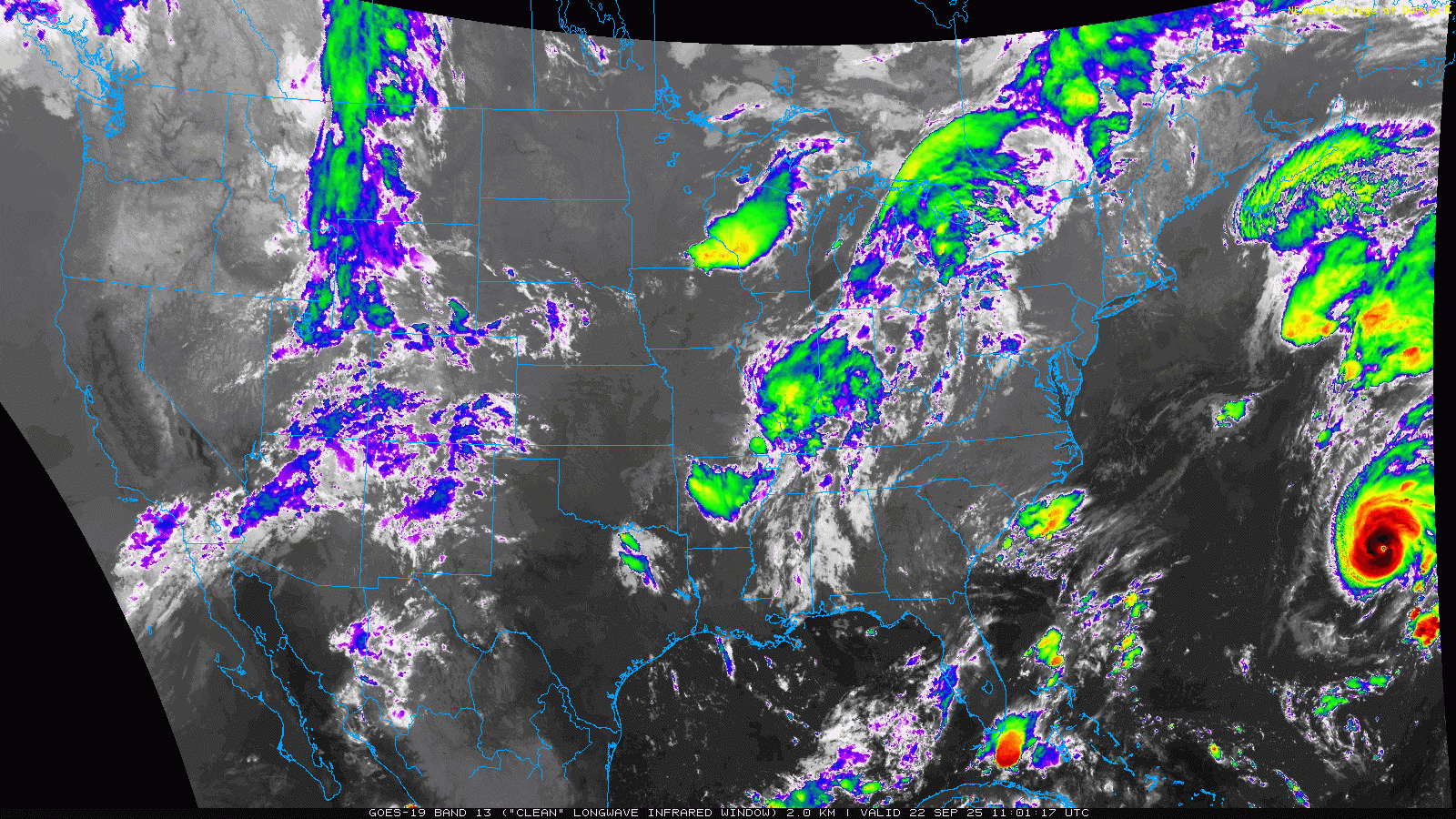
On the satellite the Upper Great Lakes are clouded over with the convergence of system.
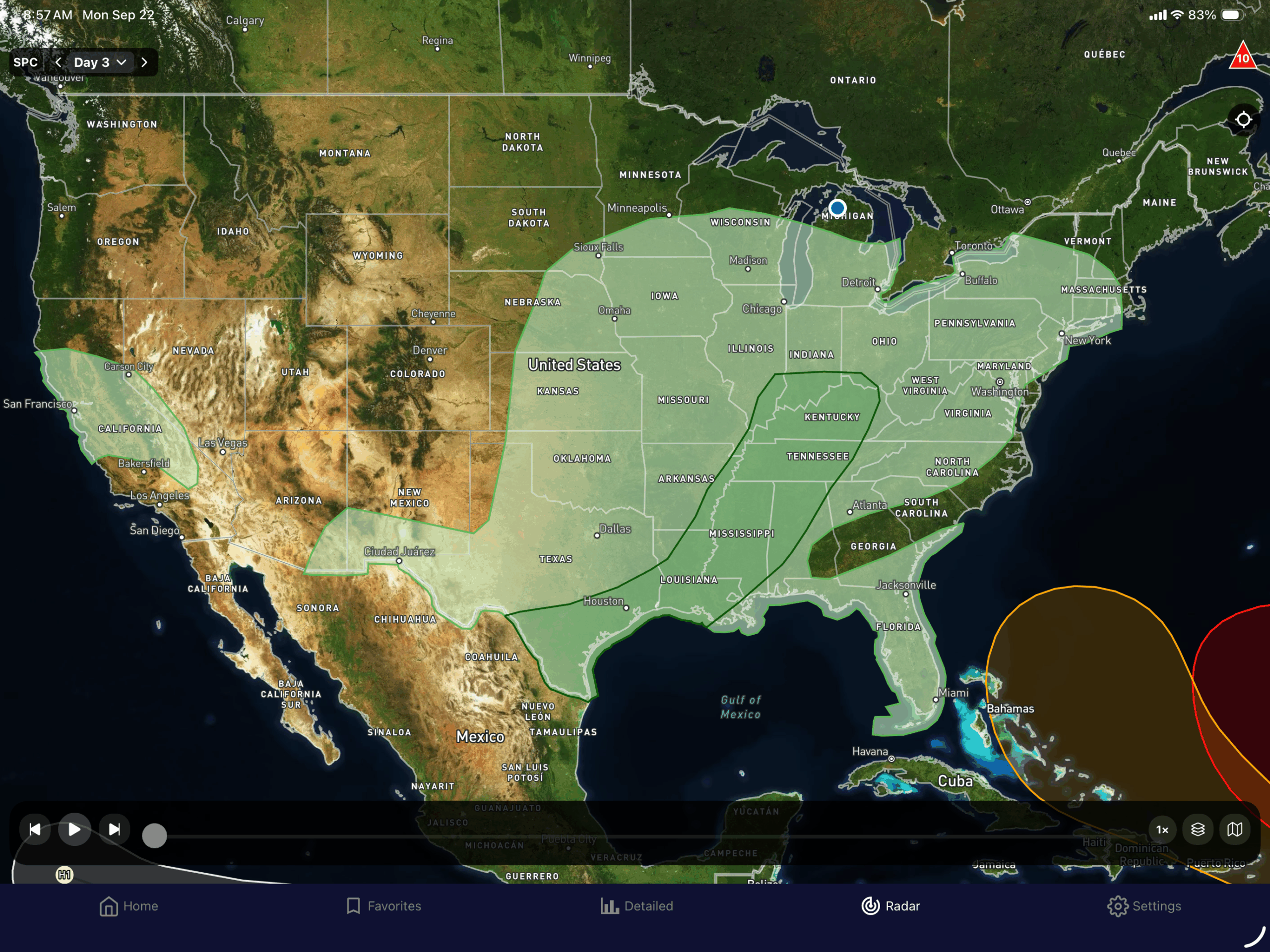
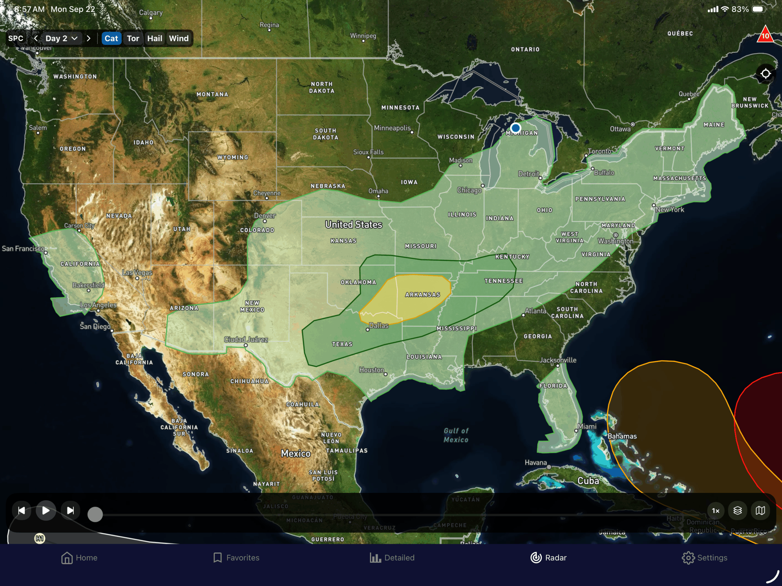
So Lower Michigan continues with the chance for showers and thunderstorms through Wednesday. With high pressure building into the region by Thursday.
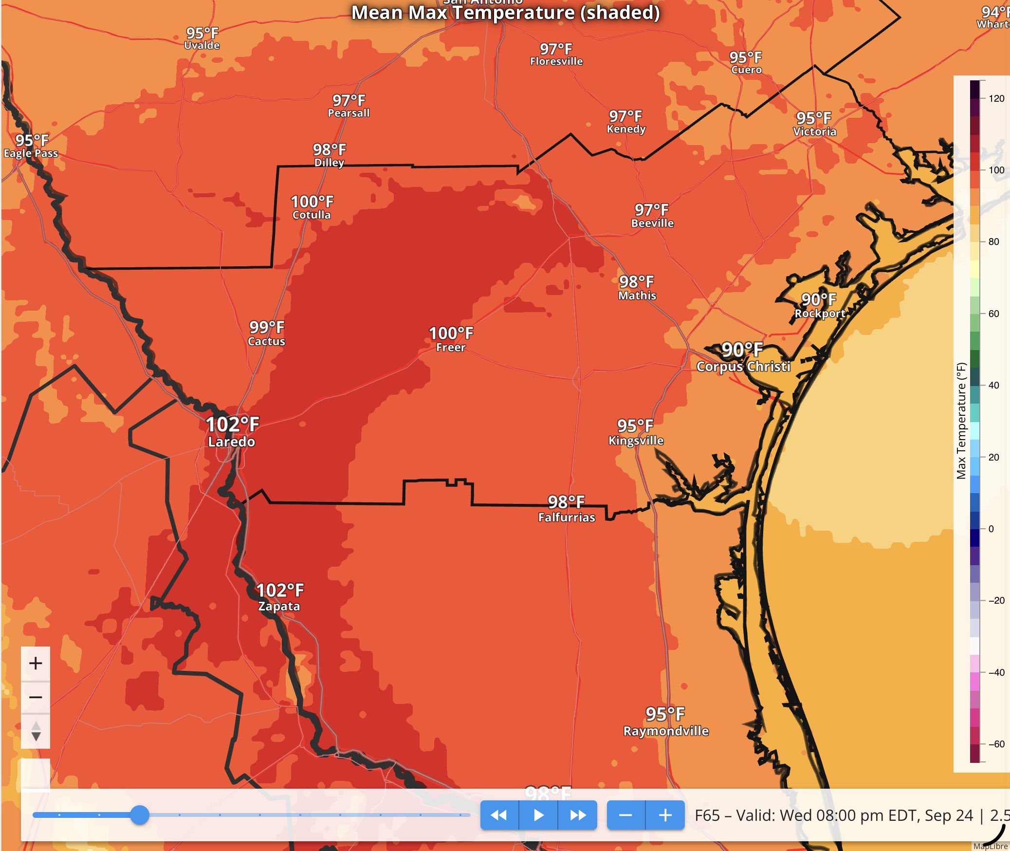
For South Texas, a cold front (yes, I said it), looks to be making its way south from the Northern Plains today, and pushing through late Wednesday or Thursday. So the High temperatures for Today through Wednesday look like this…
They will cool down to this…
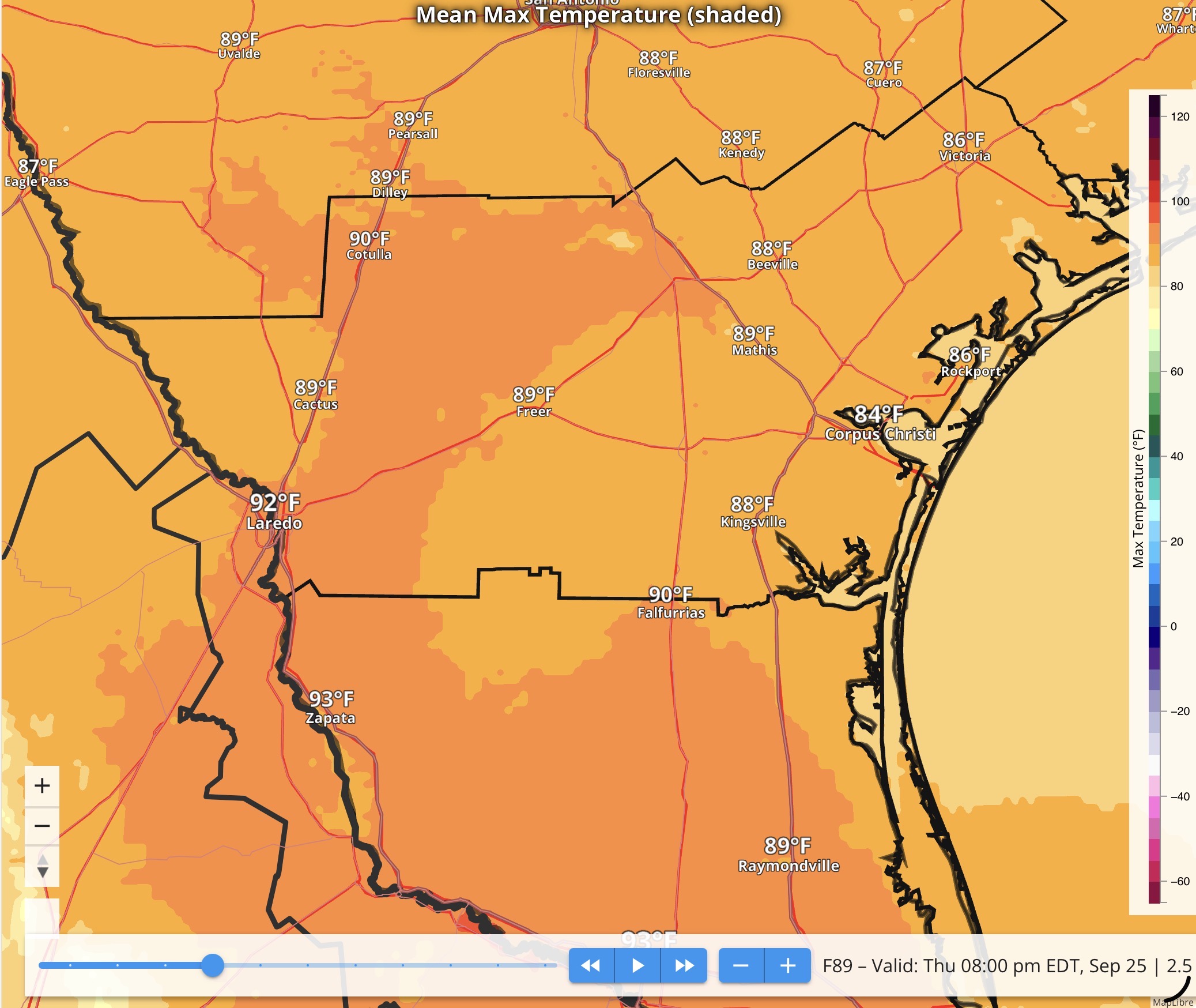
by Thursday. That’s about a 10ºF difference. So the first front looks to make it into the region finally.
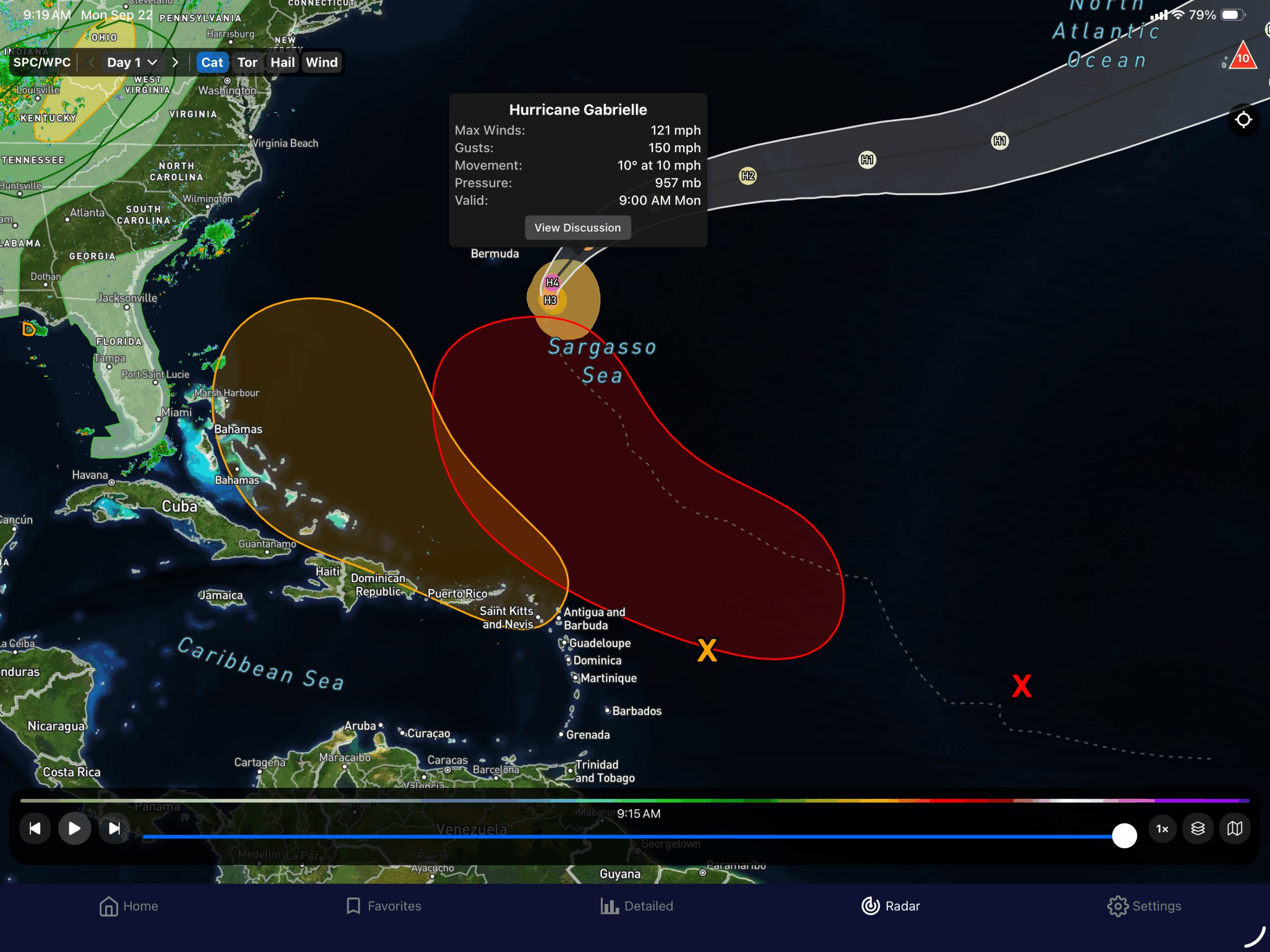
The title comes from the latest Tropical outlook as we pass the peak of the Atlantic Hurricane season, then the switch get thrown.
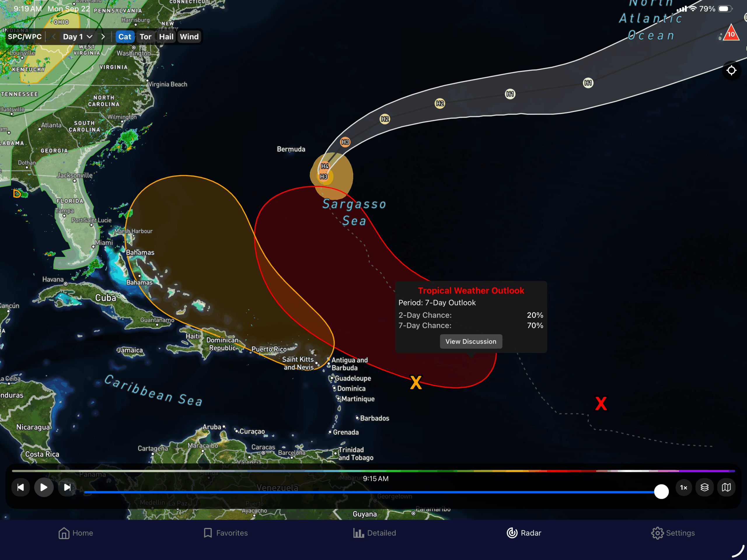
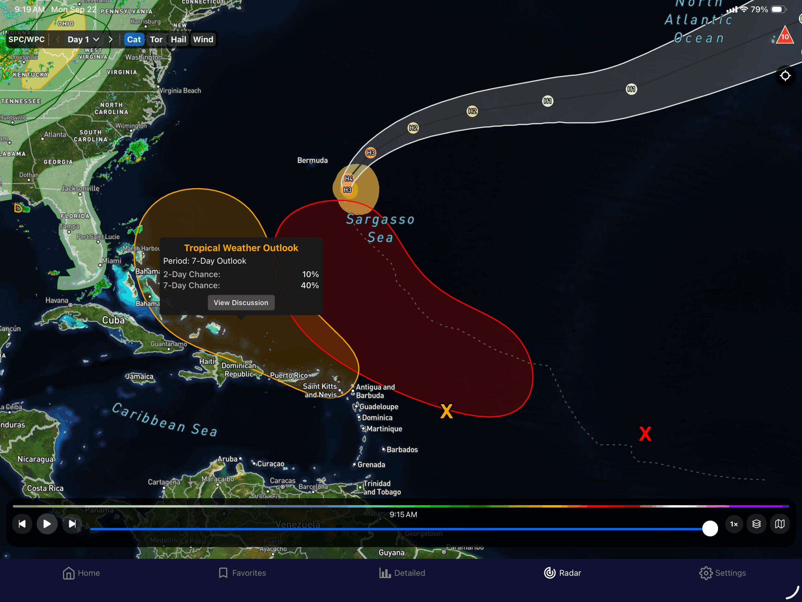
Hurricane Gabrielle is now a major hurricane (cat3 or better), its 120 mph sustained winds. It is move north, and is only expected to produce large swells and gusty winds near Bermuda. It could affect the Azores, and possibly Great Britain (but not as a tropical system).
There is a strong (red colored) wave that is expected to (70% chance) develop within the next 7 days, but a 20% chance in the next 2. This wave looks to follow Gabrielle.
The second one (the orange one) looks to develop near the Lesser Antilles or the Virgin Islands, and has a 40% chance for development over the next 7 days.
I have also been seeing that a sneaky wave (looking at the models) may develop 6-10 days out and could get into the Gulf. Also, and this is important, beware of the one model run disaster films. The GFS has been known to develop things and more likely it not happening, especially during this time of year. It does at front end, and it does it at the back end. Watch the NHC (or you can follow me since I tend to follow NHC), if anything develops.