I am a meteorologist and a former youth leader at church…I have a lot to say on both subjects…and then some
Things are a little slow starting this morning, but quiet so far. The weather is quiet as well. Over South Texas and Lower Michigan, rain is still possible in both places (there’s a little more to it than just that saying), and it is definitely cooler in Lower Michigan. So let’s get into it…
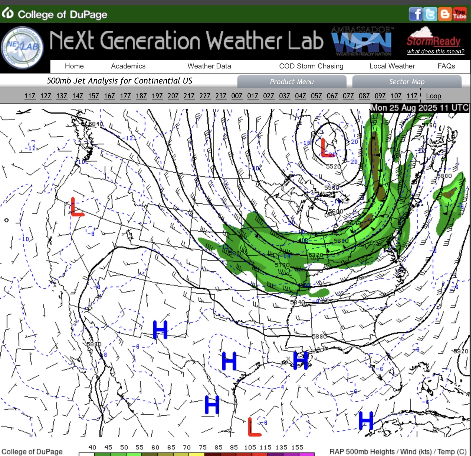
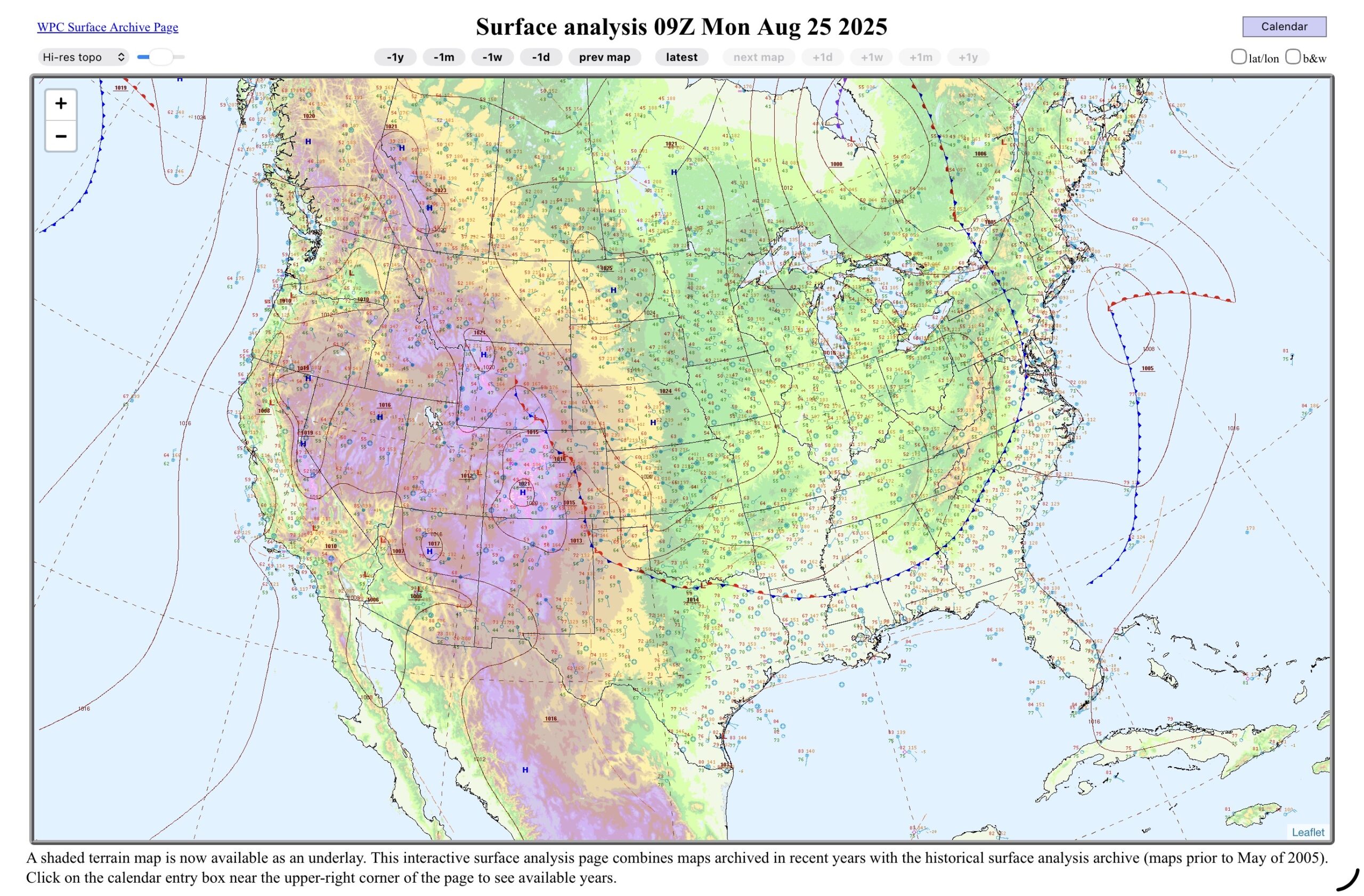
Over Lower Michigan, the upper level low to the north is still slowly moving east, but the main jet streak, is now south of the region. This puts us in the cool, unstable air, but no extra uplift from the higher winds. South Texas remains under the upper level high. On the surface map, the cold front is through the Great Lakes and is cutting through the northeastern states, and then down the east coast to the southern states, then across to North Texas, where it is a stationary front, and back up the Rockies. The stationary front, and monsoonal moisture will be a key player over the next few days. South Texas at this point looks like it back in summer mode, with onshore winds.
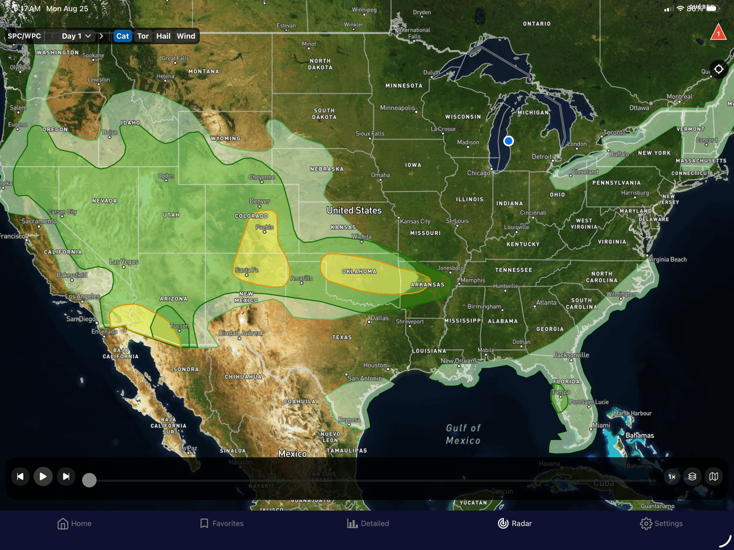
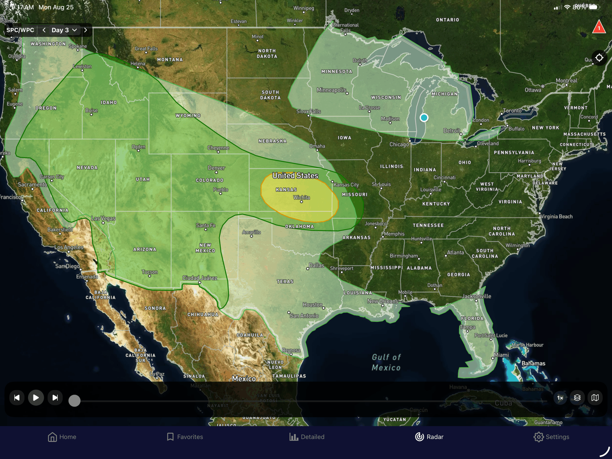
You can kind of see the outline of the front on the SPC/WPC outlooks maps this morning. The front in the Northeast kicks off showers and thunderstorms, as well as in the southeast US and along the Gulf Coast. The stationary front is the main player, along the Rockies, and the upper level ridge over most of the Desert Southwest. The slight risks are along the front in the Southern Plains, and in the Desert Southwest where the monsoonal moisture is producing a flash flood threat.
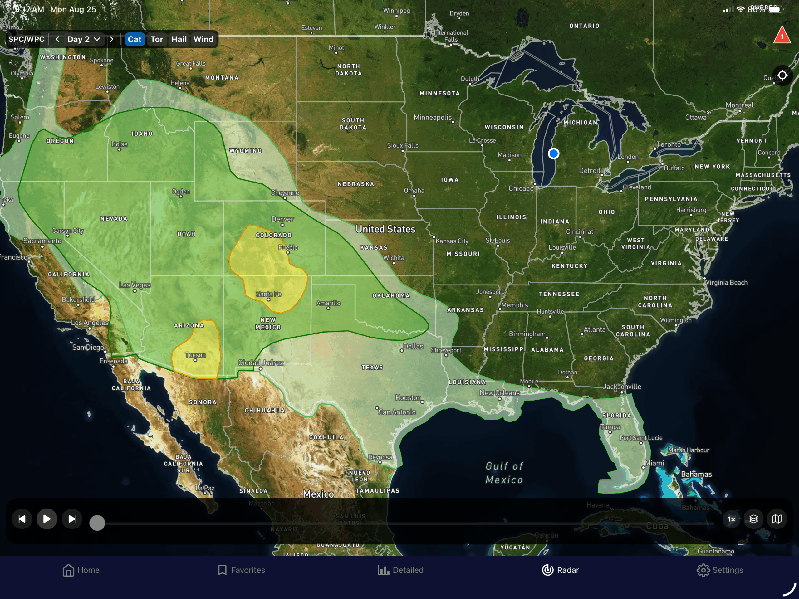
Tuesday looks similar, but the northeast rain is offshore. Wednesday looks similar as well, but there is another cold front coming down out of Canada, and into the Upper Great Lakes.
In the Tropics, TS Fernand is no threat to land, and the wave headed for the Caribbean is now at 0% chance of development.
So let’s look at the local forecasts…
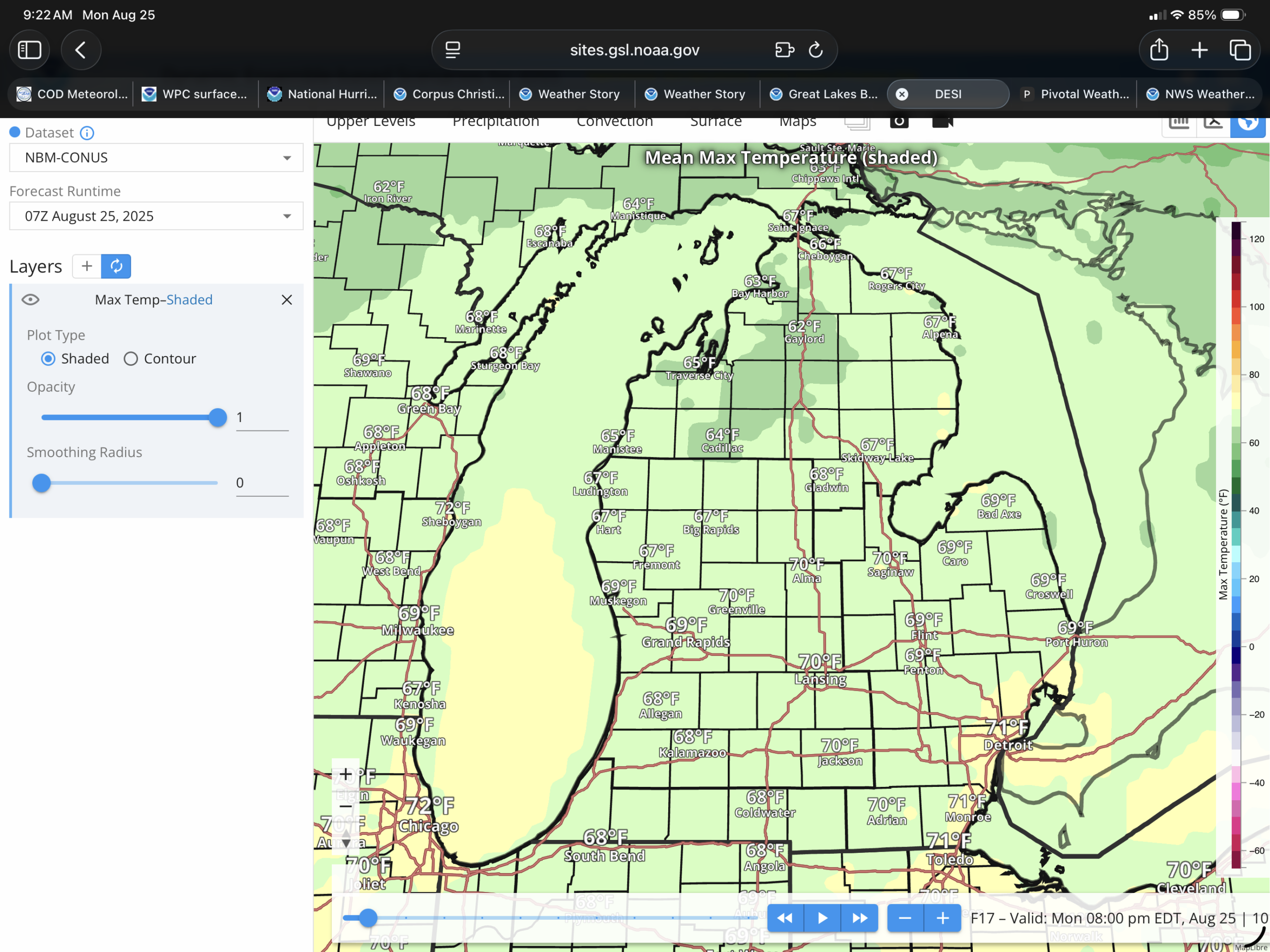
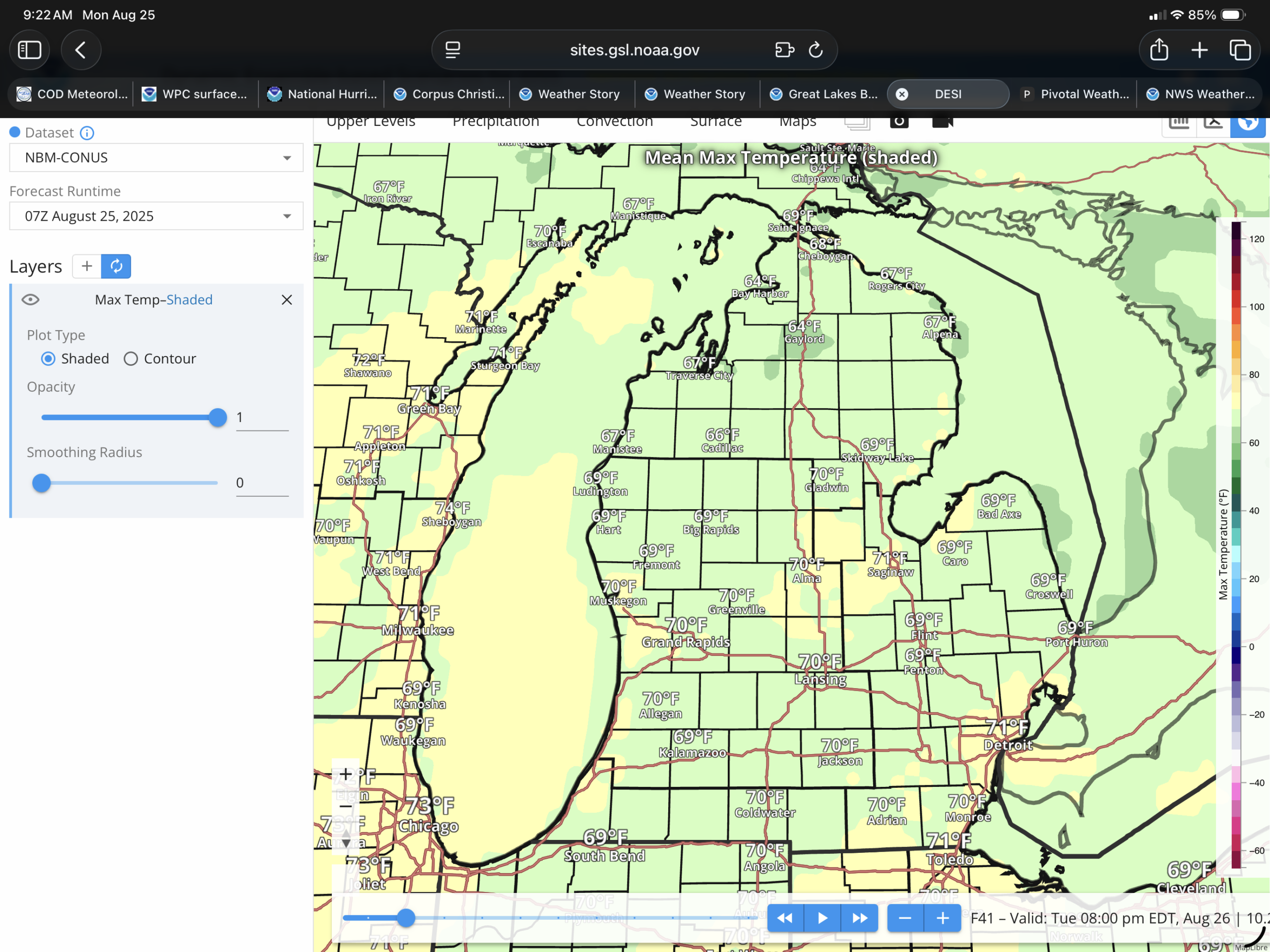
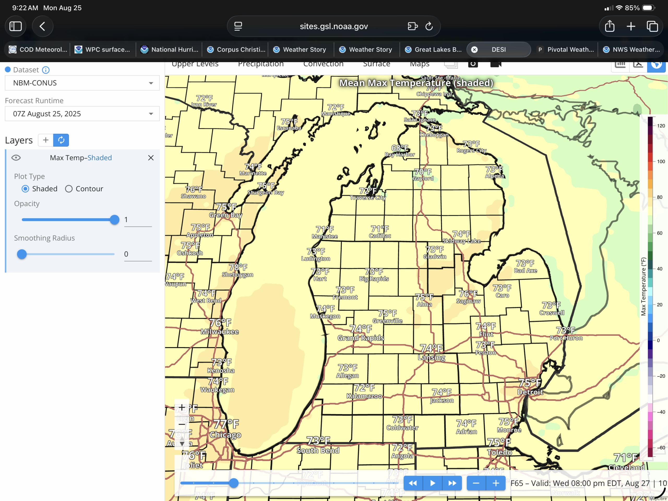
Lower Michigan will gradually warm from the 60s to the lower to mid 70s by Wednesday. Showers should be on the way down, with isolated to scattered showers expected today. Dry Tuesday, as the high moves over us, and then showers and thunderstorms are expected Wednesday with the high chances north of US-10, and the medium chances south.
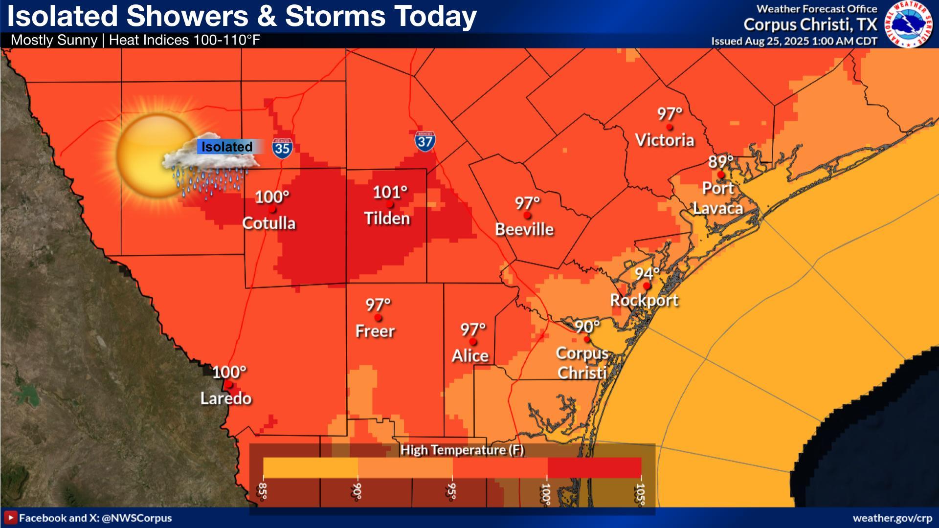
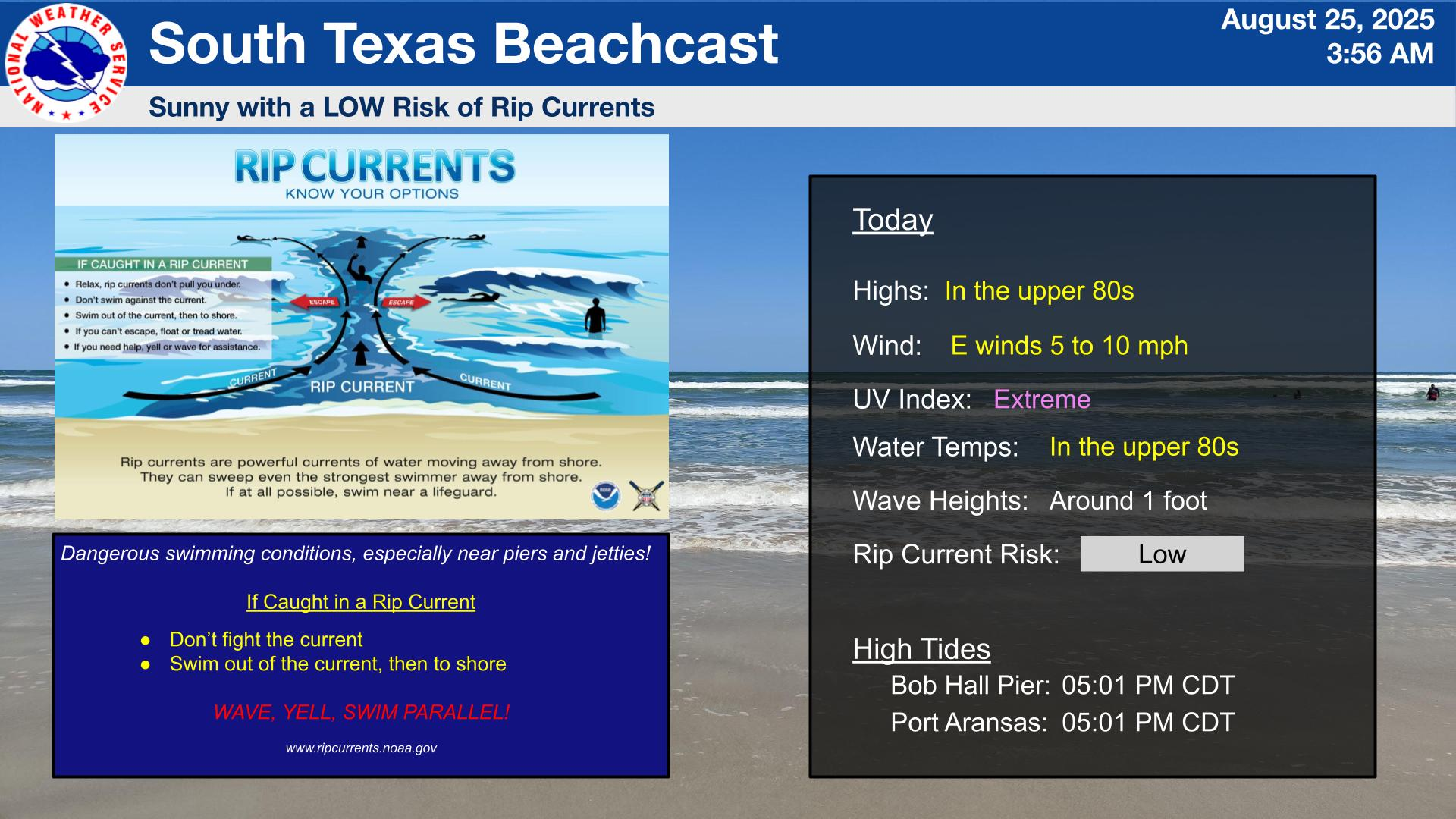
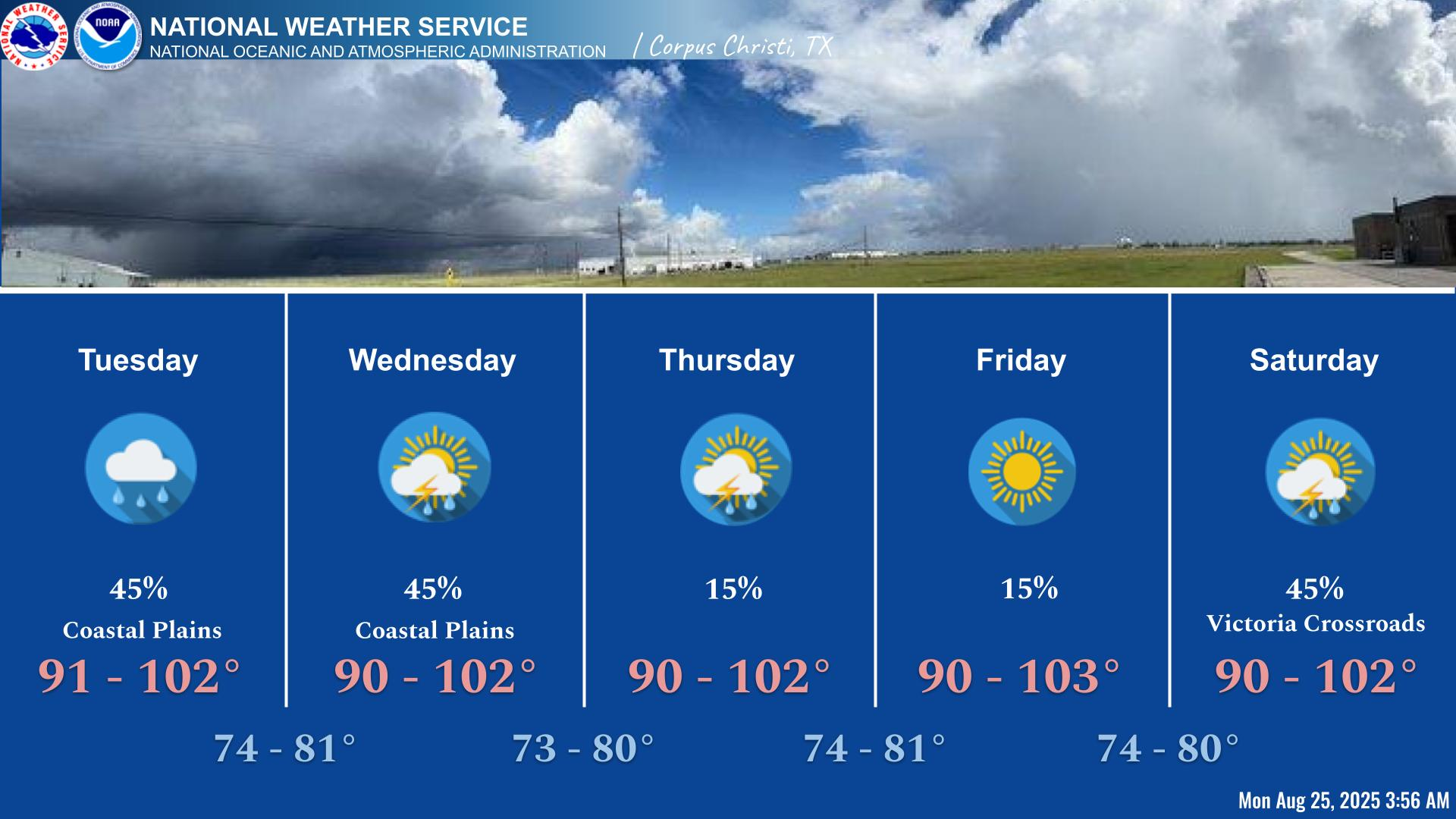
As I said earlier, South Texas is in summer mode, with temperatures back around 100ºF in the Brush Country, and the beaches in the upper 80s. Isolated showers and thunderstorms, most likely will move in with the sea breeze by the afternoon. There is a low risk of rip currents at the beach. It looks like there will be some thunderstorm chances coming up as well this week.