I am a meteorologist and a former youth leader at church…I have a lot to say on both subjects…and then some
Had to get a few projects done on the RV yesterday, and we go our hoses changed out, on the boat. Things are coming together, although a little slower than we would like.
In the weather, of course the big story is Hurricane Erin, which is a category 2 storm.
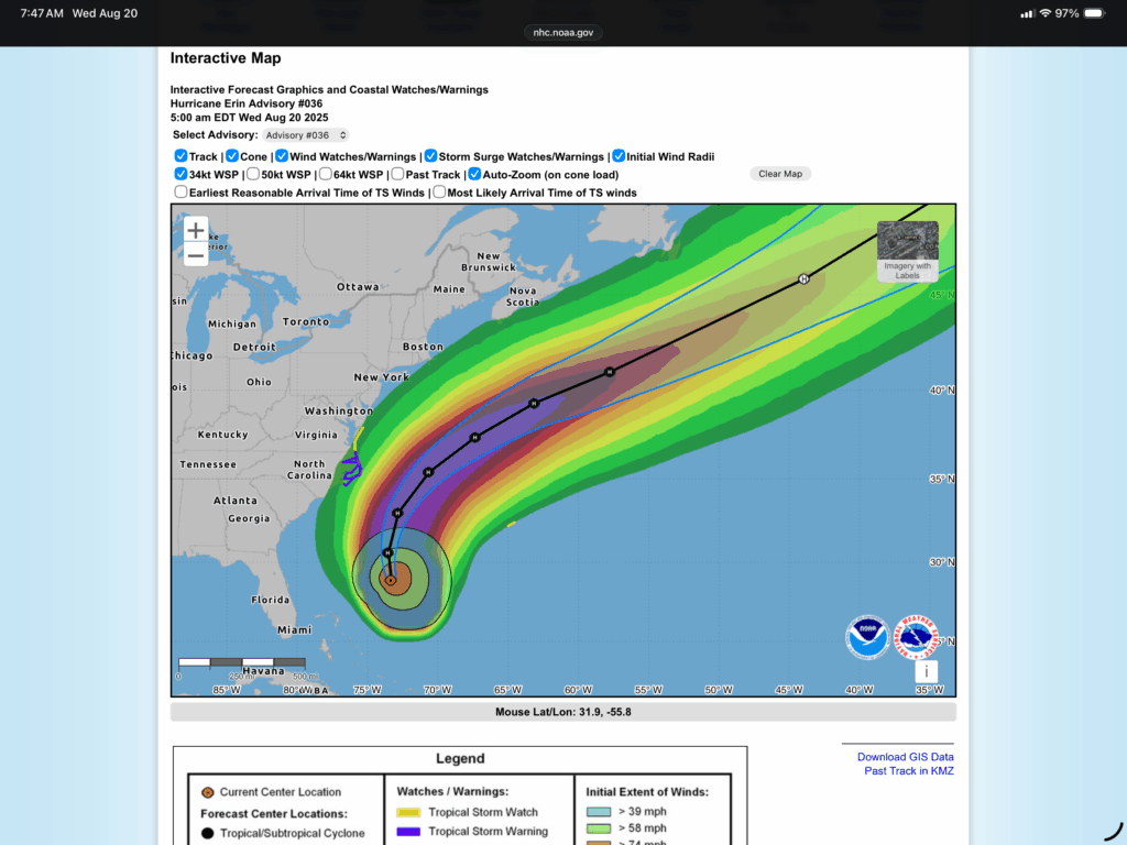
Maximum sustained winds are near 100 mph (155 km/h) with higher gusts. Some strengthening is possible during the next day or so. Weakening is likely to begin by Friday, but Erin is forecast to remain a hurricane into the weekend.
Erin is a large hurricane. Hurricane-force winds extend outward up to 90 miles (150 km) from the center and tropical-storm-force winds extend outward up to 265 miles (425 km).
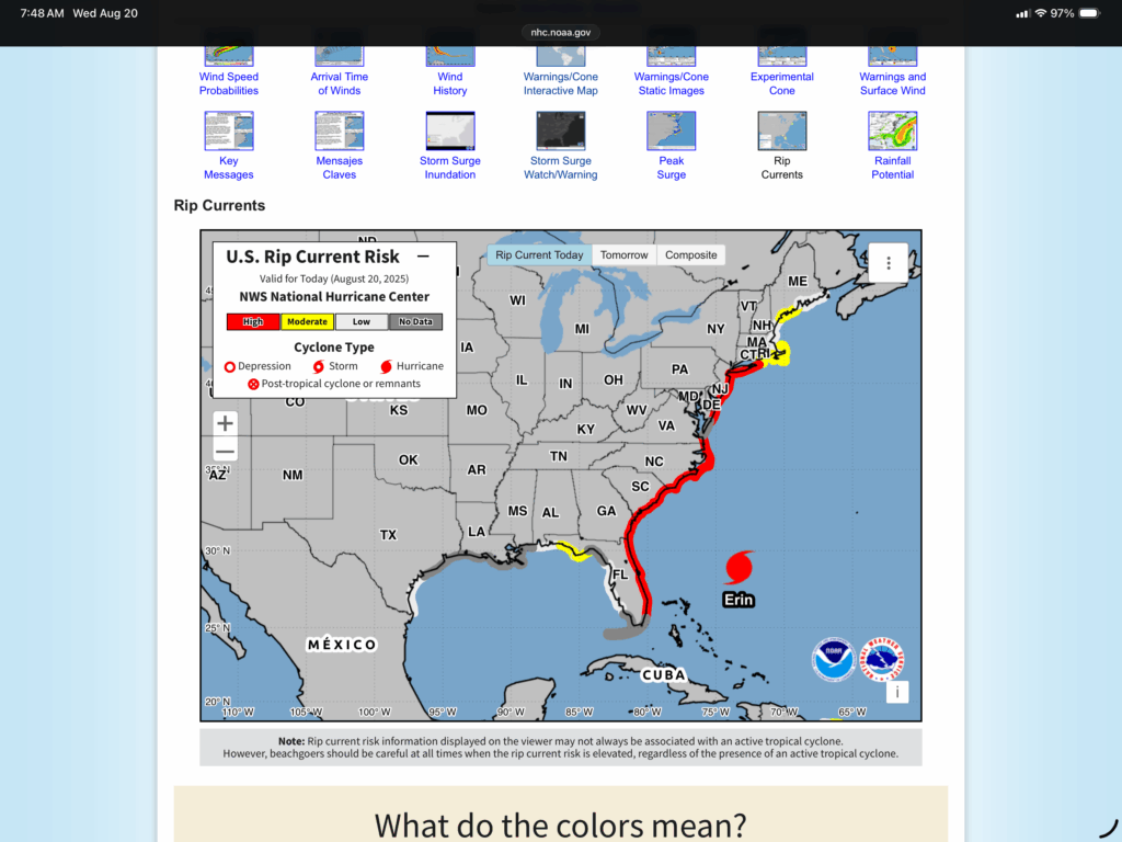
The main story with Erin, since the storm won’t make any landfalls, is the large wind field, which is producing a high rip current risk along most of the Atlantic seaboard. The only people that will be happy about this is surfers. Stay safe…
With that out of the way, let’s look the rest of the forecast…
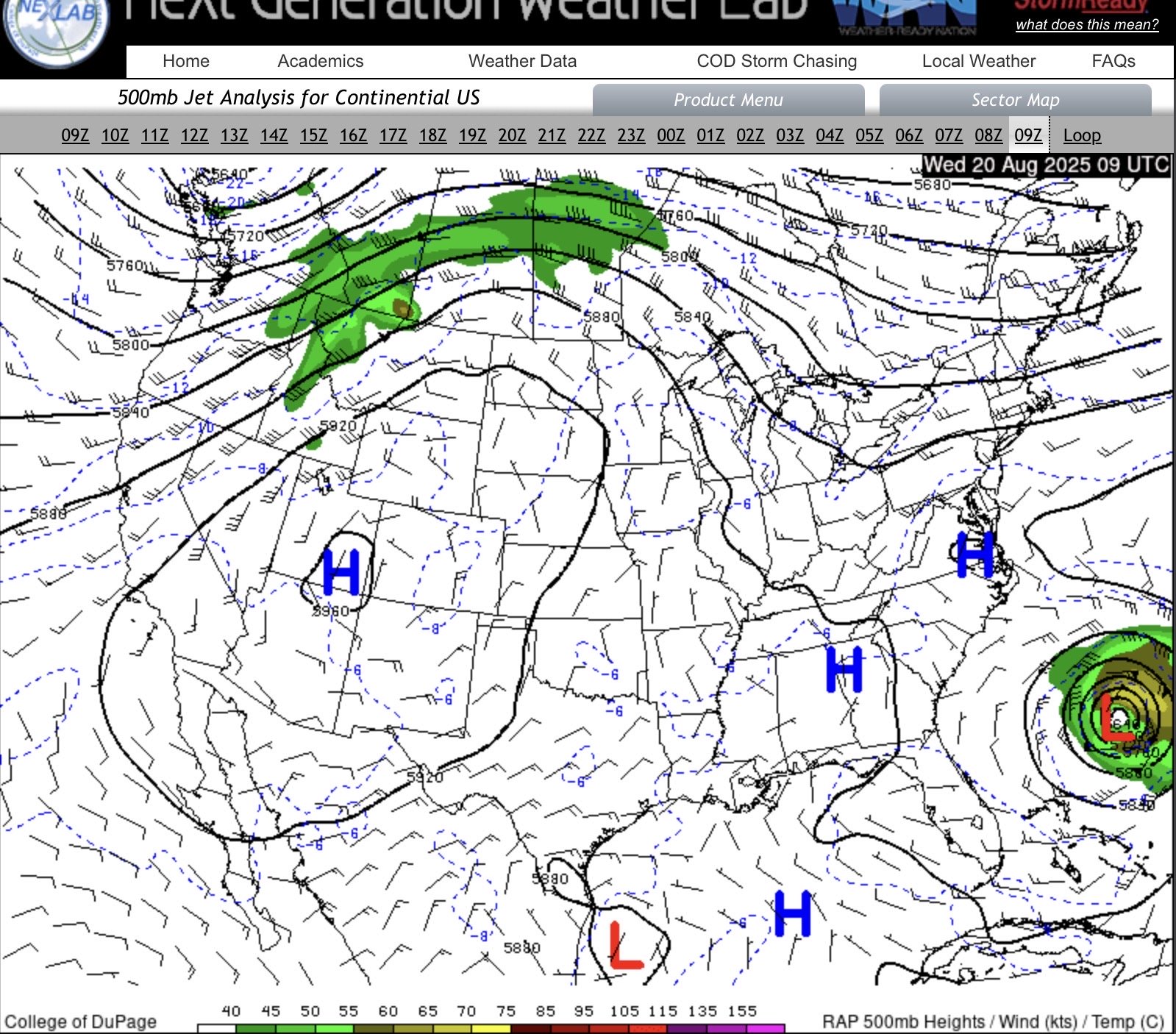
I’ll mention that when I saw the 6-10 day outlook with below normal temperatures and then the current upper air pattern, all I could think of was the ridge/trough jet stream pattern which is starting to show. Not sure that it will remain like this, but we are getting close to September and the color change starts in Michigan soon. Anyway, the trough over the Upper Great Lakes will keeps us on the cool pattern for the next few days, and probably cloudy. We are getting into the “unstable” season for the Great Lakes, where the water temperatures will be warmer than the air temperatures, which can complicate a forecast(like cloud cover).
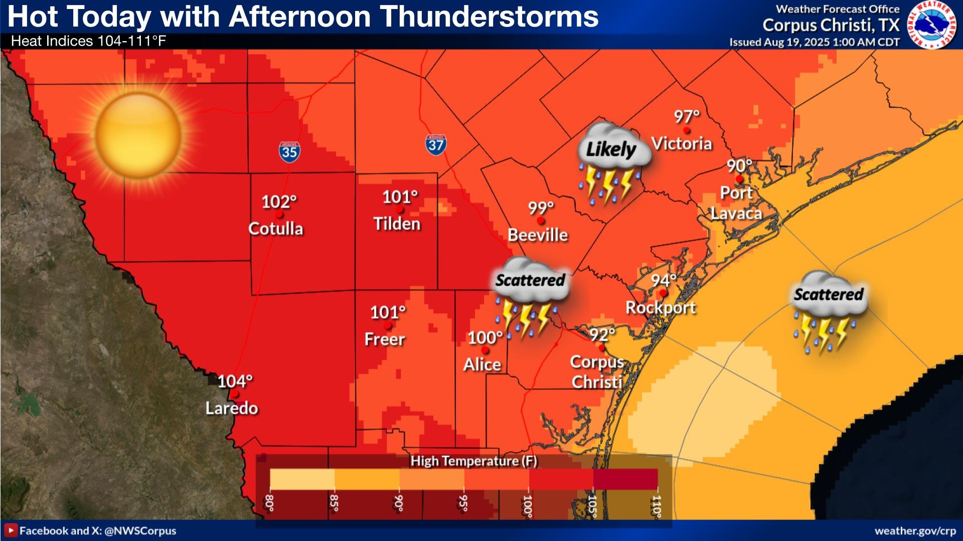
For South Texas, the main ridge is now to the west, and other is a broad upper low over the region, which looks to drift over the region through the next week.
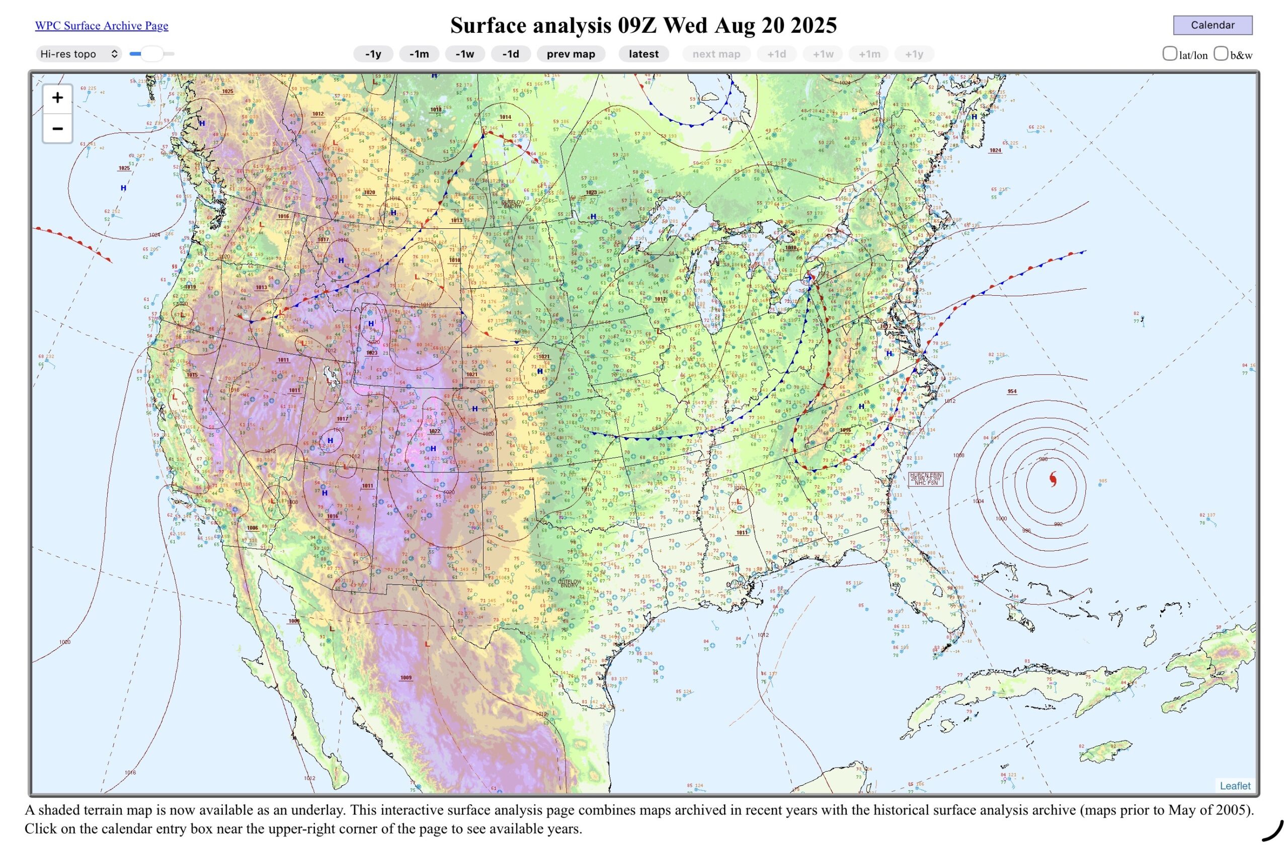
On the surface chart the cold front and low is just starting to move out of the Lower Great Lakes, although it probably won’t move very fast as Erin stops thing up, until it gets into the jet stream and begins to move east. There is a front in the Canadian Prairies with a front that trails it. That will be the next weather maker in the days to come.
The Upper Great Lakes will be thunderstorm free, and probably begin to clear later today, or at least tomorrow (Thursday). Then that prairie low will move across the northern tier of states, and move into the Upper Great Lakes by Friday. So outdoor activity will be pretty good over the next couple of days (in Michigan).
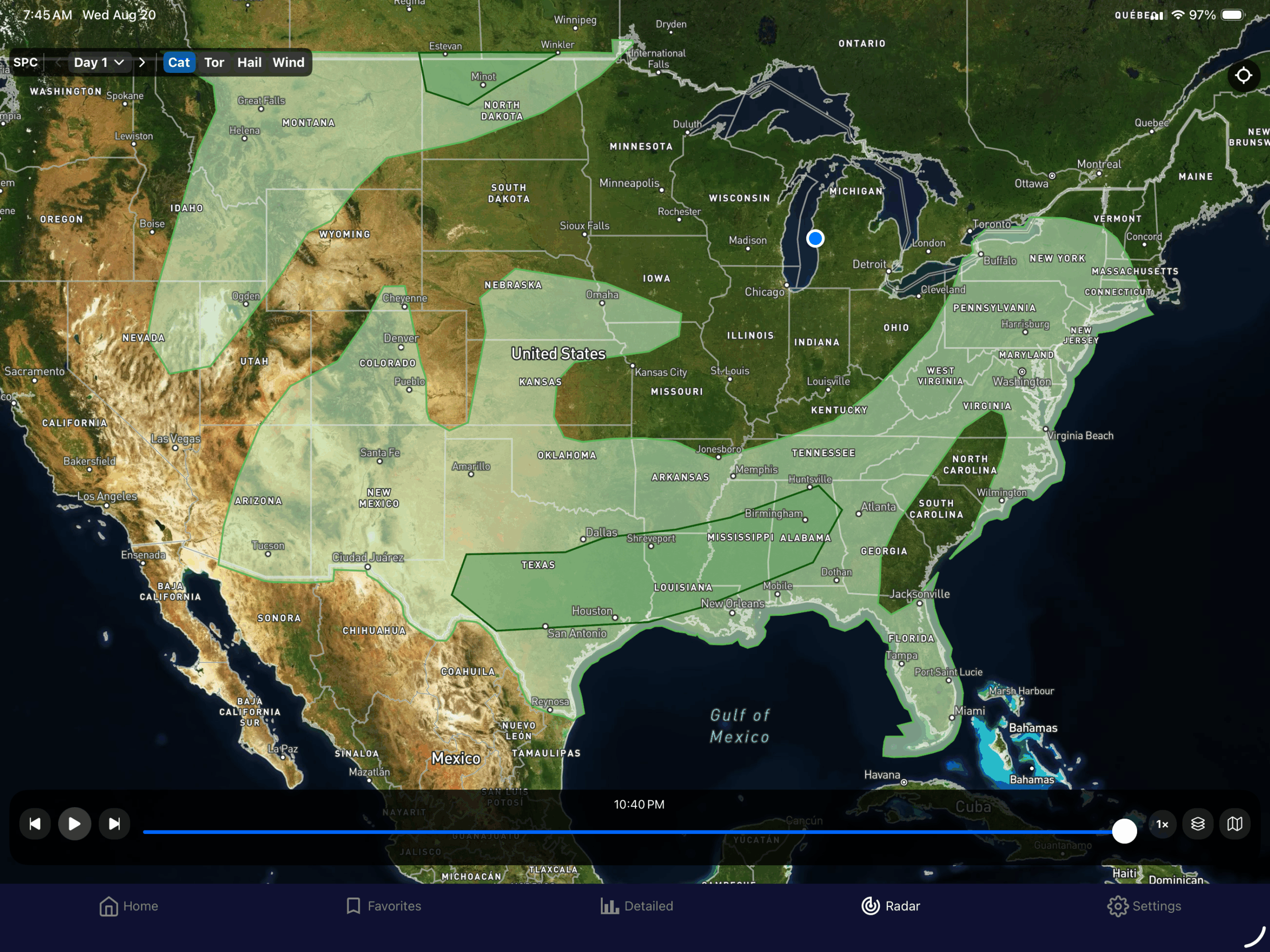
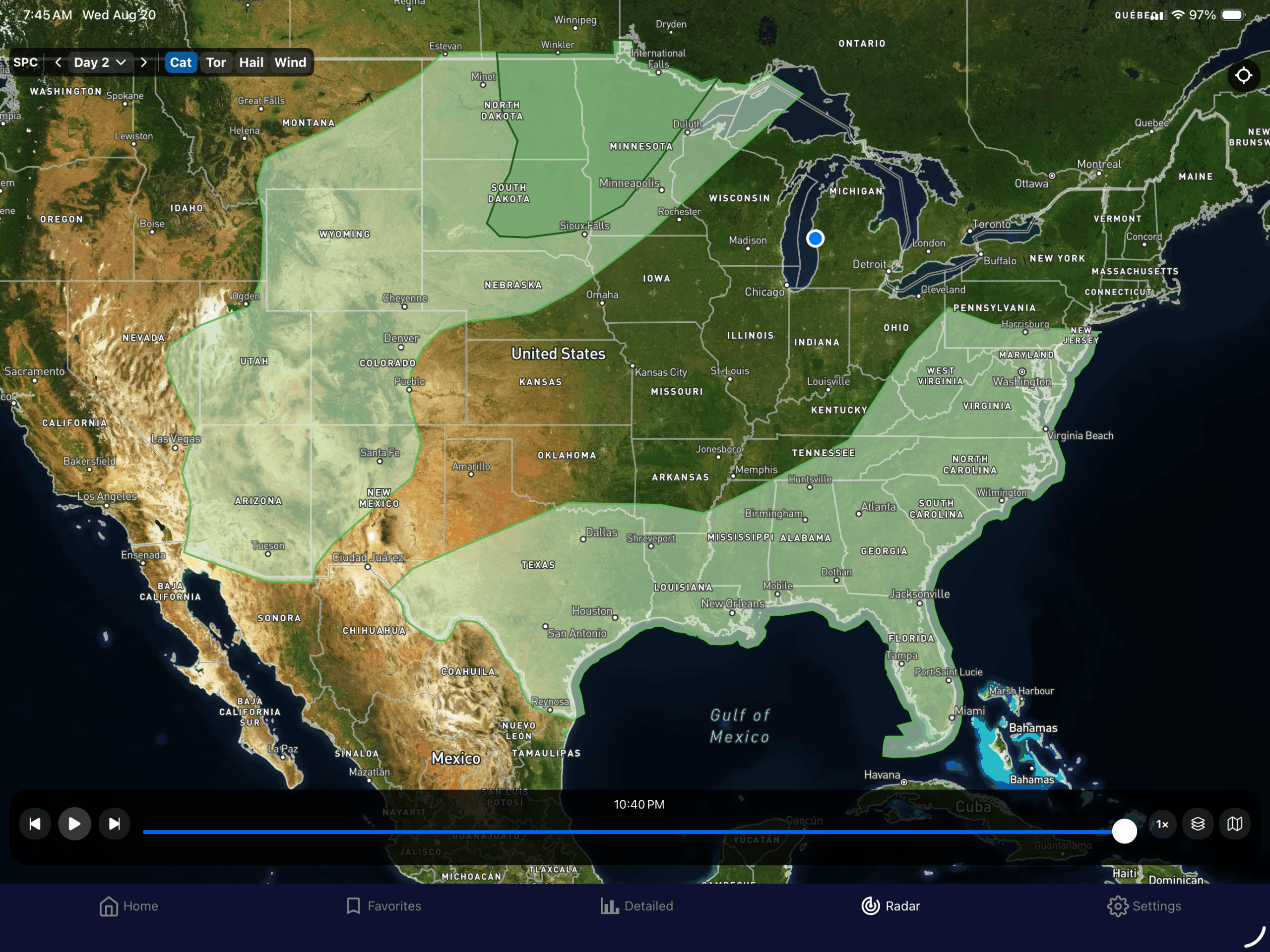
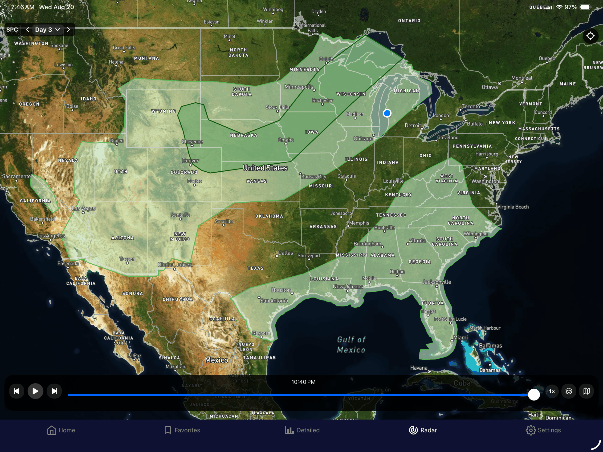
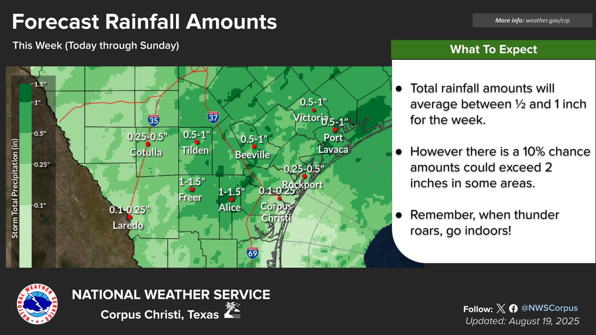
That upper level low will continue to bring a low to medium chance of rain to South Texas over he next few days. In fact, the Corpus Christi office had this graphic showing the amount of rain over the next week that is possible.
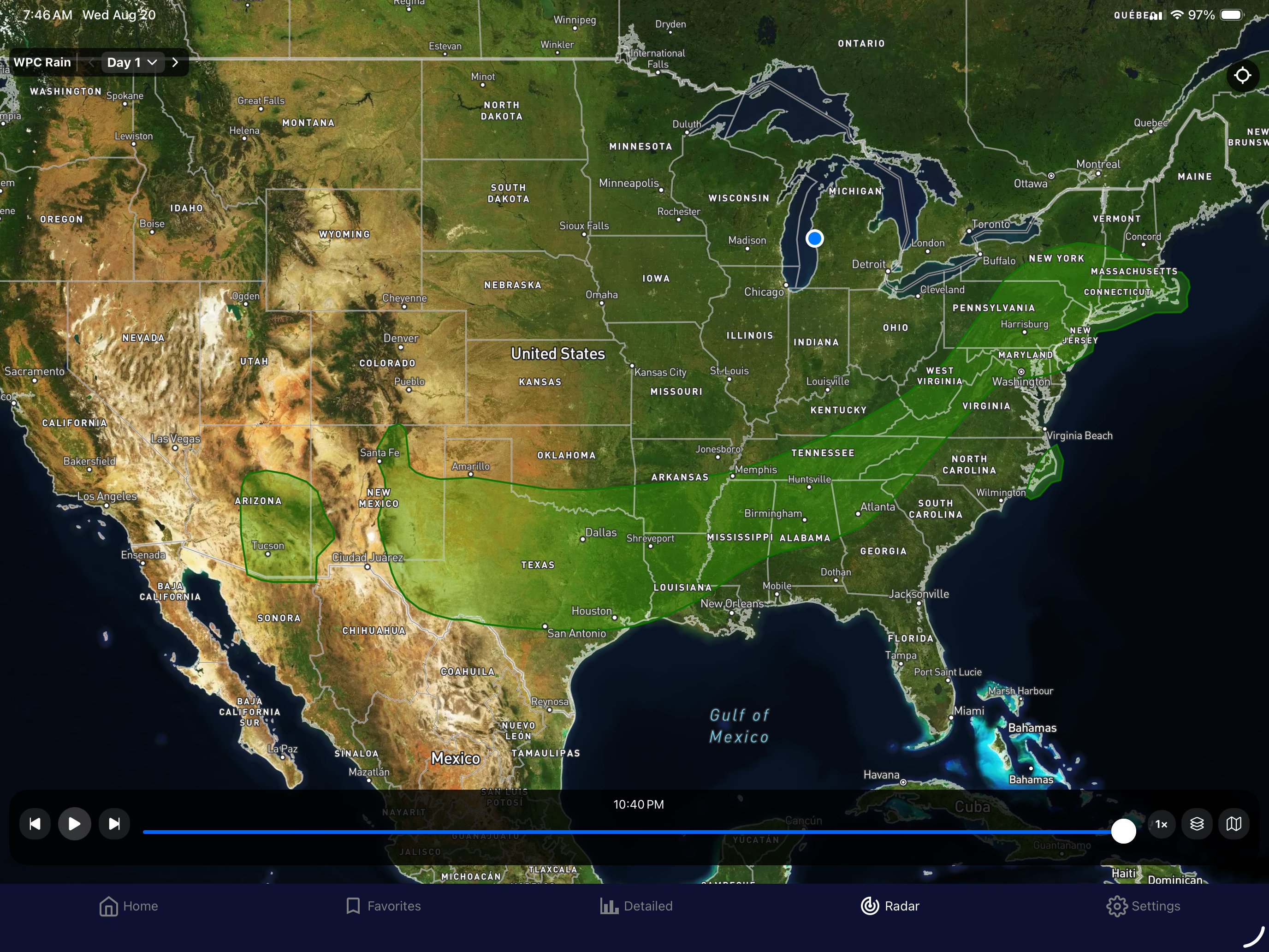
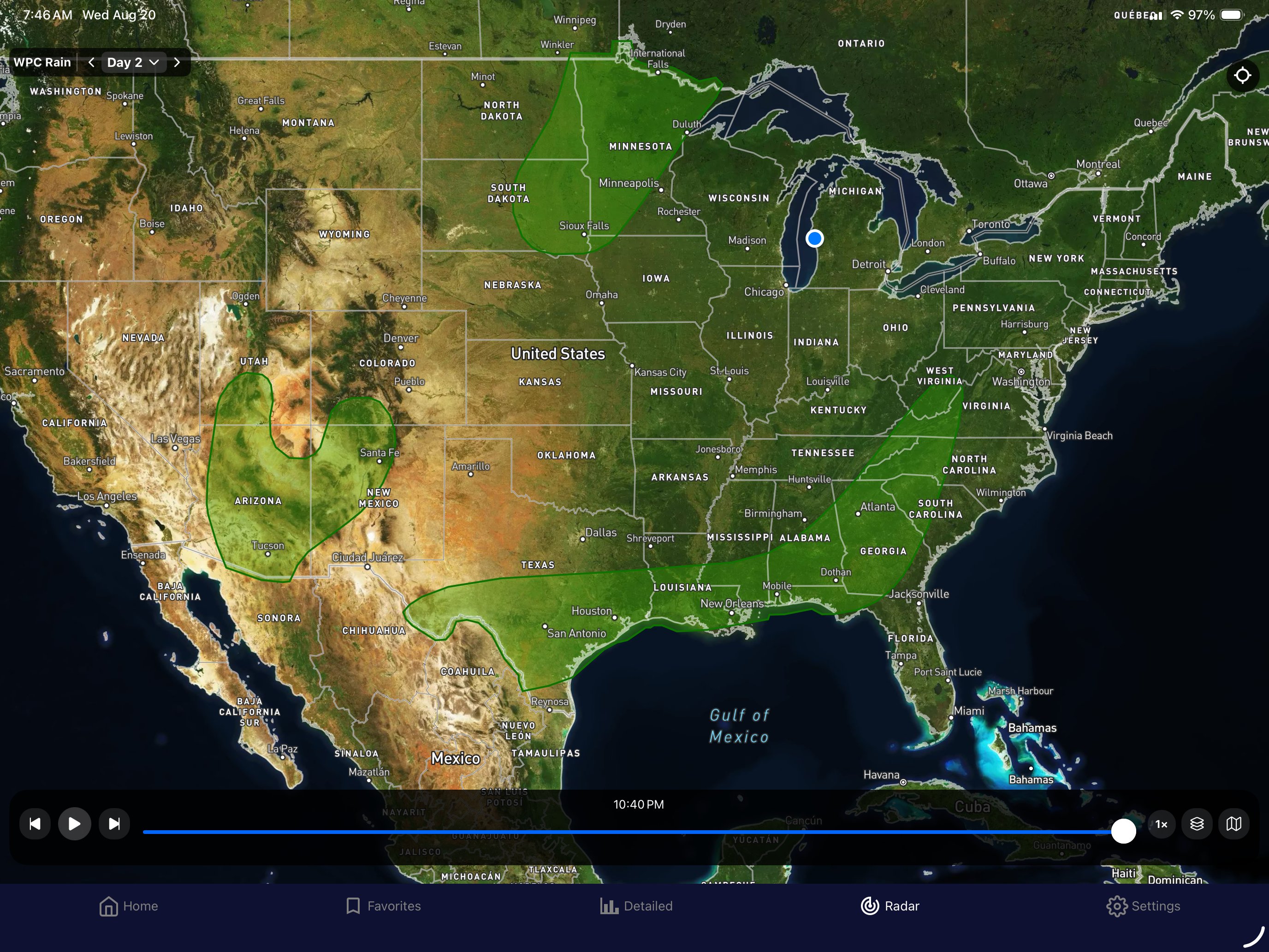
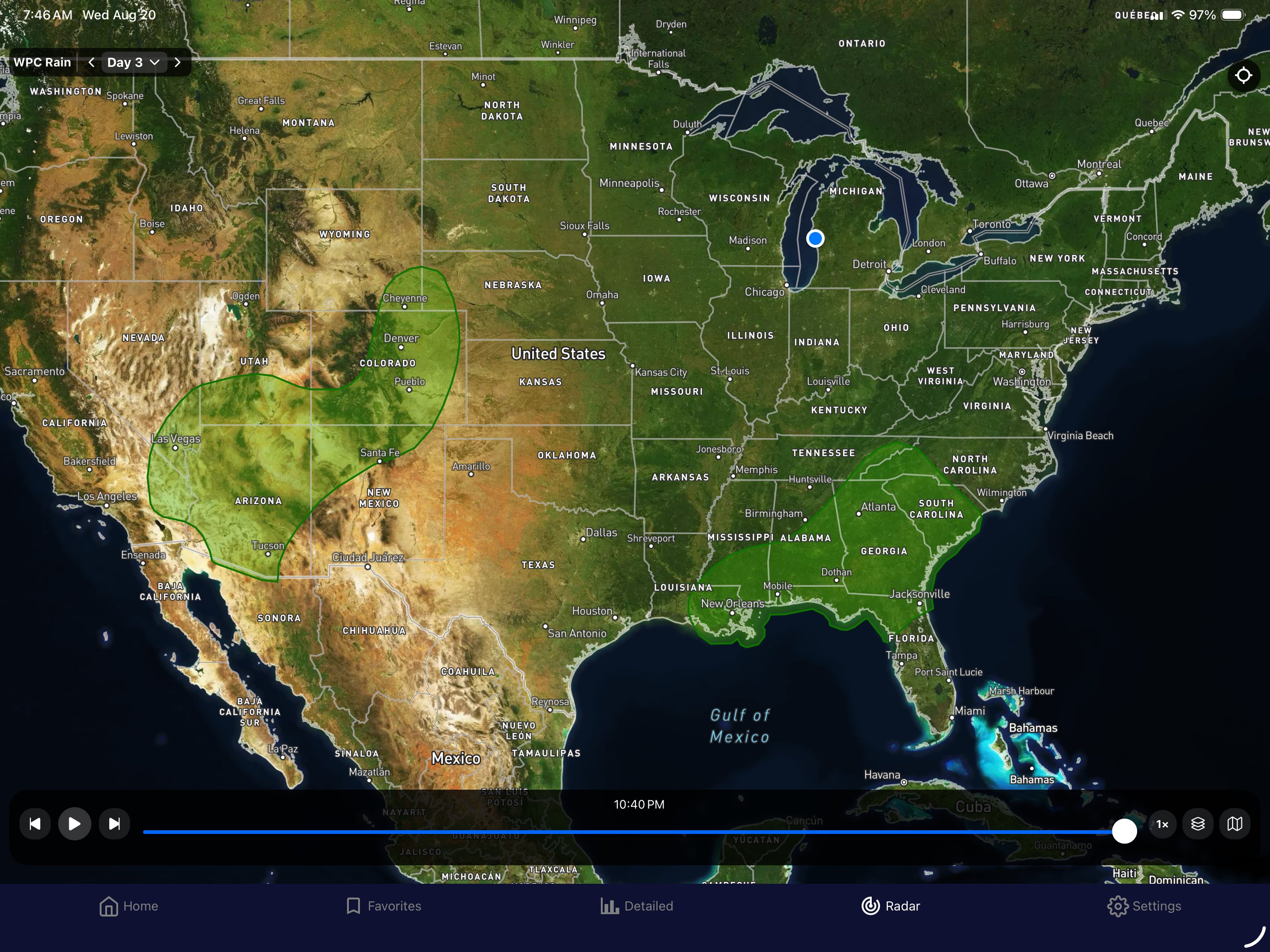
Today through Friday look like the risk of excessive rain is low the next few days in Michigan, and it is marginal on Thursday for South Texas.
So here are the local forecast for the recreational interests, primarily the beaches…
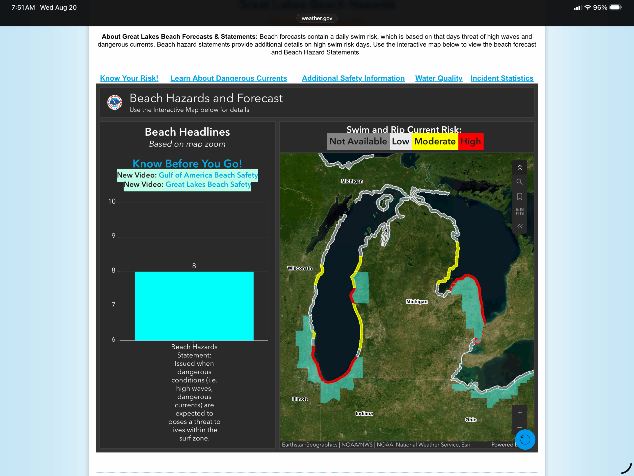
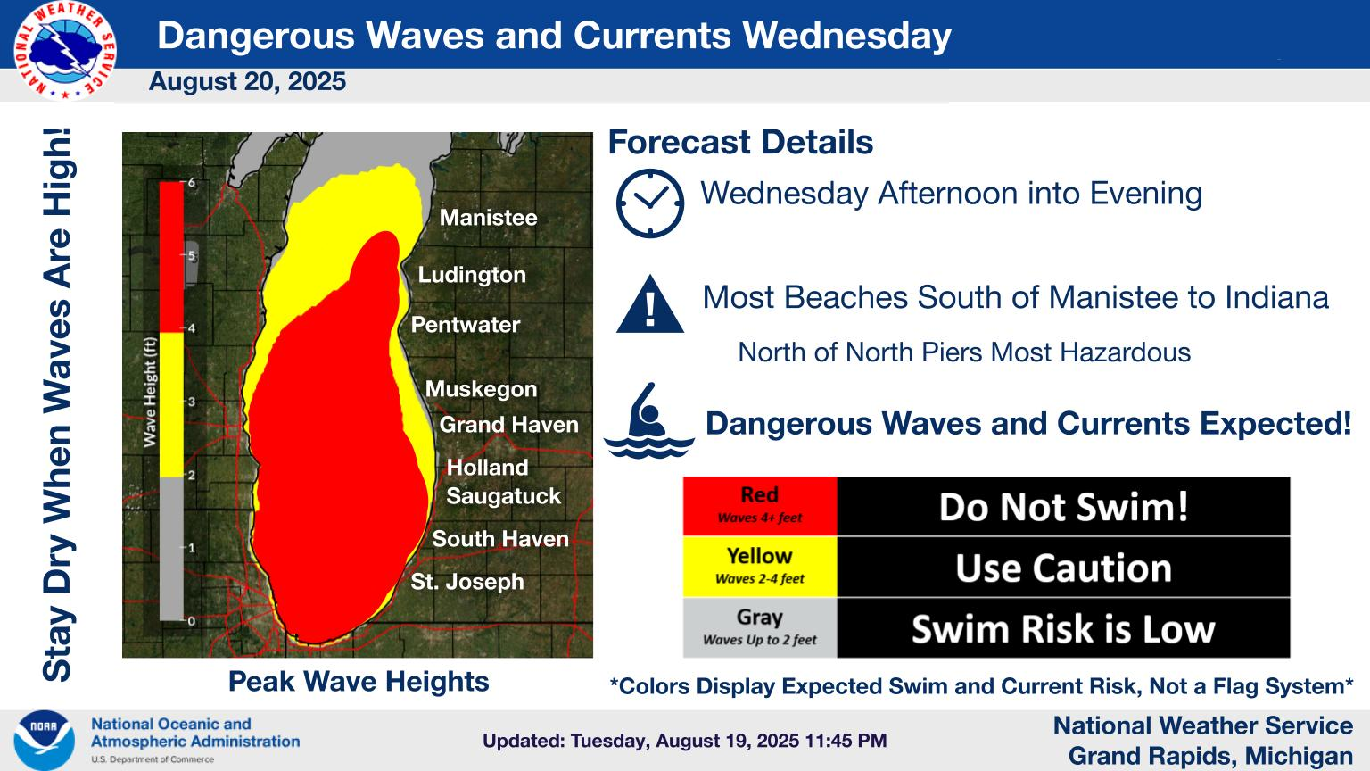
Lower Michigan has high rip risks on the north facing beaches on Lakes Michigan and Huron, primarily on the southern part of each lake. The northern parts look pretty good, but the temperature is cool.
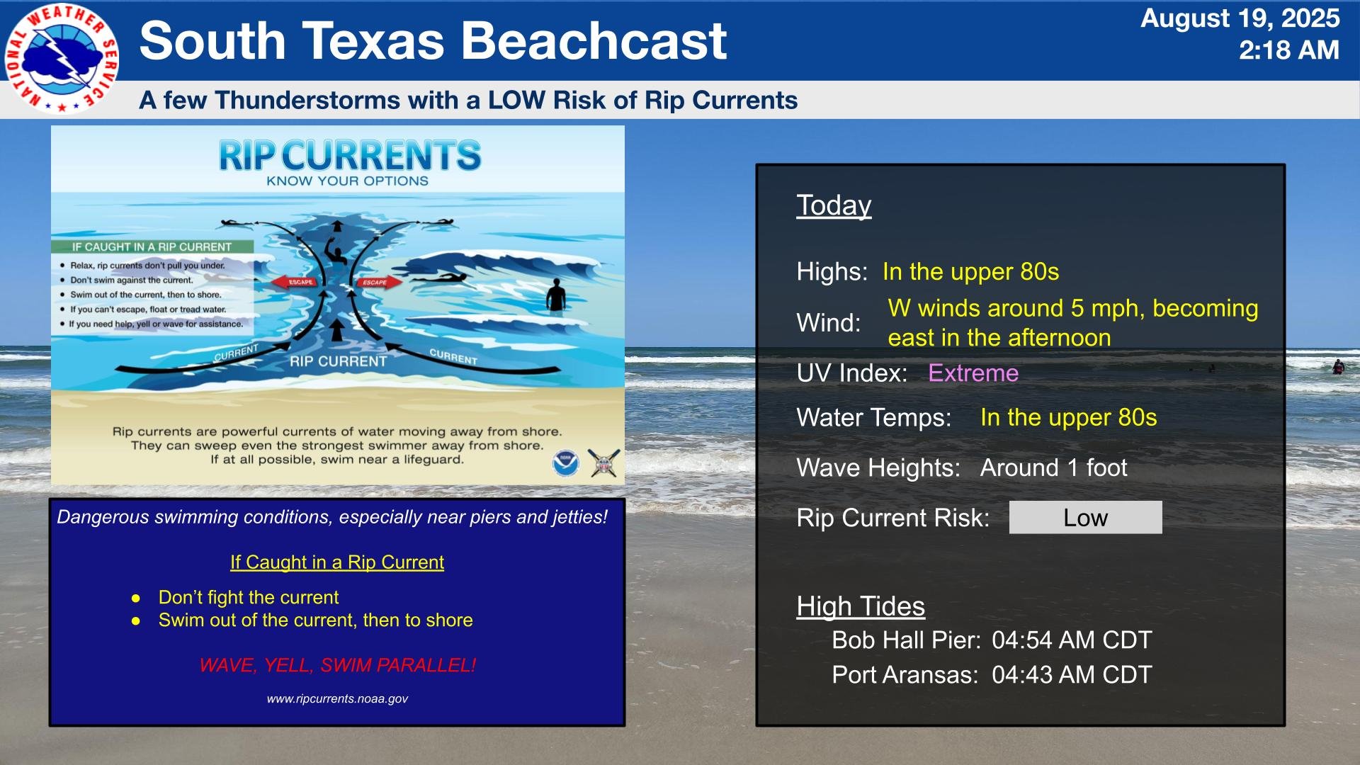
It will continue to be hot in South Texas, so go to the beach, but beware of thunderstorms. Don’t get caught outside with a nearby storm.
So let’s look at the 6-10 day outlook…
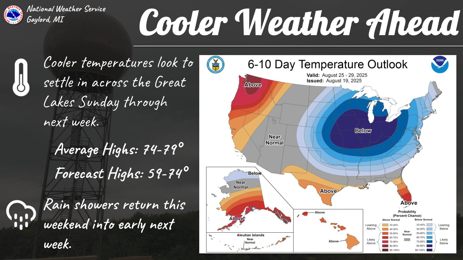
This one came from the Gaylord, Michigan office. So, they are advertising the cool down for the the 24-29 of August (no, that’s not a typo, the Climate Prediction Center (CPC) has been showing this cool down since the previous day, with it centered on the Upper Great Lakes.) which will move south and out of the region. Sorry South Texas, it’s unlikely to reach y’all, and it looks like, during that time, that you will still remain above normal.
That’s about it for now.