
I am a meteorologist and a former youth leader at church…I have a lot to say on both subjects…and then some
We have family coming today, and another busy day of errands. The RV is being washed, due to all of the bugs and road grime on our trip back to Michigan. We do have a few leads on selling it. I like doing the videos, but the editing and uploading takes more time, so another post…
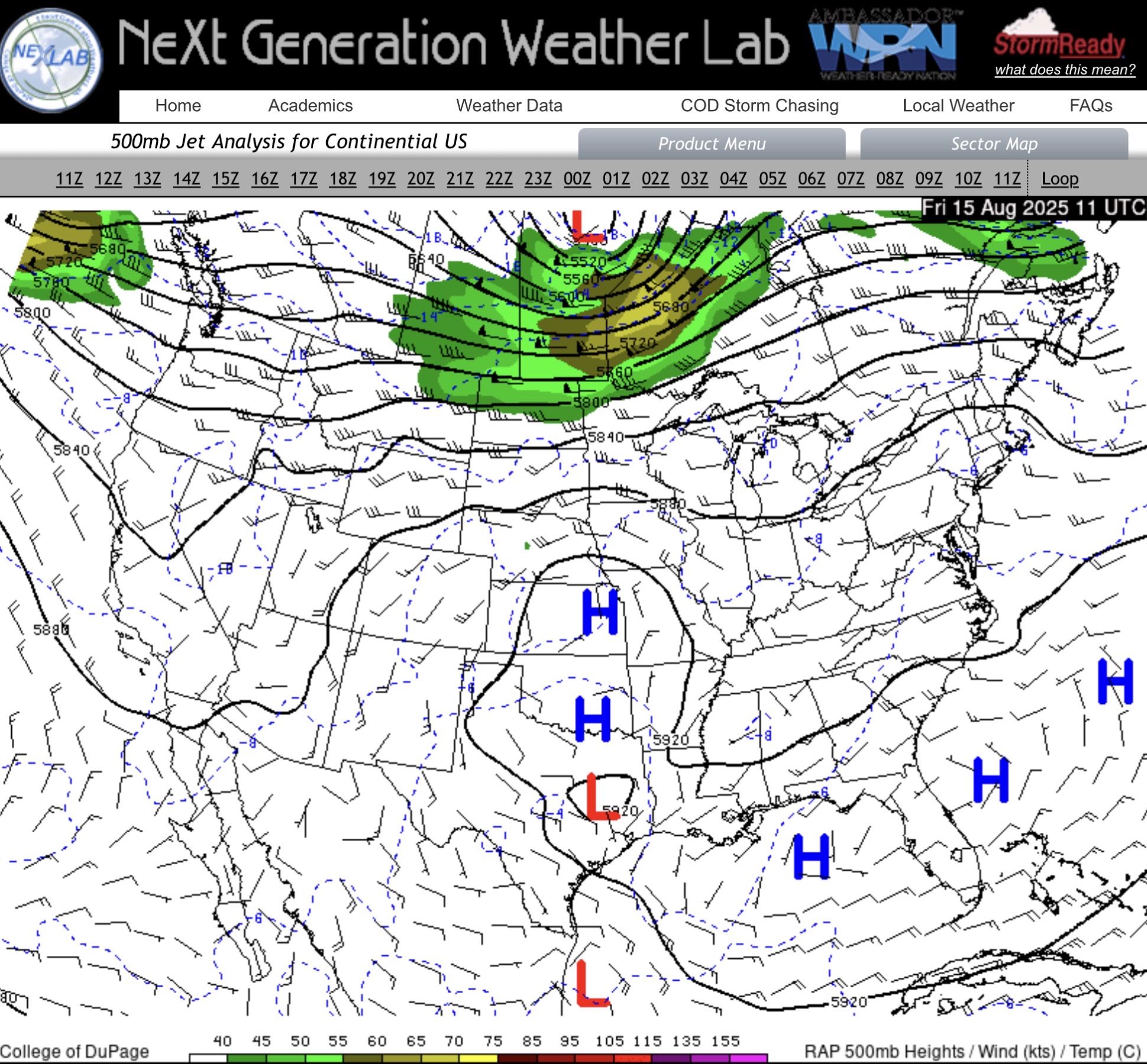
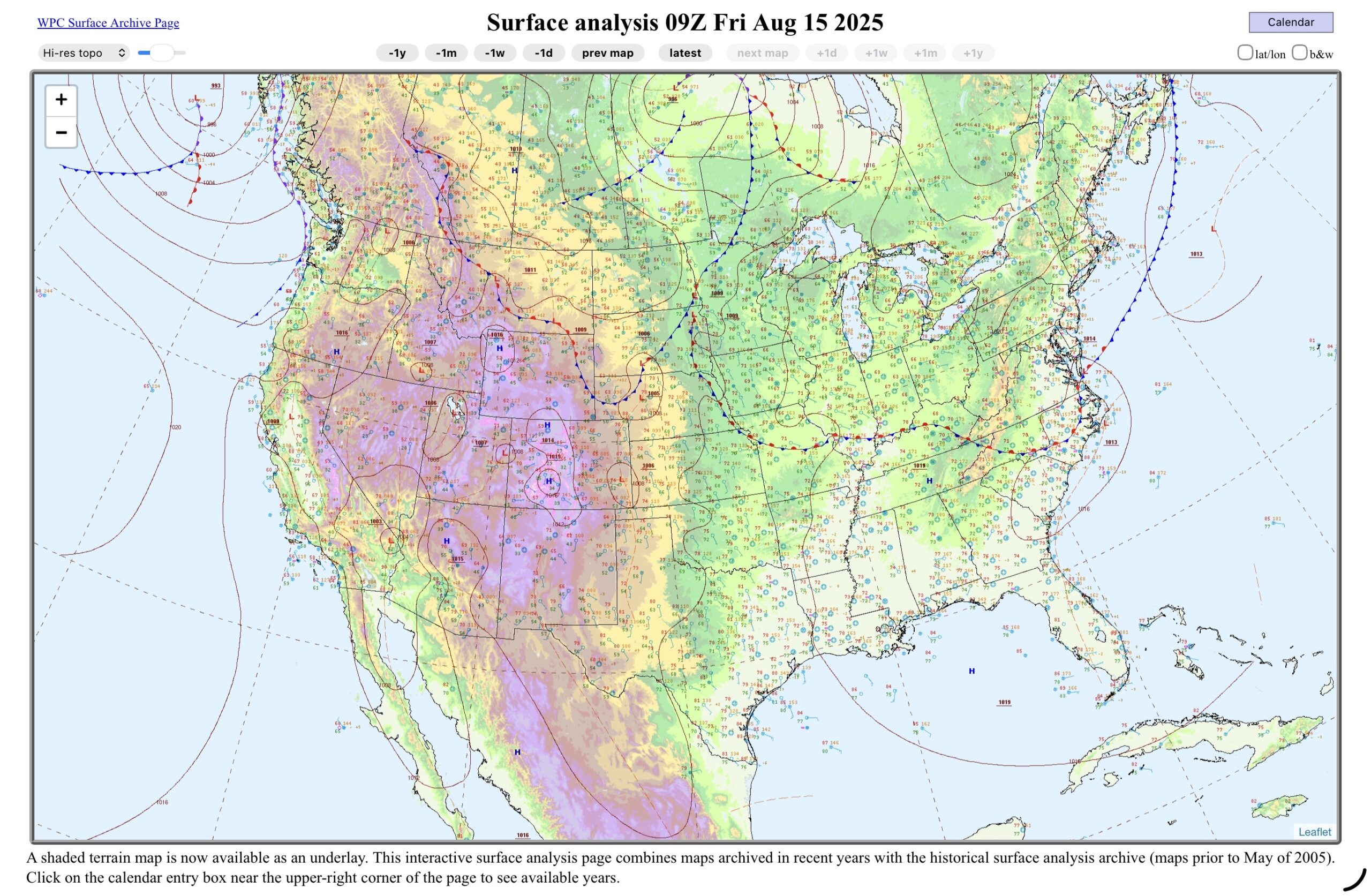
We have another jet streak, moving across the Northern Plains today, with low pressure and a few fronts hanging around the region.
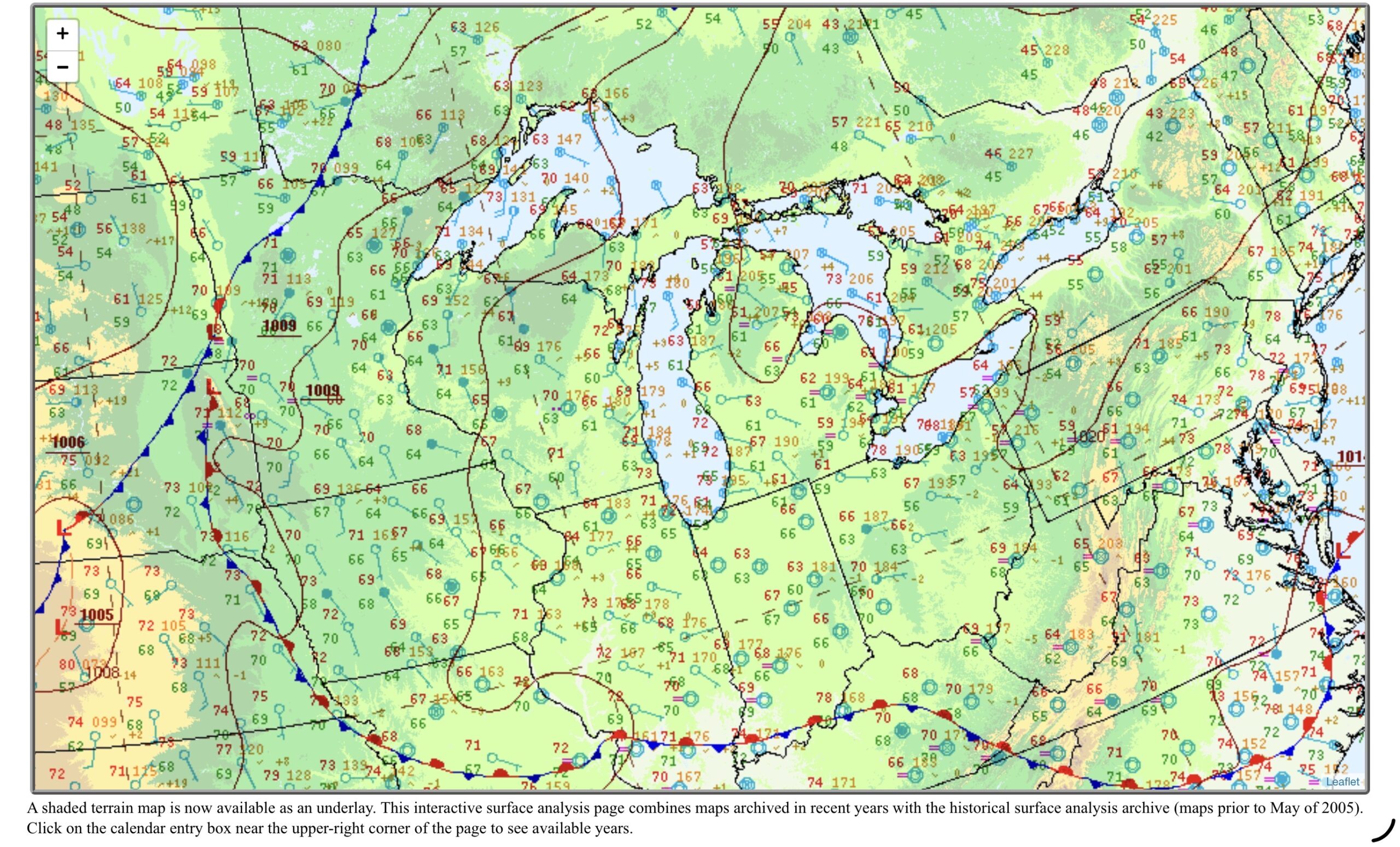
This leads to the front in the upper left of the Great Lakes analysis pushing into the Upper Great Lakes tonight, although showers are already showing up on radar in Wisconsin.

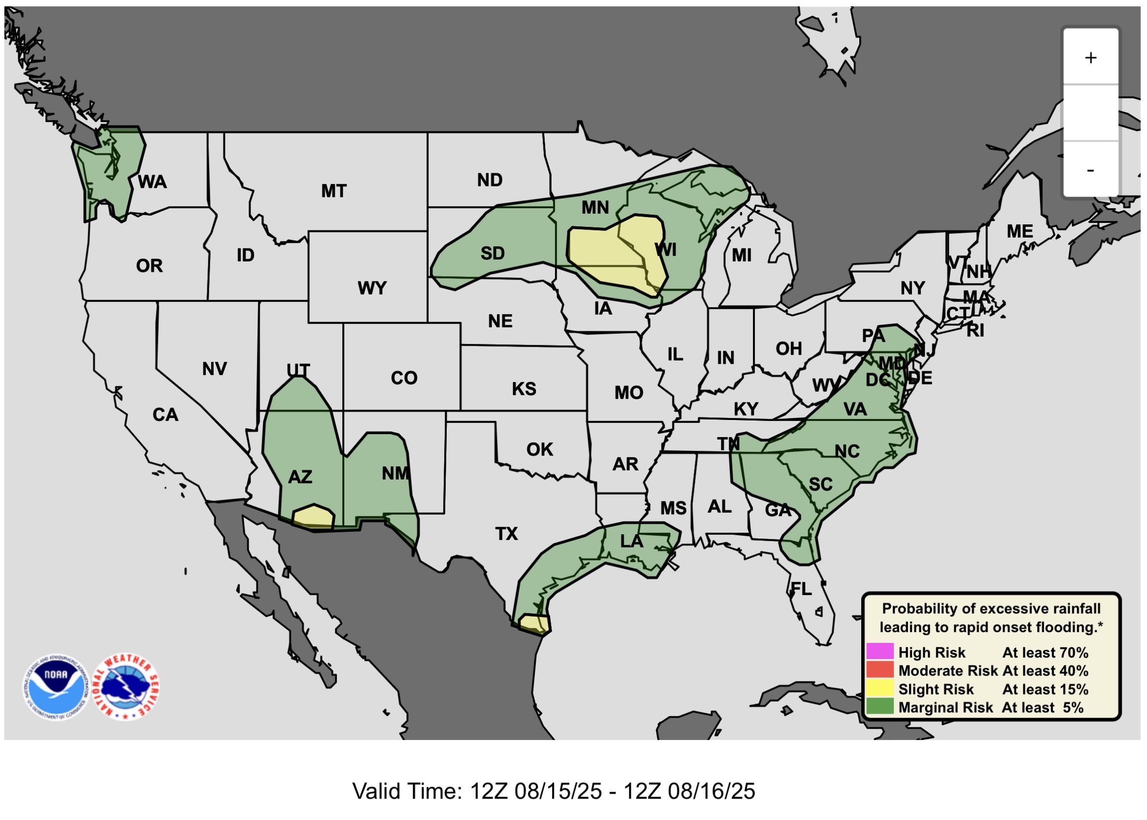
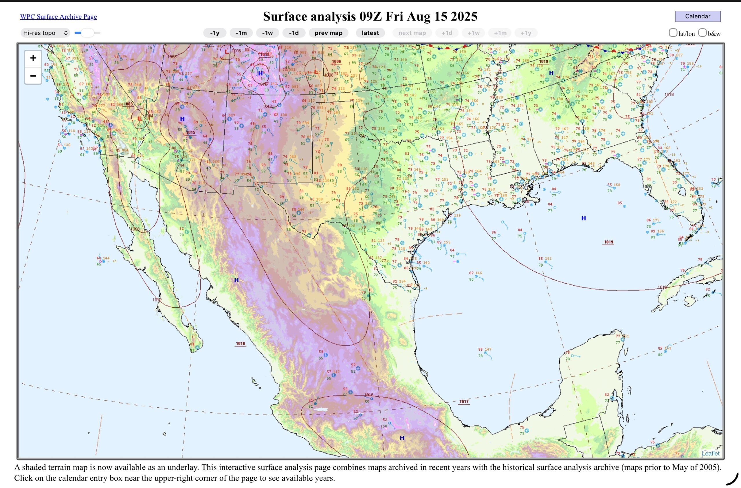
The front and lows lead to the slight risk (2 of5) for severe thunderstorms and Excessive heavy rain in the Upper Mississippi Valley. So in Lower Michigan, Sunny skies, but the thunderstorms will begin to encroach on West Michigan and NW Lower overnight. There is a slight risk from the moisture moving up from Mexico into Arizona and there is a slight risk for heavy rain with Invest 98L which is moving out of the southwestern Gulf, and the Rio Grande Valley, and South Texas. Watch out for this feature the next couple of days, but not for development, but for the possibility of heavy rain going into South Texas.
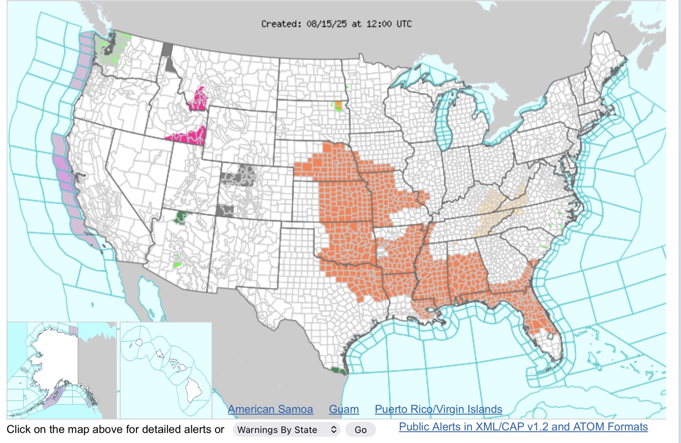
Current WWA is mainly heat related in the Central Plains and into the Gulf Coast States. The Red Flag warnings are less out west as the winds have dropped to 5-10 mph, but it is still very dry in the afternoon. Watch out for Burn bands.
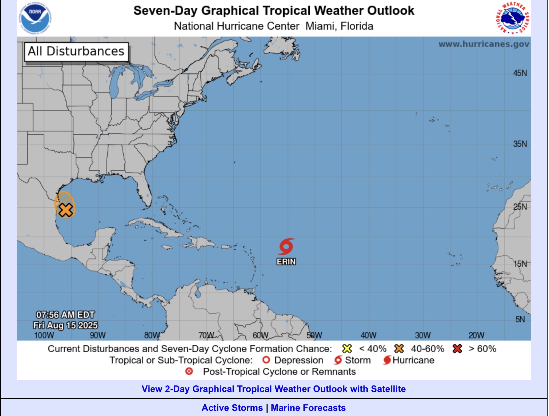
I mentioned 98L earlier, which is that orange X and hatched area. There is a 50% chance it could develop into a tropical depression today, before it make landfall tonight. However, the heavy rain threat is the main issue to watch today through the weekend, depending on how long the moisture and forcing sticks around.
Erin continues to move WNW away from the islands, and current model tracks show the projected path to be between the US Coast, and Bermuda and the passing NE out to sea. If you are in either area (US or Bermuda) keep an eye on it. A little course change could bring issues to either place.
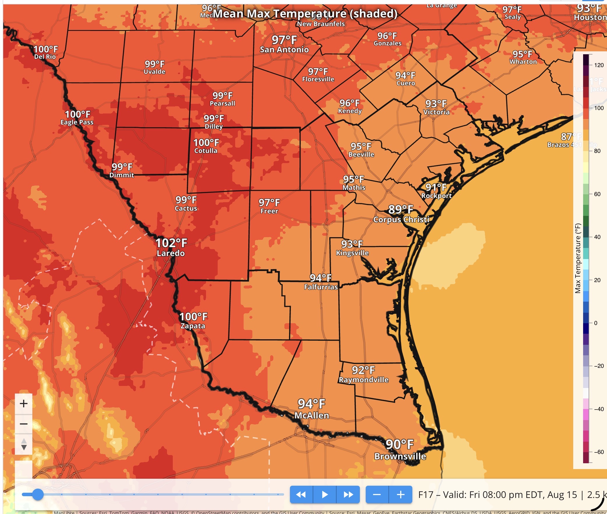
We’ve talked about the local impacts for both Lower Michigan and South Texas today, so the temperatures for both places look like this…
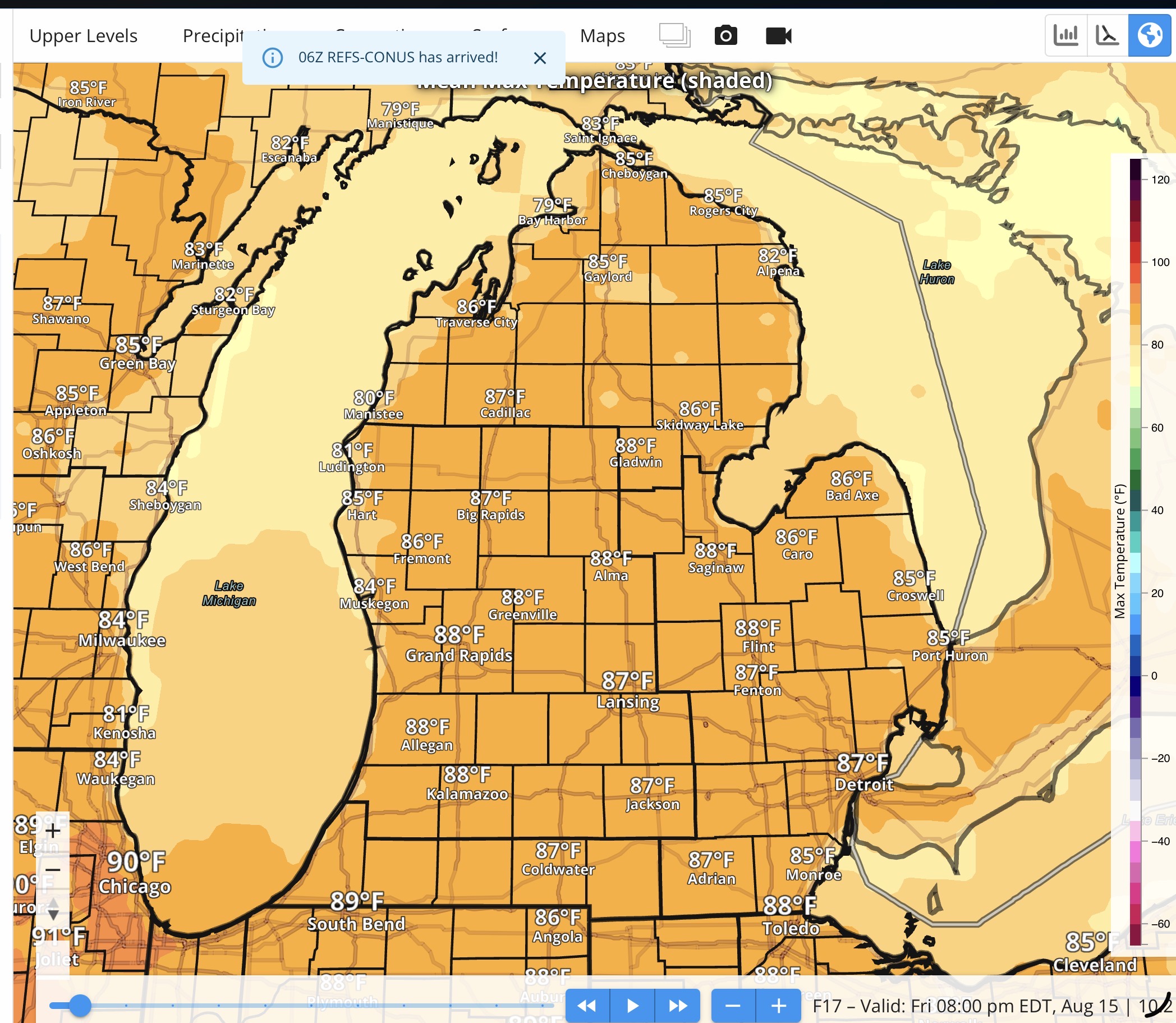
Mid to upper 80s in Lower Michigan today, lower 80 at the beaches.
For South Texas, it’s summer…Upper 80s to around 90 along the Coastal Bend and Coastal Plains (Victoria Crossroads too). Mid 90s to lower 100s (102º in Laredo).
Rip Current Risk along the beaches in Michigan remains low. While the Rip Current Risk along the Middle Texas Coast is expected to moderate today with 98L generating some bigger swell.
Video is here…