
I am a meteorologist and a former youth leader at church…I have a lot to say on both subjects…and then some
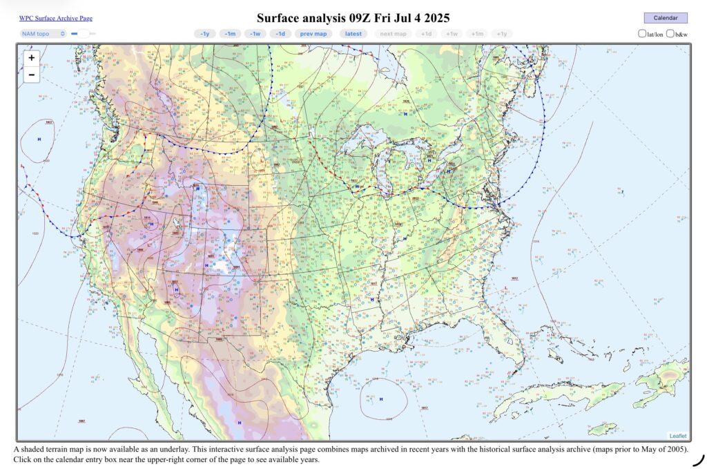
Looking at the surface map this morning you will notice a theme…the main weather will be where this morning’s fronts and lows are. Not that they aren’t usually, but the marginal and slight risk areas are aligned pretty well.
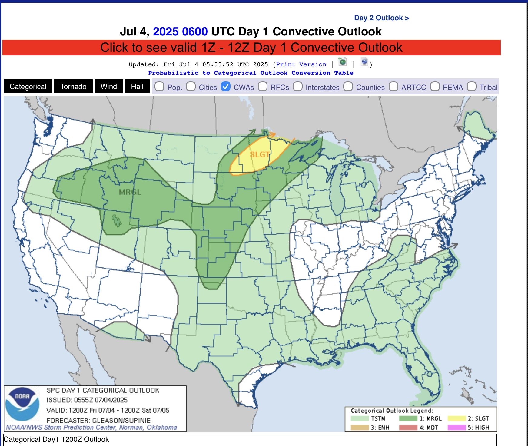
The slight risk is near the surface low near Minnesota and North Dakota, with a general (level 0 of 5 in severity) risk of thunderstorms along the warm front that stretches into Michigan. Looking at the local APX (Gaylord, MI) forecast late day 15-25% Chance for thunderstorms. Of course, the exception is the south where there is high pressure, but loads of moisture for afternoon thunderstorms to pop up.
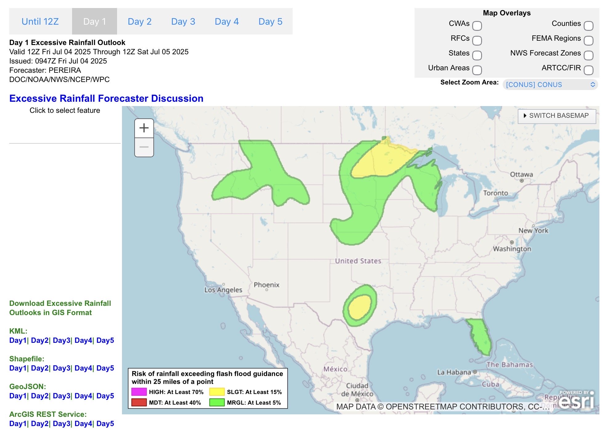
WPC has a much more scaled back out look for today with chances for heavy rain in eastern North Dakota a northern Minnesota. Another MCS in Central Texas tonight (there is ongoing flooding in San Angelo as I write this). And then Florida with the tropical moisture.
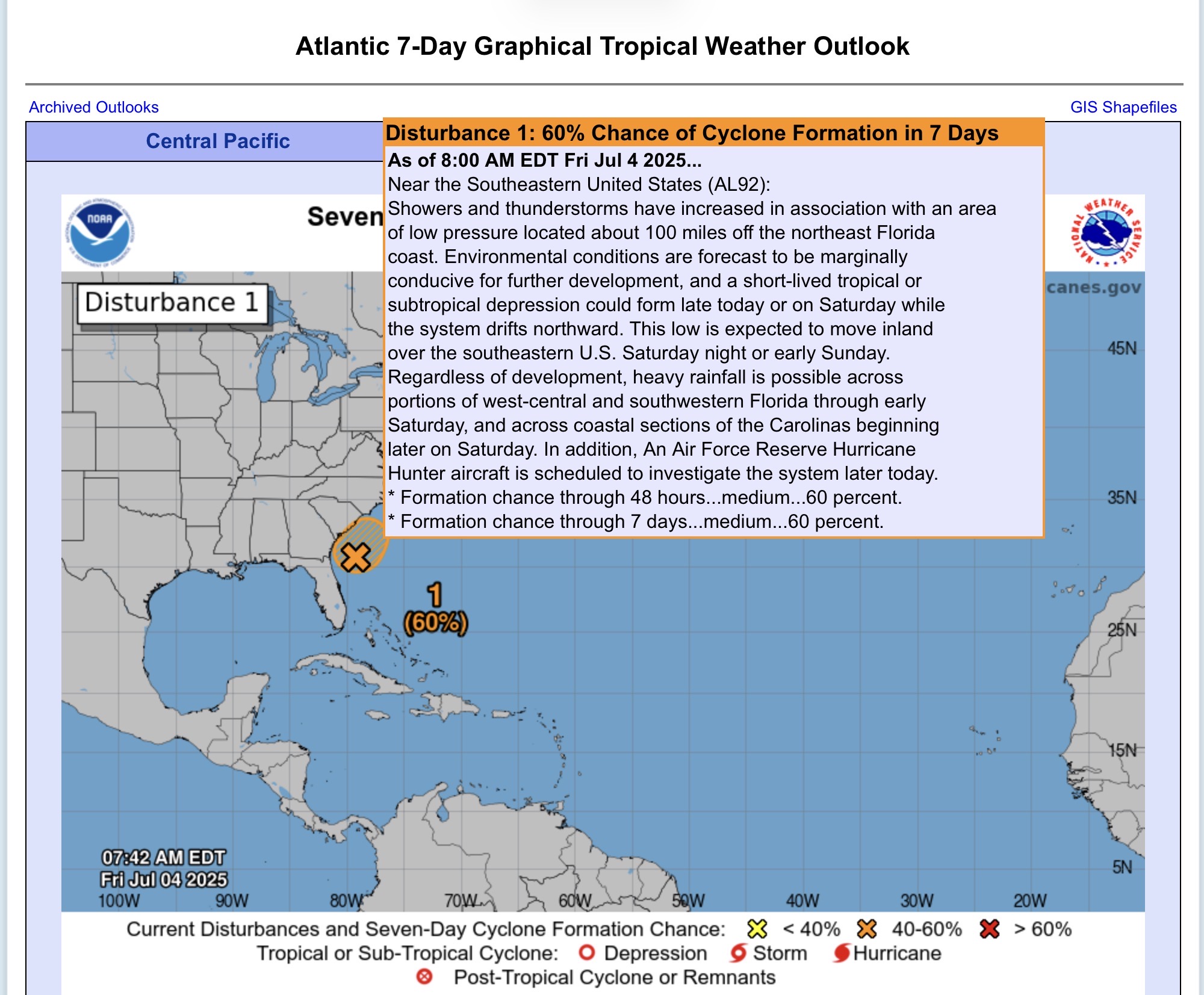
Last, but not least, the SE Atlantic states are now at a 60% chance for formation in the next 2 days with the remnants of the cold front where thunderstorms are beginning to form a low pressure system that will be a tropical system. I left the discussion for it on the graphic.
So there you go. Happy Fourth of July!