I am a meteorologist and a former youth leader at church…I have a lot to say on both subjects…and then some
As promised, I’ve started to do the morning weather for the regions (S TX and N MI). I’m typically going to start like this…A surface weather map, Upper air chart (500 mb), Satellite, radar, with outlooks today, then the outlooks for the next few days. I may have a model graphic in there as well if it helps to tell the story of the forecast. Once I’m good with the written one, I’ll figure a time to do the recorded version in the future.
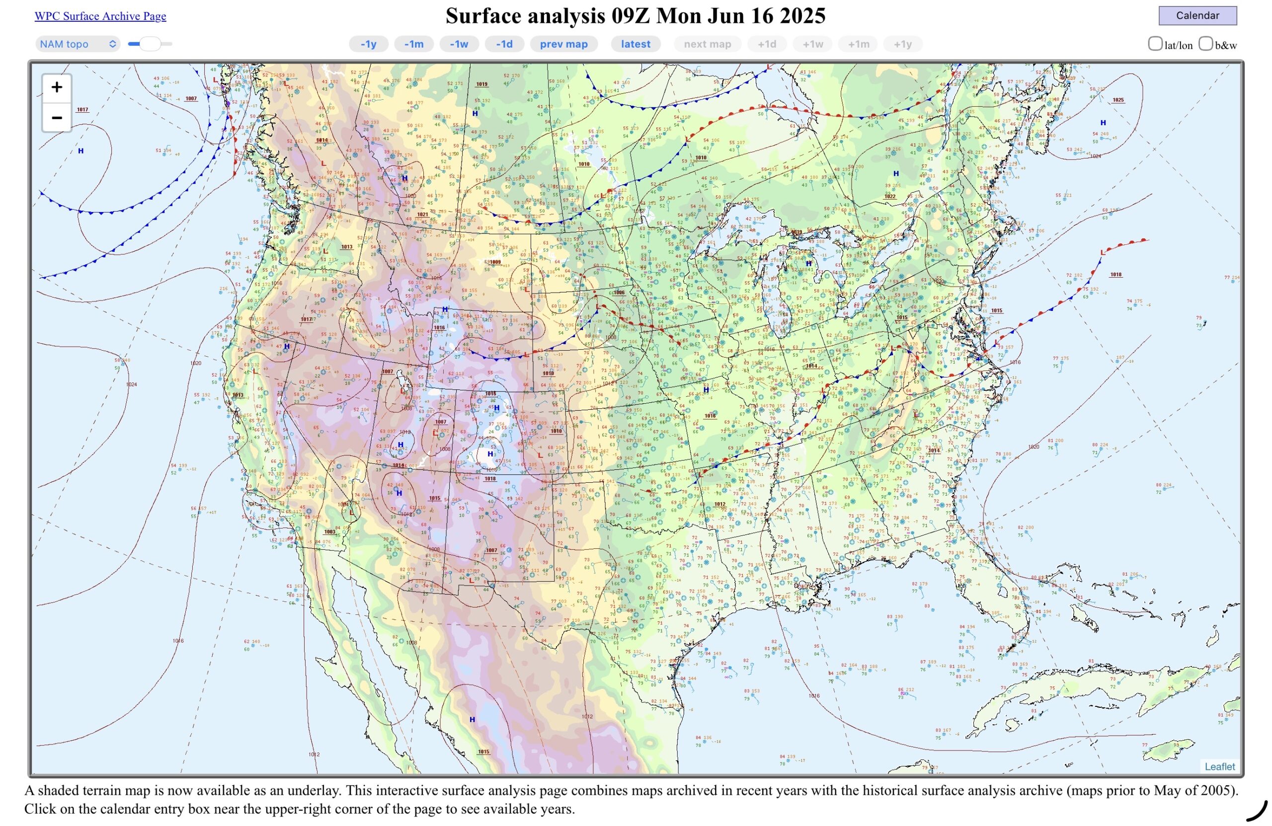
We have a weak high pressure over the Upper Great Lakes with a host of fronts and low pressure systems upstream. Along the Coastal Bend of Texas, the southeast prevailing flow has definitely taken over after the month of May which had one or two frontal passages, or they were close to getting that far south. However, we are going into the summer months, and the cold fronts usually don’t have the umph to get much farther south than North Texas. Moisture is being pumped into South Texas, which is a hopeful sign that the ongoing drought will begin to reverse.
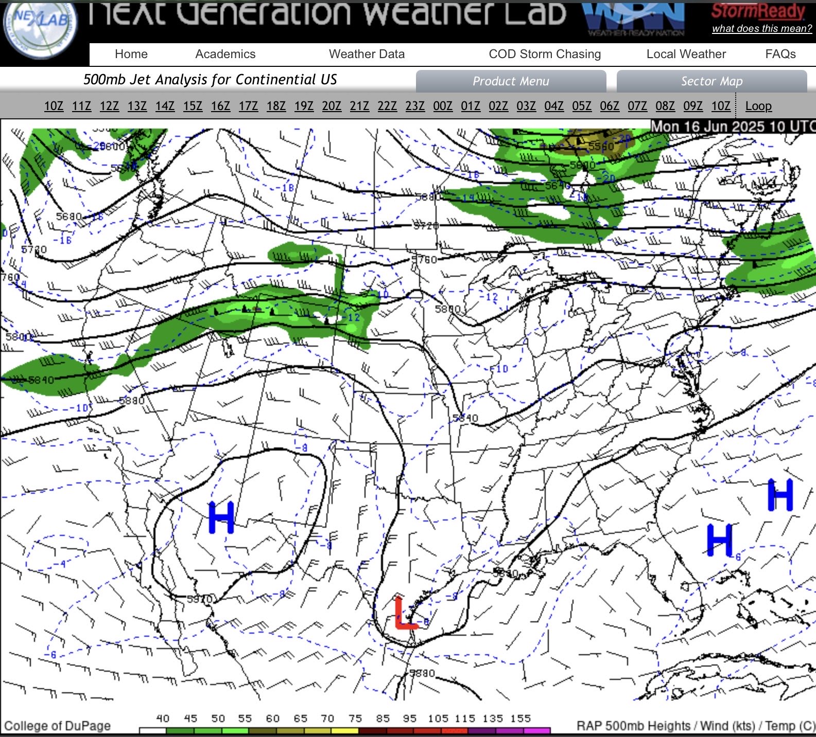
The upper air is weak as well over N MI and S TX this morning. There is a 500 mb low over the region, which will produce isolated thunderstorms over the Coastal Bend today, and the 500 mb high to the west which will start pumping up the temperatures as it moves a bit more east. In northern Michigan, There is a shortwave disturbance which is expected to kick off thunderstorms in the afternoon and evening, although the main action for that will be in the Plains and Midwest.
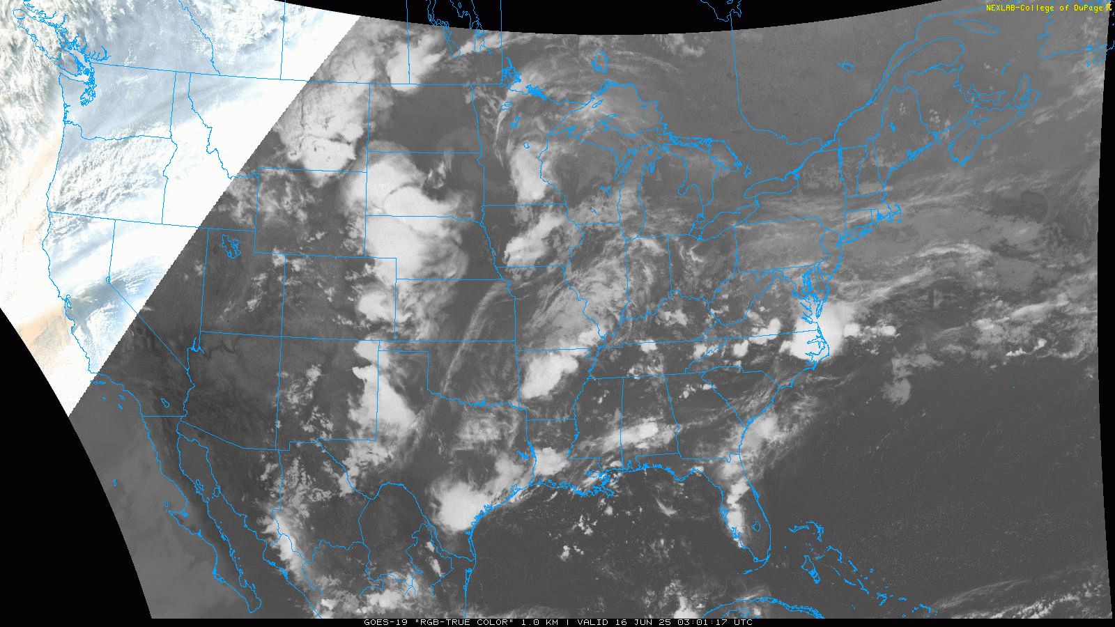
The satellite loop this morning kind of shows what I was describing with the thunderstorms moving over The Dakotas, and another feature over the Mid-Mississippi Valley. The moisture overnight in South Texas is still producing more showers, and some low clouds. Just enough moisture left over for the afternoon heat to kick off isolated showers and thunderstorms along the sea breeze.
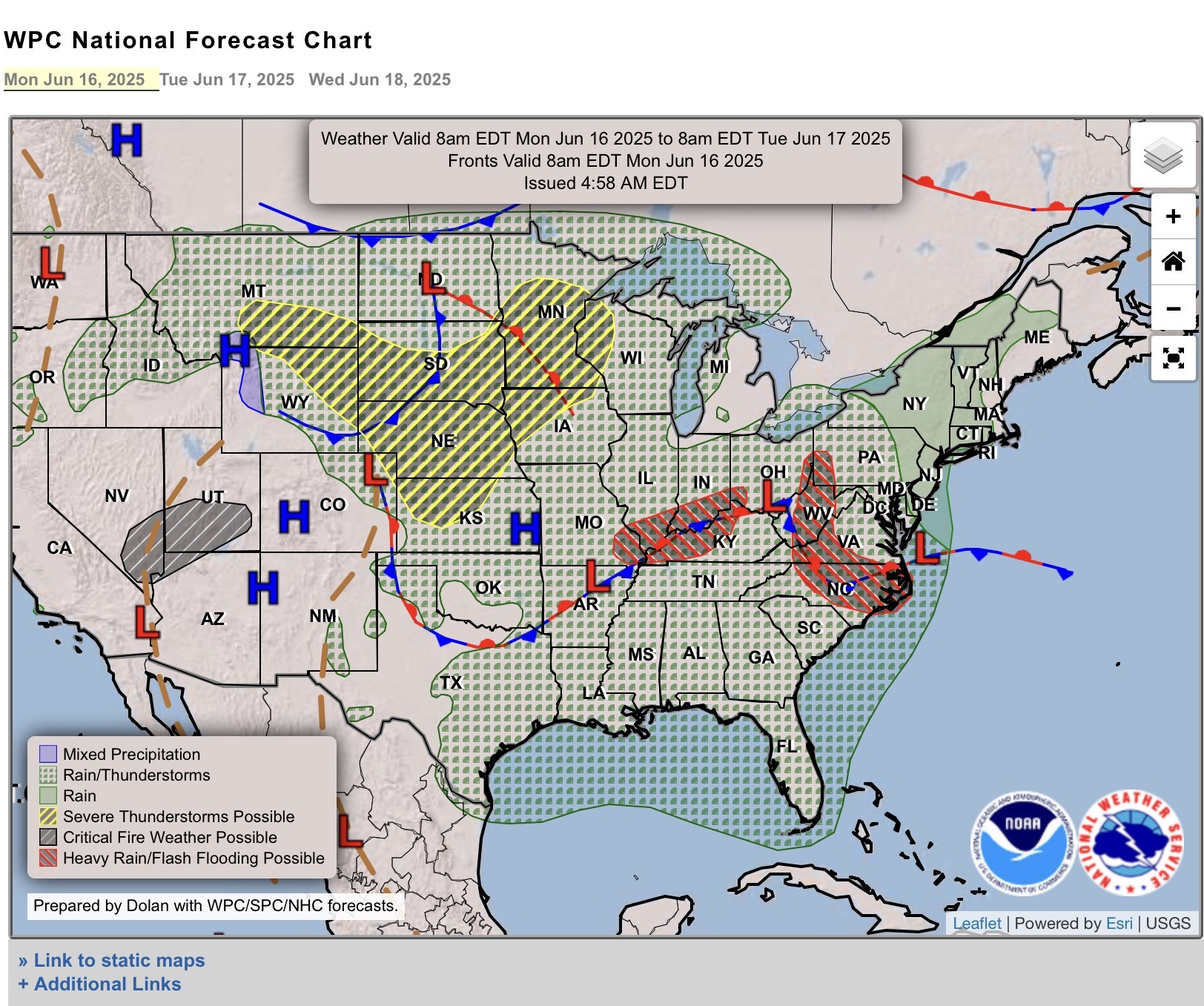
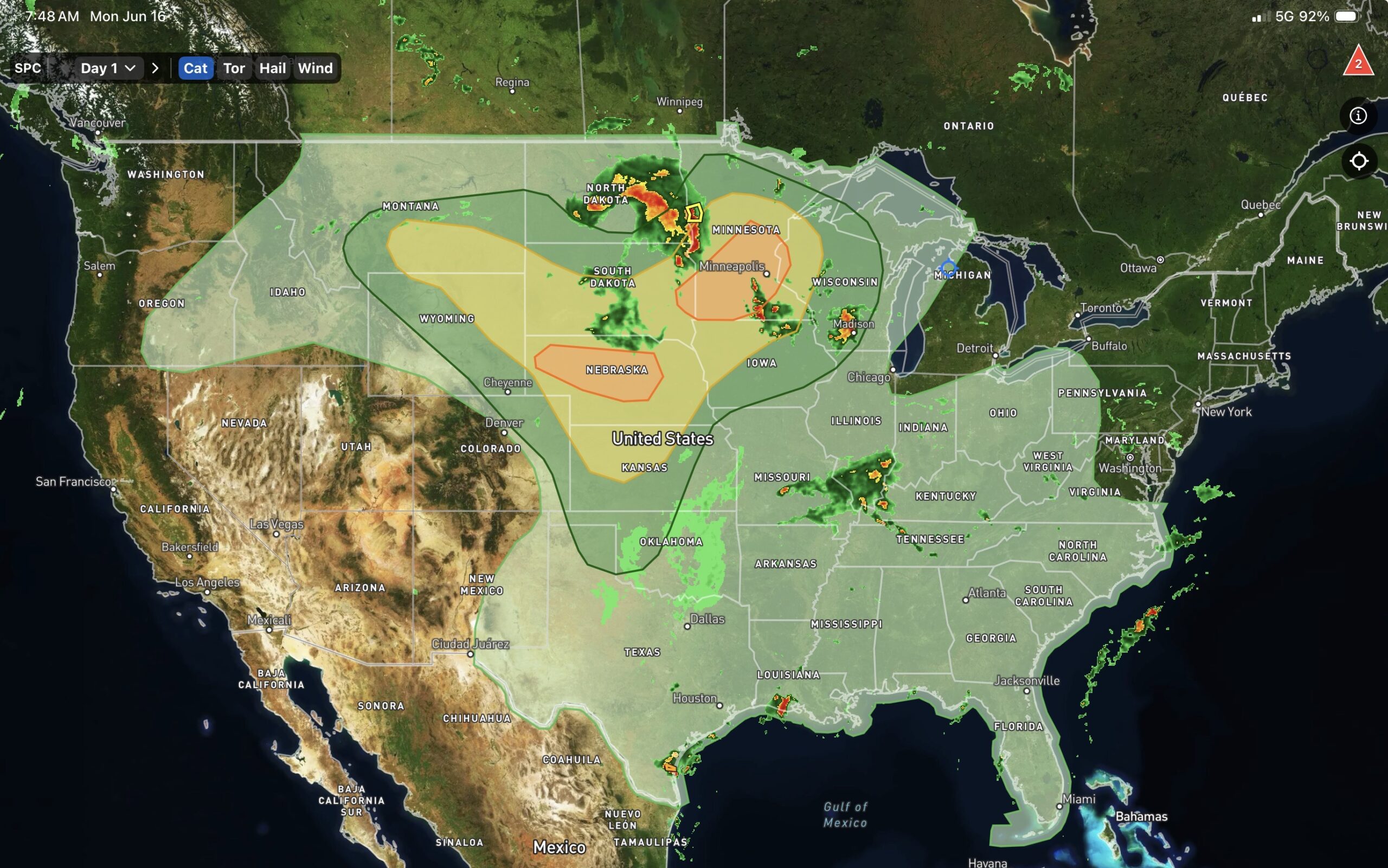
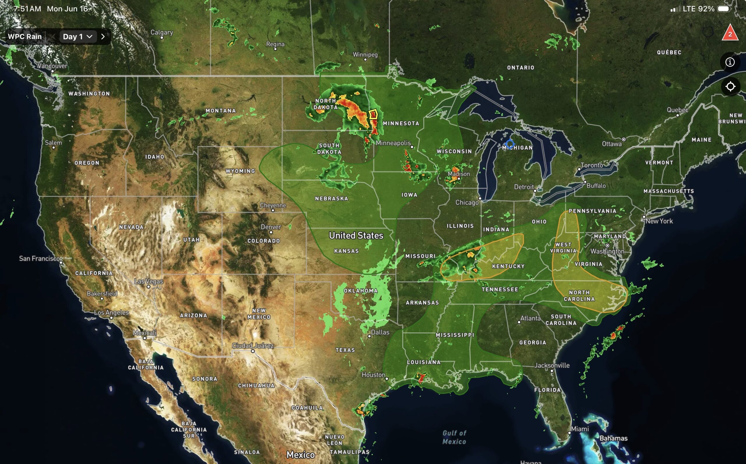
These three maps are from, left to right WPC and Everything WX app (more about that app in a bit). Starting with the left graphic (you can click on it and it will expand) WPC has the low moving through the Dakotas, and another spinning up eastern Colorado to kick off the thunderstorms with marginal to enhanced risks (center map). The enhanced risks (3 of 5 levels from the Storm Prediction Center (SPC)) are in the vicinity of the sfc (surface) lows. So as they track east, the best chance for severe weather will be there. The left map shows the WPC’s (Weather Prediction Center) risk of exceeding Flash Flood Guidance. There’s a marginal in the Plains and upper Midwest, with the thunderstorms, due to the thunderstorms producing heavy rain. However, there are some slight risks in the Mid-Atlantic States, and the lower Ohio Valley, and the marginal risks down to the Gulf Coast. The Slight (2 of 5 levels from the WPC) risks are due to the stationary fronts and the lows along them. Never underestimate a boundary that doesn’t move. Thunderstorms can form along it and keep running over the region. If that happens, heavy rain is the result. There have already been flash flood issues a day or two ago in West Virginia, so the slights could be upgraded as the situation evolves today.
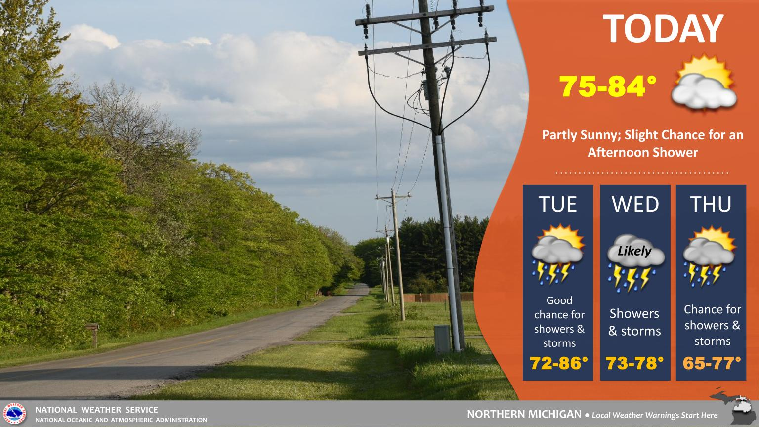
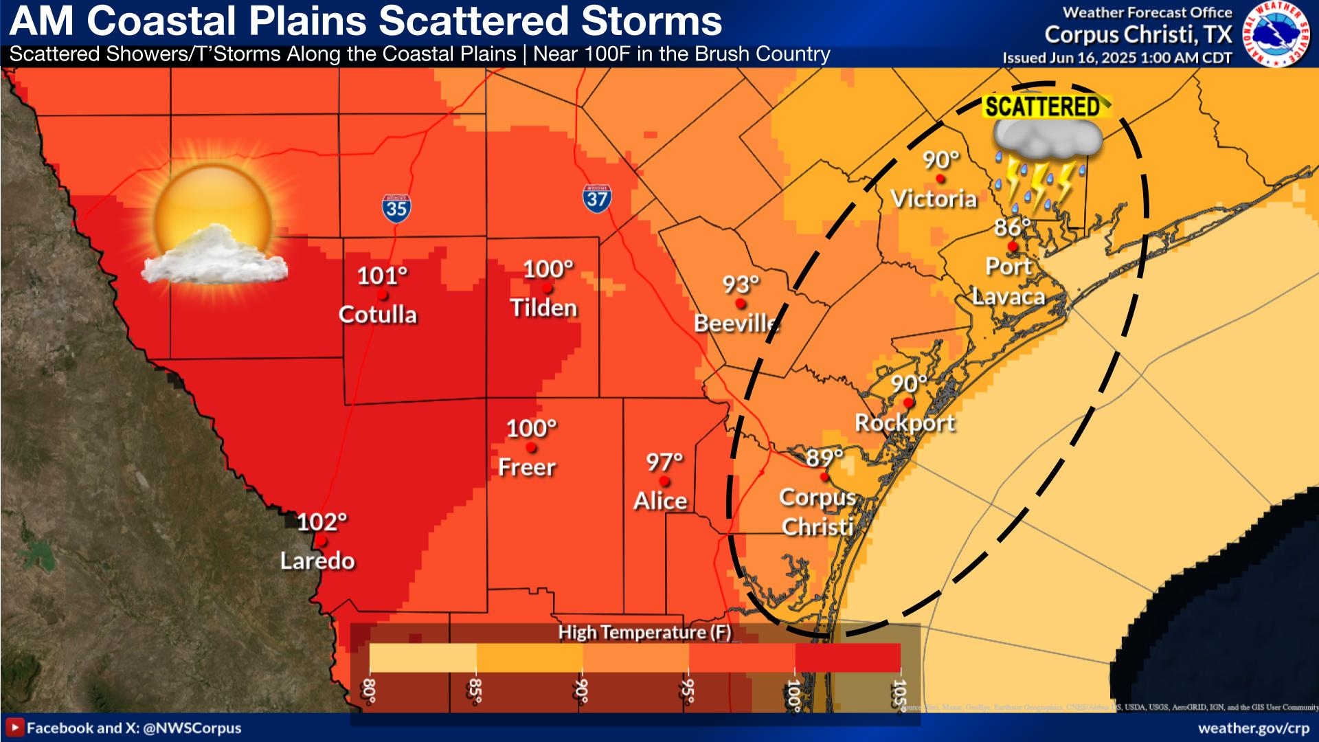
I need to get going, and move my 5th wheel. So, I’ll leave you with forecast graphics from Gaylord, MI and Corpus Christi, TX.