
I am a meteorologist and a former youth leader at church…I have a lot to say on both subjects…and then some
I’m going to see how this goes over. I’m thinking that I will do morning videos (Coffee and a Weather Map with Jeff), and then at night do a post on the hot spots for the night. If there are no hot spots, then no post. We’ll see how that goes. Alright, let’s jump into it…
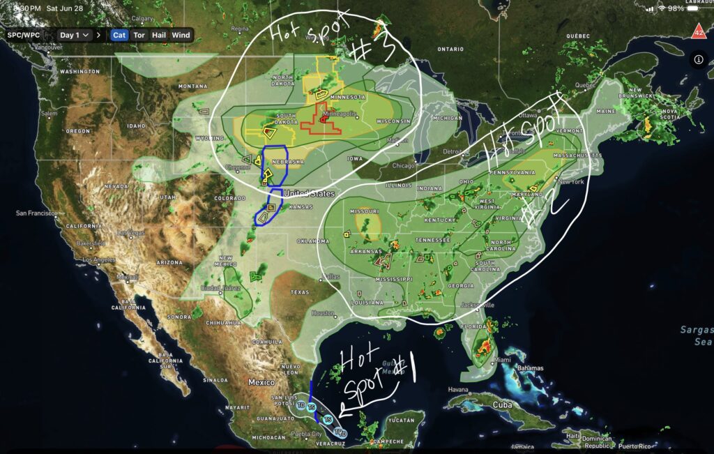
The first hot spot is TD #2, in the Gulf. The wave that has progressed into a depression and will likely become Tropical Storm Barry overnight or Sunday morning.
Hot Spot #2 is Low pressure and front that stretches from western Quebec to the northern Appalachian Mountains, and then into the Ohio Valley. While the front stretches there, the marginal severe threat stretches into the Southeastern States.
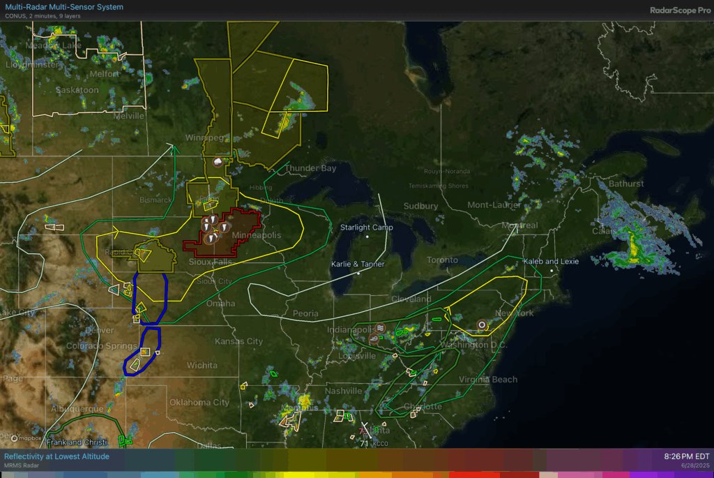
You can see it better in this map with the slight and marginal risks outlined in te east and southeast.
Hot spot #3 is the Northern Plains, with the Tornado watch in South Dakota and Minnesota. There are some Severe thunderstorm watches surrounding it, plus a couple of convective and precipitation discussions.
All of these are well covered, if you listen to Max Velocity’s live stream. It doesn’t look like Ryan Hall is streaming, but it he does have his Y’all bot channel so you can watch that if you want a stream.