I am a meteorologist and a former youth leader at church…I have a lot to say on both subjects…and then some
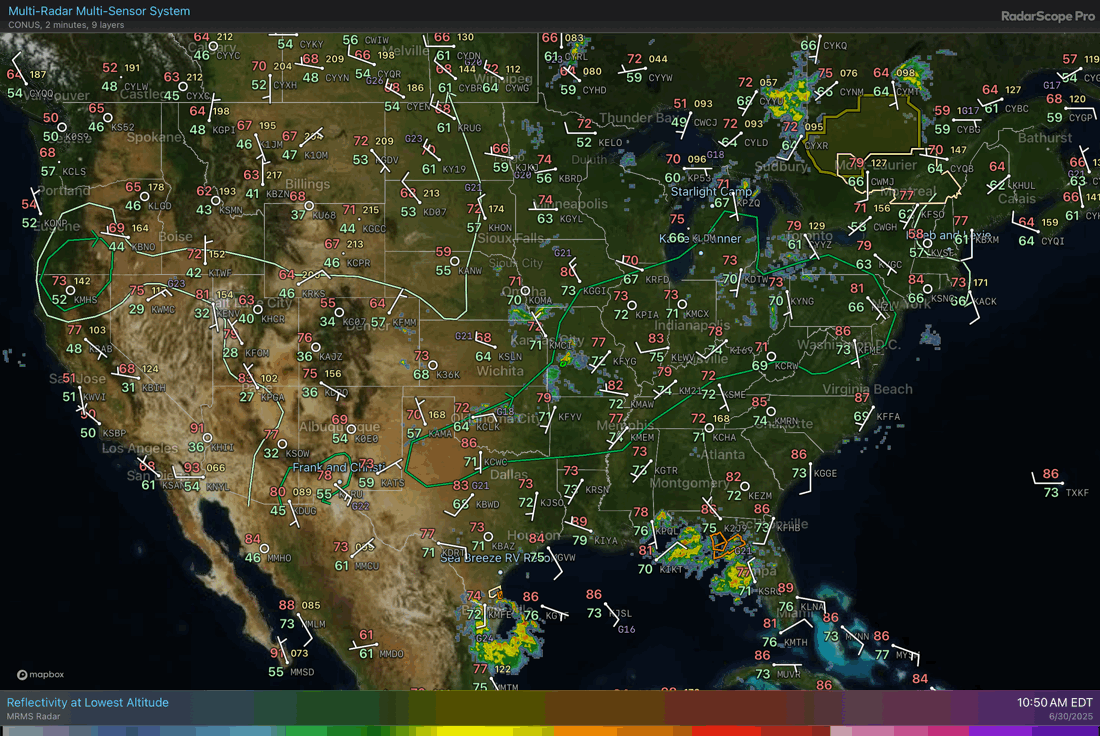
We are at that transition time of day, when the thunderstorm complexes are falling apart (usually), and the afternoon convection are puffy cumulus clouds on satellite, with a few showers around. Such is the MRMS radar page above. The hot spots from last night are ebbing, with the main fronts still showing some organized rain.
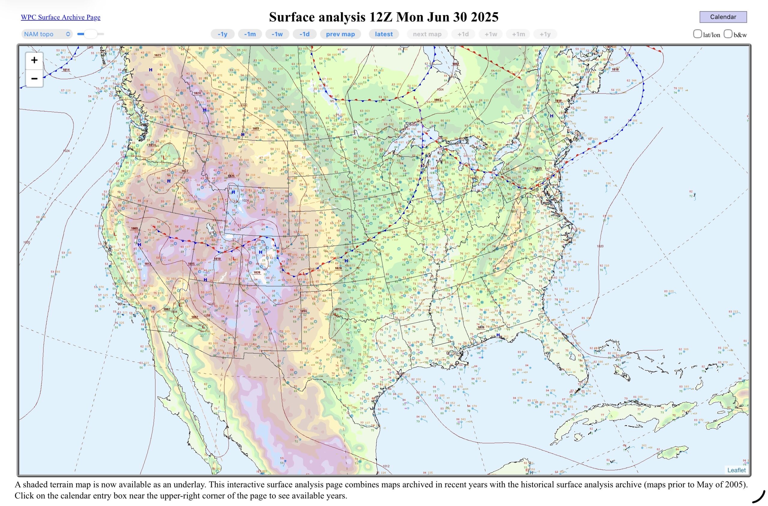
The map on the left is the surface map from 8am this morning with cold front pushing into the Upper Great Lakes. The showers and thunderstorms associated with it have either died, or pushed off into Canada or Lake Huron. That front trails southwest, into eastern Colorado, with what’s left from last night’s convection dying in Kansas. Otherwise, there is still a shortwave in the eastern Gulf, near Florida’s Big Bend region which is kicking off showers and thunderstorms, and the remnants of Barry in Mexico and the western Gulf.
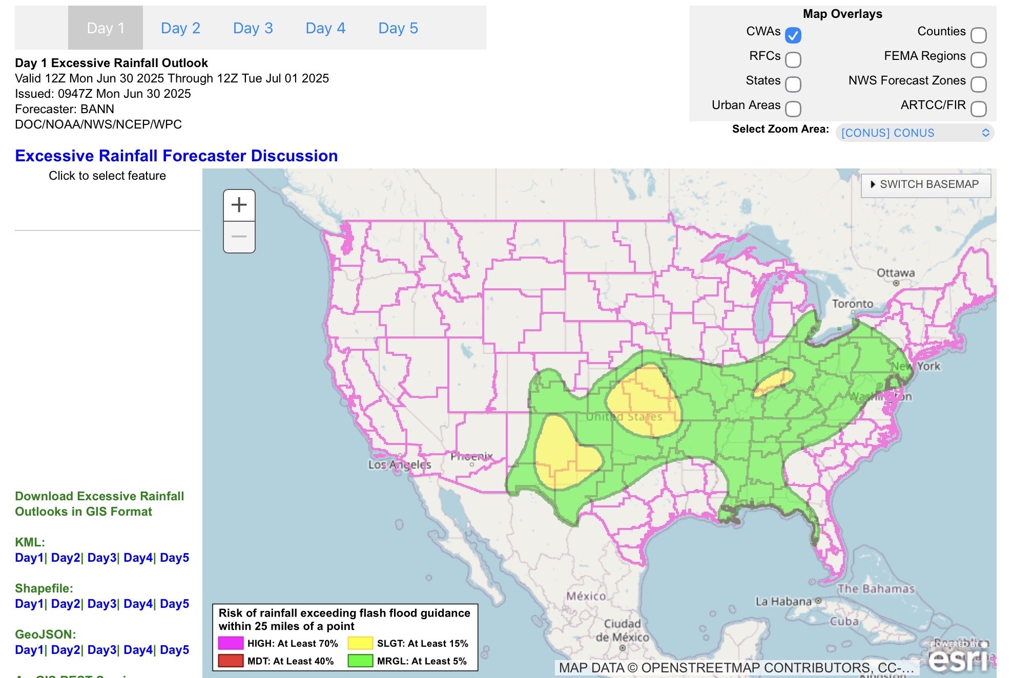
So, the day’s heaviest rain (middle image from WPC) is expected along that cold front along the Ohio River Valley, back into Kansas. Heavy rain is also possible in New Mexico (Surprise!, not!) from the monsoonal moisture, the front, and some of the remnants of Barry.
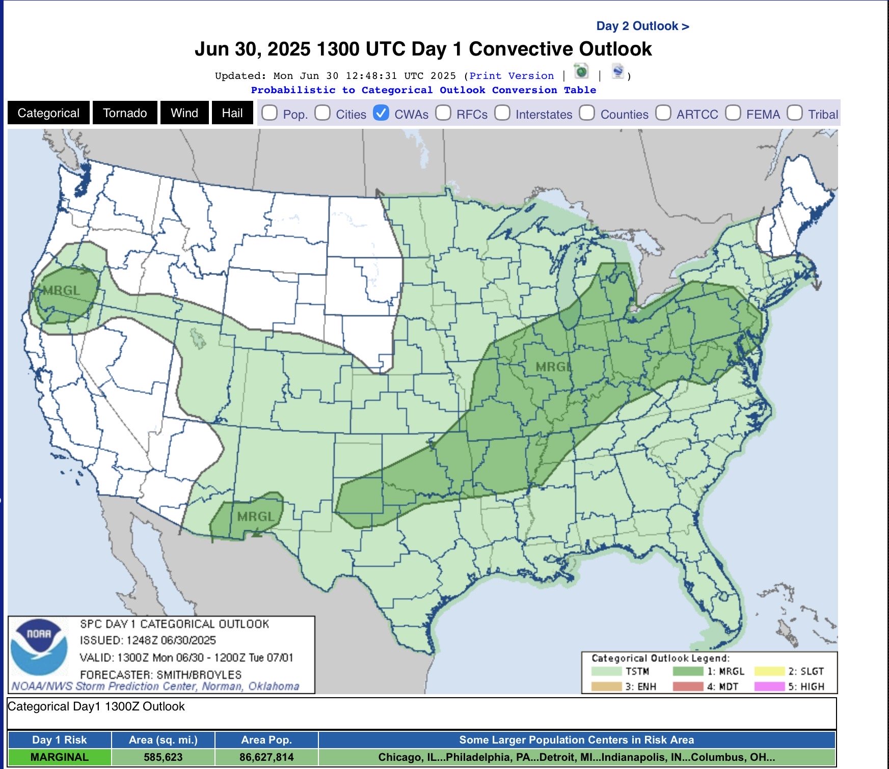
On the image to the right (SPC day 1 outlook), there is a large area of marginal risk (level 1 of 5) along the front this morning from the Lower Great Lakes to West Texas and New Mexico. Some of this may fire off in the afternoon, but the storms are expected to be strong to severe. Otherwise, thunderstorms are expected in the eastern half of the country.
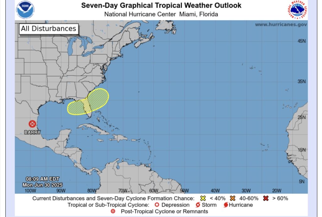
The last thing is the remnants of Barry, which we have covered, and the 20% chance for tropical development during the next 7 days. The front, that we have discussed earlier, will eventually reach Southeastern states and stretch across the Florida peninsula.
The thunderstorms are could produce a circulation. The ECMWF suggests mainly in the Atlantic off of Jacksonville this weekend, while the GEFS (ensemble GFS) mainly in the Big Bend of the eastern Gulf this weekend. Either way, there will be a lot of rain come this weekend over Florida, especially the northern part.
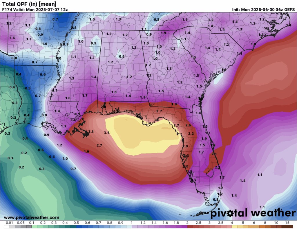
This is the total mean rainfall expected on the GFS ensembles through Monday morning. With over 2.5” in northern Florida and the panhandle, while heaviest rain is in the Gulf. We’ll see. (The ECMWF 06z run doesn’t go out that far).