
I am a meteorologist and a former youth leader at church…I have a lot to say on both subjects…and then some
I’m down state looking at boats today. So until I get back home, I’ll be typing things for the weekend.
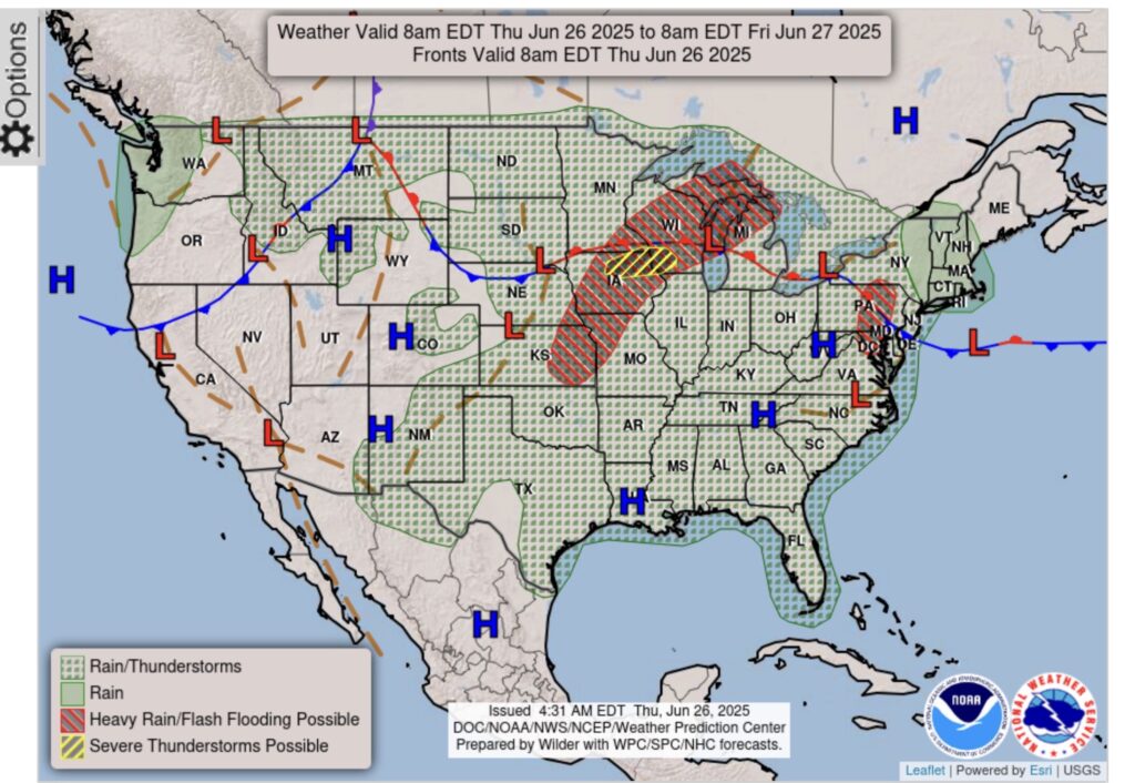
With the Monsoonal Moisture beginning to ebb in New Mexico, it looks like it has moved to the Upper Great Lakes. With the jet stream along the Canadian border and the warm front through the region, heavy rain is possible.
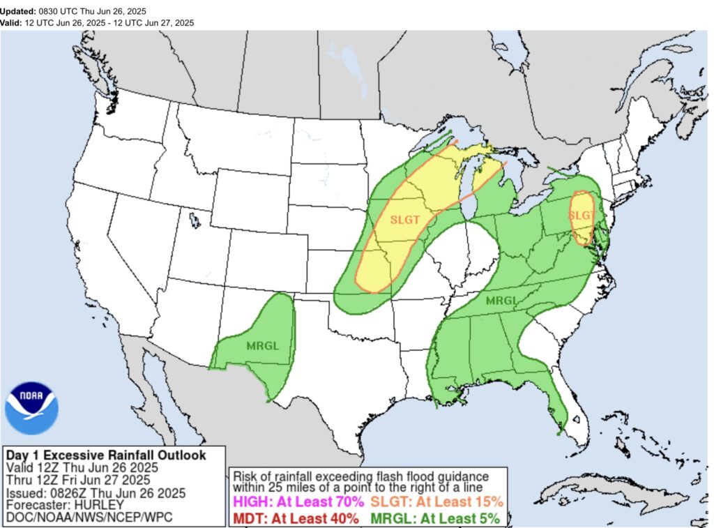
So WPC, has put Upper and Northern lower Michigan in a slight risk (2 out of 5) for heavy rain.
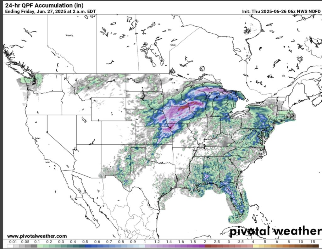
You can see as the GFS is pushing the heaviest rain in the Upper Mississippi Valley and the Upper Great Lakes. So be aware of the possibility of heavy rain, today.
South Texas will still have isolated to scattered showers along the Middle Texas Coast.