
I am a meteorologist and a former youth leader at church…I have a lot to say on both subjects…and then some
Here it is Saturday, I had a bit of day off after doing the live stream Thursday night. That was a wild ride, as I was getting flash backs of working a straight lined wind event in 2015. If you want to see the damage reports or such, go to the NWS Corpus Christi X account or their Web page. Also I shared a lot on my X account, and my Facebook page
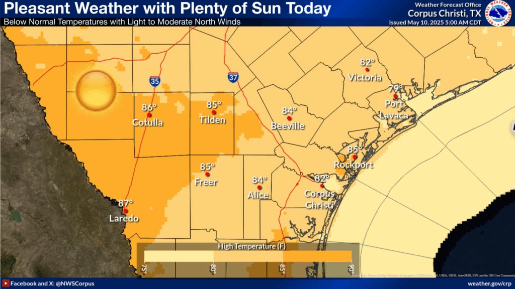
So for today, the idea is for a sunny to partly cloudy sky in the lower to mid 80s. The only caveat to this is the spoke of energy that is rotating down, from the north, associated with the upper level low to the east. I was looking at some site specific NBM numbers, and during the afternoon, there is a very low chance (10-20%) of a shower or a thunderstorm to move into the Coastal Bend (Just remember that a 10-20% chance of something means an 80-90% chance that nothing happens.).
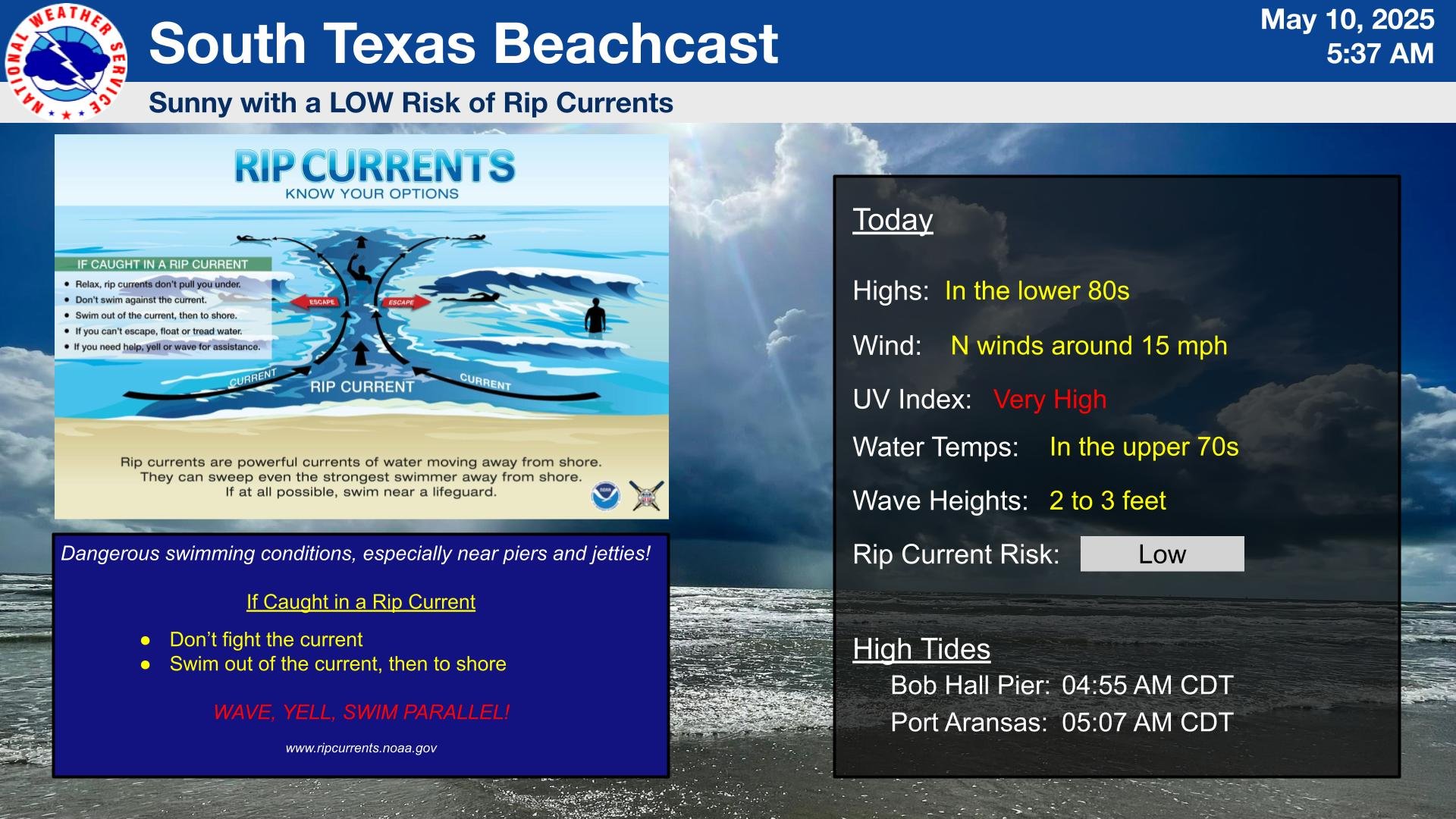
The beach weather looks good with that same caveat in mind.
So let’s see what’s causing the weather…
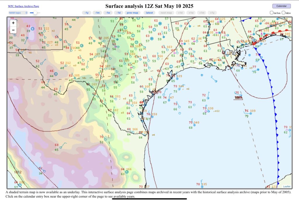
Over South Texas this morning, high pressure continues to build into the Rio Grande Plains, working its way to the east and the Coastal Bend. We will still be getting a north wind with the high to the northeast. The surface low to the east near the Mississippi-Alabama-Florida region of the Gulf Coast, is under the upper level low.
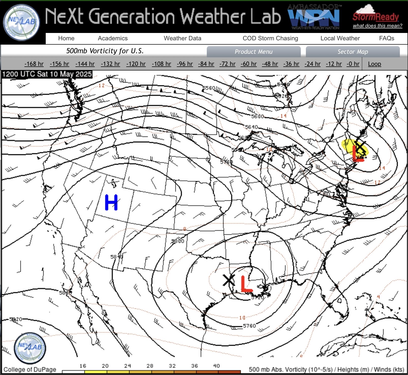
If you see the upper level low is a bit oblong, that lobe to the west of the low center (where the X is) will rotate south. The energy in the lobe can help destabilize things in the afternoon
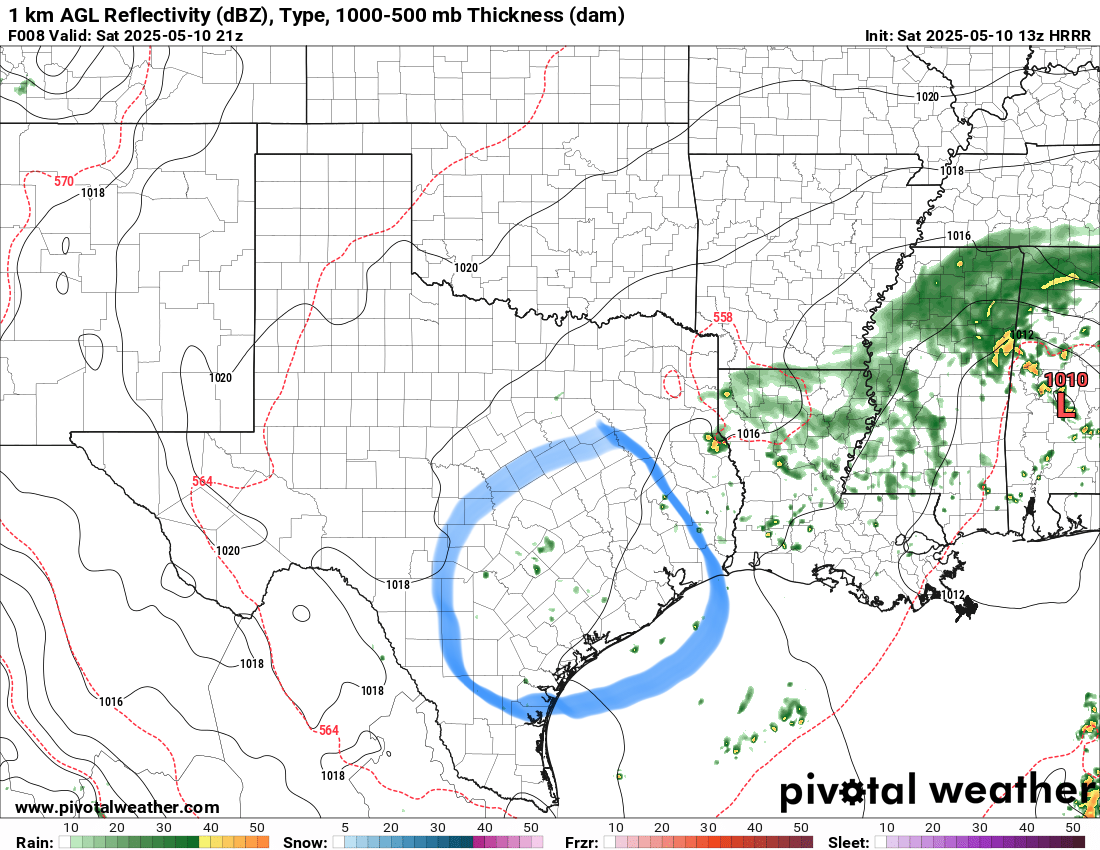
This is the HRRR model at 21z (4:00 PM CDT). The air is dry, so little is expected for the rain showers, but like I said earlier the chances are low, but not zero.