I am a meteorologist and a former youth leader at church…I have a lot to say on both subjects…and then some
A friend asked if I was just going to talk about the weather for just Michigan, since we are heading that way in less than a week. I responded, that I would cover South Texas and N Michigan, and anywhere there is interest weather. Well, there is interesting weather in both places. Before we get into the details, let’s look at what’s going on now…
Here’s the morning upper level map with the High over Low Rex block, beginning to move onto the Great Lakes and Ohio Valley. The cause of the movement will be the low over the Rocky Mountains and the Pacific Northwest. We’ll get to the reason it moves in a little bit. Over the Southern Plains, There is a weak ridge as well.
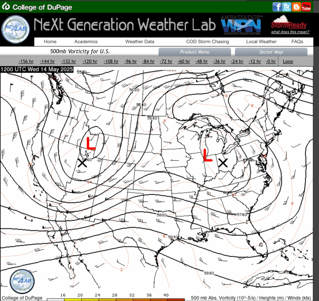
Over the surface, there is weak high pressure over the Great Lakes, with a weak surface low over the Middle Atlantic States. It’s interesting to note that the stationary front in the Dakotas, lines up with the leading edge of the jet stream that goes north through the Dakotas as well, just like they taught us in meteorology school.
Which leaves us with weak high pressure over the Southern Plains, down to Deep South Texas, which is helping the heat.
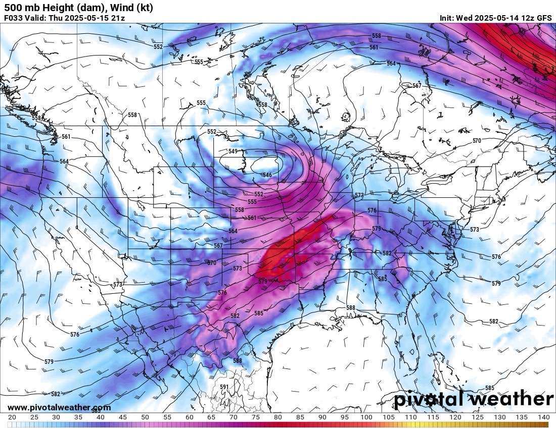
So in about 24 hours, the upper level map will look like this. The winds will at 500 mb will accelerate pushing the features along. The Rex block is now for the most part gone, now being replaced with an energetic 500 mb low and jet streak over the Plains. This pattern will kick off Severe weather in the north and keep the heat going down here in South Texas.
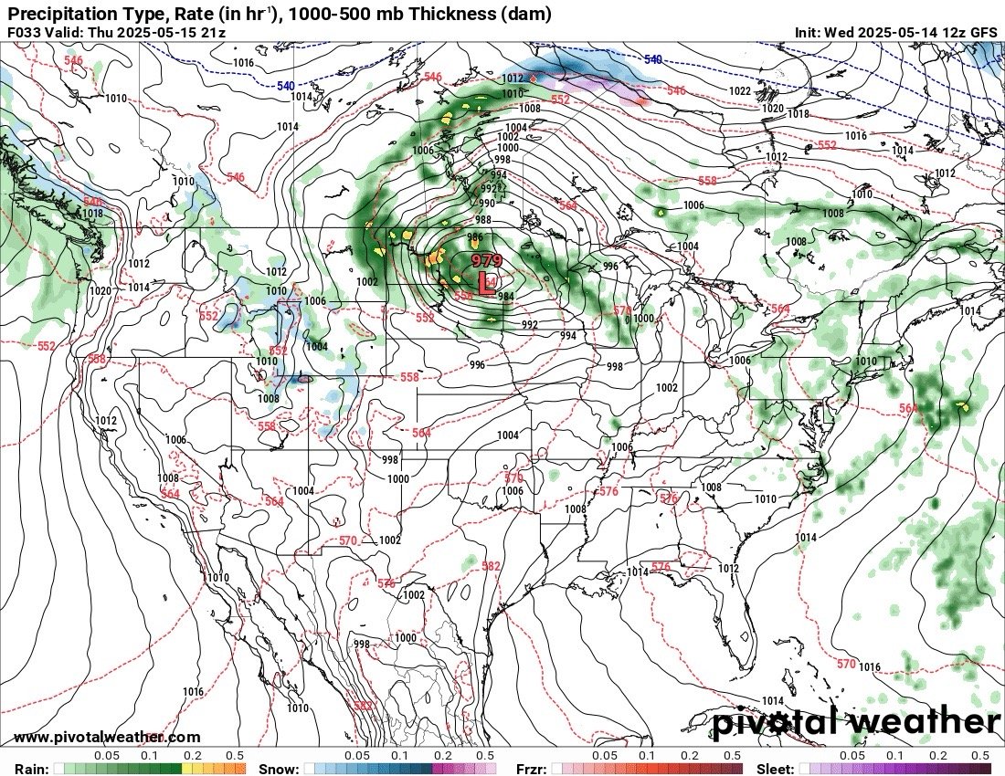
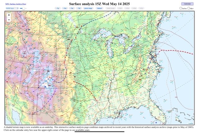
Here’s the surface chart from the same time as the upper level chart above it. Weak high pressure over the south with a south flow off of the Gulf. A strong surface low in the Dakotas and a warm front over Michigan.

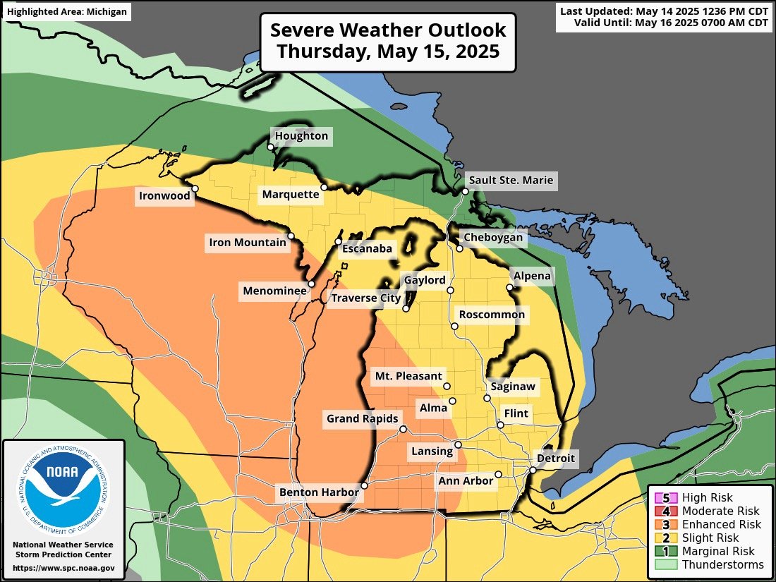
This may be a little easier to see. By 12z/15 (7am CDT, or 8AM EDT on the 15th), you see the surface low in the Dakotas, and the warm front over Michigan. The cold front is approaching as well. This is the severe weather area (yellow) for tomorrow. The heat area is in the south where the weak front/Low pressure, and high pressure are.
So first the heat…
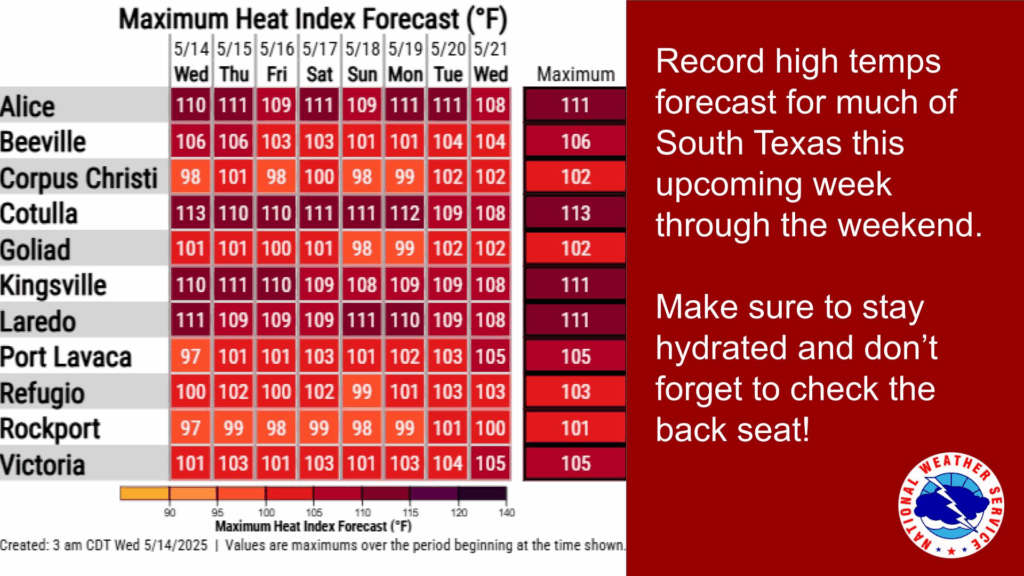
Here’s the heat index forecast for NWS Corpus Christi’s area (South Texas), with many sites over 105ºF and several over 110ºF. So there is a Heat Advisory out for most of the region through at least Thursday, but is likely to run into next week.
So that leads us to the Great Lakes…
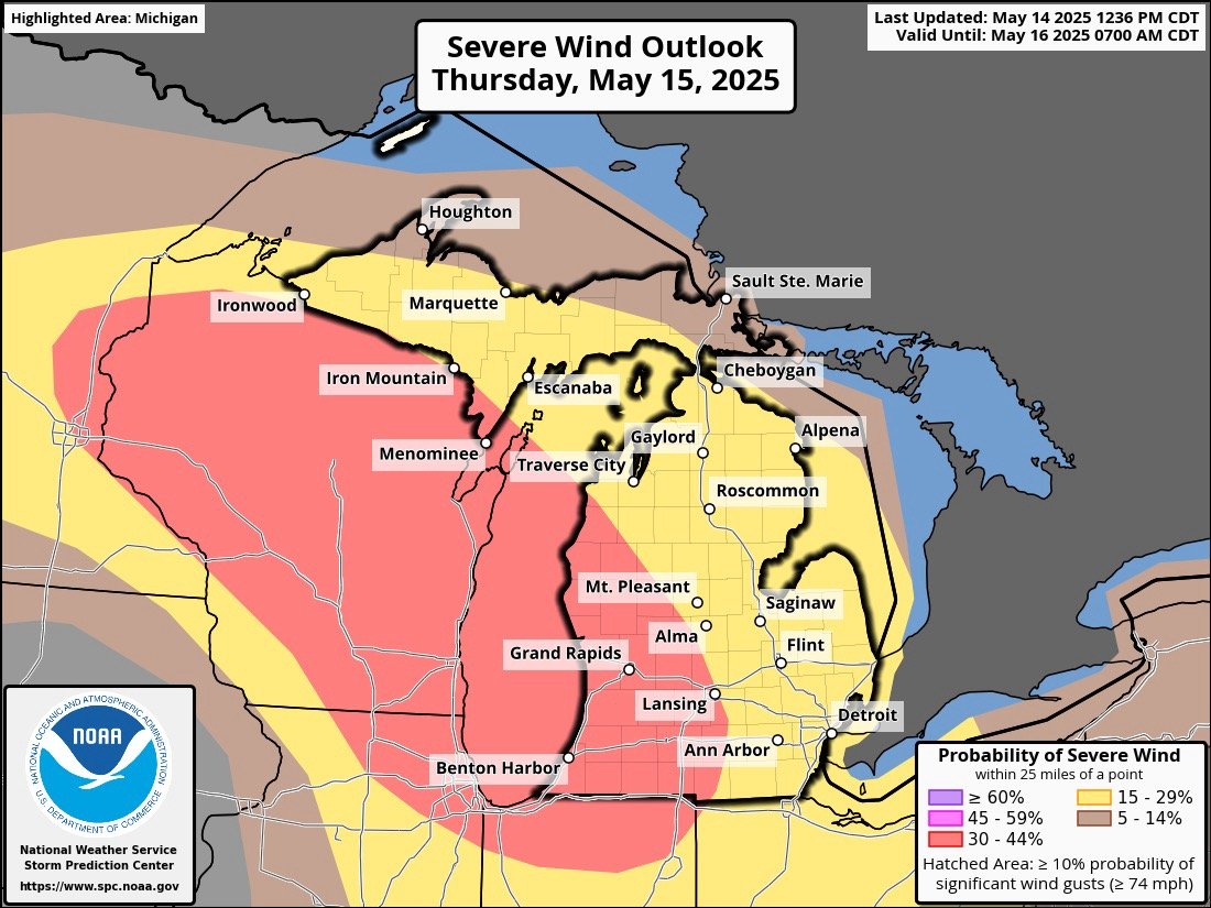
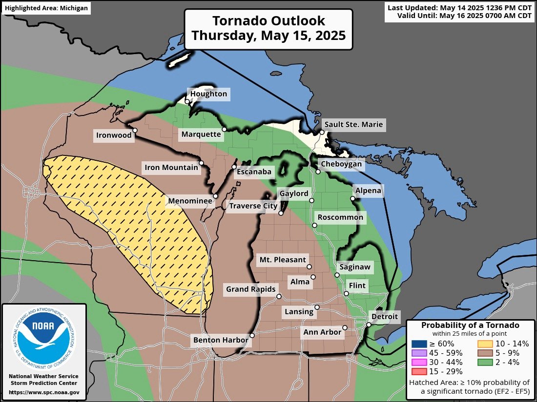
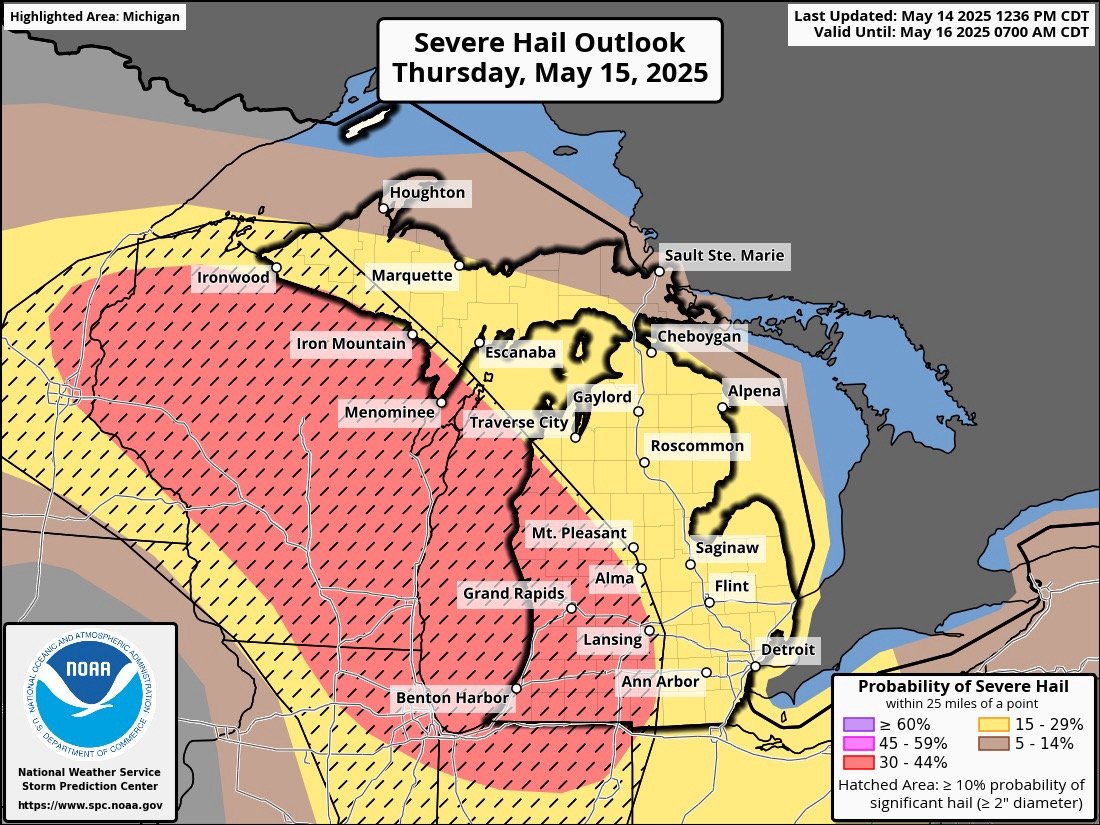
As the warm front moves into the Great Lakes, the Thunderstorms will gain heat and humidity for the fuel. As I pointed out earlier with the forecast for the 500 mb pattern, all of that wind is poised to move into the Upper Great Lakes, and specifically Lake Michigan. While the highest tornado threat is in Wisconsin, there is a significant hail threat (hatched area on the severe hail outlook map) and the likelihood of severe winds (>58 MPH) is medium (33-45% of occurrence within 25 miles of a point).
In the past, I was always alerted when there was a slight risk(2 out of 5 levels with the NWS), but the enhanced risk (3 out of 5), elevates this to concern. Not to mention with Family in Michigan, the concern is higher.
I’ll reevaluate everything tomorrow morning, and decide when I can go live, and watch the thunderstorms across the state.
If you are in Texas, the will be your main concern for most of this next week. Keep hydrated!